Kanoj

Last updated

Kanoj, formerly known as Ra Kanoj, was a town destroyed whose ruins are stretched for a mile. They are located in Lakhpat Taluka of Kutch district of Gujarat, India.

Lakhpat Town in Gujarat, India

Lakhpat is a sparsely populated town and sub-district in Kachchh district in the Indian state of Gujarat located at the mouth of Kori Creek. The town is enclosed by 7 km long 18th-century fort walls.

Kutch district District of Gujarat in India

Kutch district is a district of Gujarat state in western India. Covering an area of 45,674 km², it is the largest district of India. The population of Kutch is about 2,092,000. It has 10 Talukas, 939 villages and 6 Municipalities. The Kutch district is home to the Kutchi people who speak the Kutchi language.
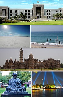
Gujarat State in India

Gujarat is a state on the western coast of India with a coastline of 1,600 km (990 mi) – most of which lies on the Kathiawar peninsula – and a population in excess of 60 million. It is the sixth largest Indian state by area and the ninth largest state by population. Gujarat is bordered by Rajasthan to the northeast, Daman and Diu to the south, Dadra and Nagar Haveli and Maharashtra to the southeast, Madhya Pradesh to the east, and the Arabian Sea and the Pakistani province of Sindh to the west. Its capital city is Gandhinagar, while its largest city is Ahmedabad. The Gujarati-speaking people of India are indigenous to the state. The economy of Gujarat is the fifth-largest state economy in India with 14.96 lakh crore (US$210 billion) in gross domestic product and a per capita GDP of 157,000 (US$2,200).

History

On the north bank of the Kinnar river, the town stretches in ruined heaps for about a mile. Among the ruins are indistinct traces of an old fort and of the line of the city walls. The town would seem to have been destroyed by Muslim invaders, but of its date nothing is known. About five miles south-west of Ra Kanoj is the tomb of Kasim, who according to the local story, took and destroyed the city. Kasim is said to have sent as a prize to his sovereign the king of Ghazni, two of the chief's daughters. At Ghazni they were treated with every kindness, but refused to be comforted, saying, that while they were under his charge, Kasim had violated them. Enraged at the story the king, without inquiry, ordered Kasim to be put to death and his head sent to Ghazni. When it was shown them his accusers rejoiced that they had avenged their father's death, and confessed that Kasim had done them no harm. On account of his undeserved punishment Kasim became a saint. [1]

Ghazni City in Ghazni Province, Afghanistan

Ghazni historically known as Ghaznin or Ghazna, is a city in central Afghanistan with a population of around 270,000 people. The city is strategically located along Highway 1, which has served as the main road between Kabul and southern Afghanistan for thousands of years. Situated on a plateau at 2,219 metres (7,280 ft) above sea level, the city is 150 km south of Kabul and serves as the capital of Ghazni Province.

The place was not of any note till, in the beginning of the 19th century, minister of Cutch State Fateh Muhammad started the practice of visiting it every year with much state. So greatly in their opinion do they gain from being buried near this tomb, that the Jats bring their dead from great distances, and the country for two miles round is one great graveyard. Kasim's tomb, thirty-five feet long and five broad, is made of stones piled up without cement. It is on the site of a Shiva temple, and the linga once broken has been cemented, and is now worshiped both by Hindus and Muslims as Kasameshvar. The temple pool, kund, also remains. The Muslims call the pool Kara and the saint Kara Kasim. [1]

Cutch State Indian princely state, 1147-1948

Cutch, also spelled Kutch or Kachchh, was a relatively large Indian princely state during the British Raj. Its territories covered the present day Kutch region of Gujarat north of the Gulf of Kutch. Bordered by Sindh in the north, Cutch State was one of the few princely states with a coastline.

Fateh Muhammad

Fateh Muhammad was a regent who administered Cutch State as a leader of Bar Bhayat ni Jamat under titular kings, Prithvirajji and Rayadhan III.

Related Research Articles

Radhanpur Town in Gujarat, India

Radhanpur is a town and a municipality in Patan district in the Indian state of Gujarat.

Limbhoi is a village in Modasa Taluka in Aravalli district of Gujarat state, India.

Vav is town and the headquarter of Vav Taluka of Banaskantha district in Gujarat state of India. Vav is the largest taluka of district.

Amrapar is a village in Kutch district, Gujarat, India.

Dinara is a village near Bhuj of Kutch district of Gujarat, India.

Golay or Gholay is a village of Abdasa Taluka of Kutch district of Gujarat, India.

Pipar is a village in Lakhpat Taluka of Kutch district of Gujarat, India.

Rav is a village of three hamlets; Rav Moti, Rav Nani and Temple; in an open plain, located nineteen miles from Chobari, in Rapar Taluka of Kutch district of Gujarat, India.

Sikra is a village in Bhachau Taluka of Kutch district of Gujarat, India.

Tejara is a historical place in Kutch district of Gujarat, India.

Vinjhan Village in Gujarat, India

Vinzan or Vinjhan is a village in Abdasa Taluka in Kutch district of Gujarat, India.

Vira is a village in Anjar Taluka in Kutch district of Gujarat, India. Nearby temple of Jogninar is place of religious significance.

Patgadh or Vagham Chavdagadh was a historical town and capital of western Kutch during rule of Chawda dynasty. The ruins of the town is located in Lakhpat Taluka in Kutch district of Gujarat, India. The village is on the west bank of Little Rann of Kutch.

22.81954°N 72.748444°E

Ramas is a town and former Makwana Koli princely state in Mahi Kantha.

Varahi is a village in Santalpur taluka of Patan district of Gujarat state of India.

Diyodar, also spelled Diodar or Deodar, is a town and former princely state in Diyodar Taluka of Banaskantha district in Gujarat, western India.

Suigam Is Town And The Headquarter Of Suigam Taluka Of Banaskantha District In Gujarat State Of India

Tervada is a village in Kankrej Taluka of Banaskantha district in Gujarat, India.

Sami, Gujarat town in Gujarat, India

Sami is a town in Sami Taluka of Patan district of Gujarat, India.

References

  1. 1 2 Gazetteer of the Bombay Presidency: Cutch, Palanpur, and Mahi Kantha. Printed at the Government Central Press. 1880. p. 249.

Coordinates: 23°40′41″N68°34′22″E / 23.678034°N 68.572905°E / 23.678034; 68.572905

Geographic coordinate system Coordinate system

A geographic coordinate system is a coordinate system that enables every location on Earth to be specified by a set of numbers, letters or symbols. The coordinates are often chosen such that one of the numbers represents a vertical position and two or three of the numbers represent a horizontal position; alternatively, a geographic position may be expressed in a combined three-dimensional Cartesian vector. A common choice of coordinates is latitude, longitude and elevation. To specify a location on a plane requires a map projection.