
The New Jersey Turnpike (NJTP) is a system of controlled-access toll roads in the U.S. state of New Jersey. The turnpike is maintained by the New Jersey Turnpike Authority. The 117.2-mile (188.6 km) mainline's southern terminus is at the Delaware Memorial Bridge on I-295 in Pennsville. Its northern terminus is at an interchange with US 46 in Ridgefield Park. Construction of the mainline, from concept to completion, took a total of 22 months between 1950 and 1951. It was opened to traffic on November 5, 1951, between its southern terminus and exit 10.

The Pennsylvania Turnpike, sometimes shortened to Penna Turnpike or PA Turnpike, is a controlled-access toll road which is operated by the Pennsylvania Turnpike Commission (PTC) in Pennsylvania. It runs for 360 miles (580 km) across the southern part of the state, connecting Pittsburgh and Philadelphia, and passes through four tunnels as it crosses the Appalachian Mountains. A component of the Interstate Highway System, it is part of Interstate 76 (I-76) between the Ohio state line and Valley Forge. I-70 runs concurrently with I-76 between New Stanton and Breezewood, Interstate 276 (I-276) between Valley Forge and Bristol Township, and I-95 from Bristol Township to the New Jersey state line.

The Garden State Parkway (GSP) is a controlled-access toll road that stretches the north–south length of eastern New Jersey from the state's southernmost tip near Cape May north to the New York state line at Montvale. Its name refers to New Jersey's nickname, the "Garden State". The parkway has an unsigned reference number of Route 444 by the New Jersey Department of Transportation (NJDOT). At its north end, the road becomes the Garden State Parkway Connector, a component of the New York State Thruway system that connects to the Thruway mainline in Ramapo, New York.

The Pulaski Skyway is a four-lane bridge-causeway in the northeastern part of the U.S. state of New Jersey, carrying a freeway designated U.S. Route 1/9 (US 1/9) for most of its length. The structure has a total length of 3.502 miles (5.636 km). Its longest bridge spans 550 feet (168 m). Traveling between Newark and Jersey City, the roadway crosses the Passaic and Hackensack rivers, Kearny Point, the peninsula between them, and the New Jersey Meadowlands.

The Kansas Turnpike is a 236-mile (380 km) controlled-access toll road that lies entirely within the US state of Kansas. It runs in a general southwest–northeast direction from the Oklahoma border to Kansas City. It passes through several major Kansas cities, including Wichita, Topeka, and Lawrence. The turnpike is owned and maintained by the Kansas Turnpike Authority (KTA), which is headquartered in Wichita.

The Interstate Bridge is a pair of nearly identical steel vertical-lift, Parker through-truss bridges that carry Interstate 5 traffic over the Columbia River between Vancouver, Washington and Portland, Oregon in the United States.

Interstate 470 (I-470) is a 13.72-mile (22.08 km) loop highway that bypasses the downtown area of Topeka, Kansas. I-470 begins at an interchange with I-70 in western Topeka and heads generally southeast, running concurrent with U.S. Highway 75 (US-75). The concurrency with US-75 ends 5.74 miles (9.24 km) later at the Burlingame Road interchange. I-470 becomes part of the Kansas Turnpike at its junction with I-335. From there, the highway heads generally northeast through the southeastern sections of Topeka. After traveling 7.03 miles (11.31 km) as the Kansas Turnpike, I-470 reaches its eastern terminus at I-70. The highway has annual average daily traffic (AADT) values as high as 43,000 west of Gage Boulevard to as low as 10,370 near the eastern terminus. As an Interstate Highway, I-470 is a part of the National Highway System. The non-turnpike portions of the highway are maintained by the Kansas Department of Transportation (KDOT), while the turnpike portion is maintained by the Kansas Turnpike Authority (KTA).

Interstate 78 (I-78) is an east–west route stretching from Union Township, Lebanon County, Pennsylvania, to New York City. In New Jersey, I-78 is called the Phillipsburg–Newark Expressway and the Newark Bay Extension of the New Jersey Turnpike. The highway runs for 67.8 miles (109.1 km) in the northern part of the state of New Jersey from the I-78 Toll Bridge over the Delaware River at the Pennsylvania state line in Phillipsburg, Warren County, east to the Holland Tunnel under the Hudson River at the New York state line in Jersey City, Hudson County. The Phillipsburg–Newark Expressway portion of I-78, formally called the Lightning Division Memorial Highway, runs from the Phillipsburg area east across rural areas of Western New Jersey before entering suburban areas in Somerset County. The road crosses the Watchung Mountains, widening into a local–express lane configuration at Route 24 as it continues through urban areas to Newark. Here, I-78 intersects the mainline of the New Jersey Turnpike (I-95) and becomes the Newark Bay Extension, crossing the Newark Bay Bridge and continuing to Jersey City. The route, along with Route 139, follows a one-way pair of surface streets to the Holland Tunnel.

U.S. Route 1 Business is a four-lane surface road that provides an alternate route to the Trenton Freeway (US 1) northeast of Trenton in Mercer County, New Jersey. The route is 2.73 miles (4.39 km) long and runs between US 1 in Trenton and Lawrence Township. On the border of Trenton and Lawrence Township, US 1 Bus. intersects the northbound direction of US 206 at the Brunswick Circle. The route was once part of a longer U.S. Route 1 Alternate, which continued southwest through downtown Trenton and into Morrisville, Pennsylvania.

Forgottonia, also spelled Forgotonia, is the name given to a 16-county region in Western Illinois in the late 1960s and early 1970s. This geographic region forms the distinctive western bulge of Illinois that is roughly equivalent to "The Tract", the Illinois portion of the Military Tract of 1812, along and west of the Fourth Principal Meridian. Since this wedge-shaped region lies between the Illinois and Mississippi rivers, it has historically been isolated from the eastern portion of Central Illinois.

Interstate 95 (I-95) is an Interstate Highway on the east coast of the United States, connecting Florida to Maine. Within the state of New Hampshire, it serves the Seacoast Region and is a toll road named the Blue Star Turnpike or New Hampshire Turnpike. The 16-mile (26 km) turnpike is maintained by the New Hampshire Department of Transportation (NHDOT) Bureau of Turnpikes and has a single toll plaza near Hampton.
Interstate 95 (I-95) is an Interstate Highway running along the East Coast of the United States from Miami, Florida, north to the Canadian border in Houlton, Maine. In the state of Delaware, the route runs for 23.43 miles (37.71 km) across the Wilmington area in northern New Castle County from the Maryland state line near Newark northeast to the Pennsylvania state line in Claymont. I-95 is the only primary Interstate Highway that enters Delaware, although it also has two auxiliary routes within the state. Between the Maryland state line and Newport, I-95 follows the Delaware Turnpike, a toll road with a mainline toll plaza near the state line. Near Newport, the Interstate has a large interchange with Delaware Route 141 (DE 141) and the southern termini of I-295 and I-495. I-95 becomes the Wilmington Expressway from here to the Pennsylvania state line and heads north through Wilmington concurrently with U.S. Route 202 (US 202). Past Wilmington, I-95 continues northeast to Claymont, where I-495 rejoins the route right before the Pennsylvania state line.
Interstate 95 (I-95) is the main Interstate Highway of Florida's Atlantic Coast. It begins at a partial interchange with US Highway 1 (US 1) just south of downtown Miami and heads north through Jacksonville, and to the Georgia state line at the St. Marys River near Becker. The route also passes through the cities of Fort Lauderdale, West Palm Beach, Port St. Lucie, Titusville, and Daytona Beach.

Interstate 75 (I-75) is a part of the Interstate Highway System that runs north–south from Miami, Florida, to Sault Ste. Marie in the Upper Peninsula of the US state of Michigan. I-75 enters the state from Ohio in the south, north of Toledo, and runs generally northward through Detroit, Flint, and Bay City, crosses the Mackinac Bridge, and ends at the Canadian border in Sault Ste. Marie. The freeway runs for approximately 396 miles (637 km) on both of Michigan's major peninsulas. The landscapes traversed by I-75 include Southern Michigan farmland, northern forests, suburban bedroom communities, and the urban core of Detroit. The freeway also uses three of the state's monumental bridges to cross major bodies of water. There are four auxiliary Interstates in the state related to I-75, as well as nine current or former business routes, with either Business Loop I-75 or Business Spur I-75 designations.

Interstate 70 (I-70) is a mainline route of the Interstate Highway System in the United States connecting Cove Fort, Utah, to Baltimore, Maryland. In the US state of Kansas, I-70 extends just over 424 miles (682 km) from the Colorado border near the town of Kanorado to the Missouri border in Kansas City. I-70 in Kansas contains the first segment in the country to start being paved and to be completed in the Interstate Highway System. The route passes through several of the state's principal cities in the process, including Kansas City, Topeka, and Salina. The route also passes through the cities of Lawrence, Junction City, and Abilene.
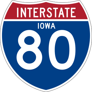
Interstate 80 (I-80) is a transcontinental Interstate Highway in the United States, stretching from San Francisco, California, to Teaneck, New Jersey. In Iowa, the highway travels west to east through the center of the state. It enters the state at the Missouri River in Council Bluffs and heads east through the southern Iowa drift plain. In the Des Moines metropolitan area, I-80 meets up with I-35 and the two routes bypass Des Moines together. On the northern side of Des Moines, the Interstates split and I-80 continues east. In eastern Iowa, it provides access to the University of Iowa in Iowa City. Northwest of the Quad Cities in Walcott is Iowa 80, the world's largest truck stop. I-80 passes along the northern edge of Davenport and Bettendorf and leaves Iowa via the Fred Schwengel Memorial Bridge over the Mississippi River into Illinois.
U.S. Route 1 (US 1) is a major north–south U.S. Route in the state of Massachusetts, traveling through Essex, Middlesex, Suffolk, Norfolk, and Bristol counties. The portion of US 1 south of Boston is also known as the Boston–Providence Turnpike, Washington Street, or the Norfolk and Bristol Turnpike, and portions north of Boston are known as the Northeast Expressway and the Newburyport Turnpike.

The U.S. 40 and 59 Bridges are twin multi-beam girder bridges over the Kansas River at Lawrence, Kansas. The west bridge carries two lanes of southbound traffic, connecting to Vermont Street, while the east bridge carries two lanes of northbound traffic from Massachusetts Street. Both bridges converge on the north end to become North 2nd Street. The east bridge is also the third bridge to be built at this location.

The Allegheny River Turnpike Bridge carries Interstate 76 over the Allegheny River. The structure features a pair of twin 2,350’ cast-in-place concrete segmental bridges. This is the first of its type in Pennsylvania. It was constructed between 2007 and 2010 and is the second bridge to stand on this site. The original truss bridge was built between 1949 and 1951 by the engineering firm Modjeski & Masters; the crossing predates the Interstate System by several years.
