Related Research Articles

Kapp Linné is a cape at the south side of the outlet of Isfjorden on Spitsbergen, Svalbard. It is named after botanist Carl von Linné. The site is the location of Isfjord Radio. Parts of Kapp Linné is a birdlife protected area.
Kapp Dufferin is a spit located northeast in Heer Land on the island of Spitsbergen in Svalbard, Norway. It is 1-kilometre (0.62 mi) wide with a lagoon, and makes up the eastern part of the coast east of Rjurikfjellet. It is named for Frederick Hamilton-Temple-Blackwood, 1st Marquess of Dufferin and Ava, who visited Svalbard in 1856 and wrote Letters From High Latitudes.

Ingebrigtsenbukta is a bay at the south shore of Van Keulenfjorden. The bay is approximately 3 km wide, running from Kapp Toscana in the west to Ålesundneset in the east. The bay was named after Norwegian whaler Morten Andreas Ingebrigtsen.
Nordfjorden is a northern branch of the fjord Isfjorden at Spitsbergen, Svalbard. It is located between Bohemanneset and Kapp Thordsen, and branches further into the fjords Ekmanfjorden and Dicksonfjorden. The 30 kilometer long glacier Sveabreen debouches into the fjord.
Olsholmen is a small island or islet at the west coast of Wedel Jarlsberg Land at Spitsbergen, Svalbard. It is located between the capes Kapp Klaveness and Kapp Borthen. The islet is included in the Olsholmen Bird Sanctuary, which was established in 1973.

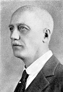
Anton Fredrik Klaveness was a Norwegian ship-owner.
Platenhalvøya is a peninsula at Nordaustlandet, Svalbard, between Zorgdragerfjorden and Duvefjorden. The peninsula constitutes the northeastern part of Prins Oscars Land. The mountains Binneyfjellet and Goodenoughfjellet are among the highest peaks of Nordaustlandet.
Kapp Platen is a headland at Nordaustlandet, Svalbard, the northernmost point of Prins Oscars Land. The headland is named after Swedish naval officer and politician Baltzar Julius Ernst von Platen. Kapp Platen includes the mountain Havsula.
Kapp Altmann is a headland at the southern side of Kongsøya in Kong Karls Land, Svalbard. It has a length of 1.9 kilometers and a width between 100 and 200 meters. Outside the spit are two small islands. The headland is named after Arctic explorer Johan Andreas Altmann. Kapp Altmann defines the western extension of the bay Breibukta.
Arnesenodden is a headland on Svenskøya in Kong Karls Land, Svalbard. It is the most northern point of Svenskøya, at the foot of the mountain Mohnhøgda. The headland is named after Arctic explorer Magnus Arnesen.
Kapp Hammerfest is a headland on Svenskøya in Kong Karls Land, Svalbard. It is the most southern point of Svenskøya, and the headland has a length of about 1.5 kilometers. The headland is named after the Norwegian city of Hammerfest. North of the headland, at the western side of the Svenskøya, is Kyrkjevika with Antarcticøya and other smaller islands.

Mariaholmen is an islet in Nathorst Land at the mouth of Van Mijenfjorden at Spitsbergen, Svalbard. It is located south of Akseløya, between Akseløya and Måseneset. While Akselsundet north of Akseløya is regarded as the main entrance to Van Mijenfjorden, Mariasundet between Mariaholmen and Måseneset is also navigable.
Klaratoppen is a mountain in Oscar II Land at Spitsbergen, Svalbard. It has a height of 524 m.a.s.l. and is located on the ridge of Värmlandryggen. The mountain is named after the Swedish river Klarälven.
Kapp Lee is a headland of Edgeøya, Svalbard. It is the northwestern point of the island, and is located north of Dolerittneset. South of Kapp Lee, and north of Dolerittneset, is a suitable harbour site for vessels.

Kapp Borthen is a headland in Wedel Jarlsberg Land at Spitsbergen, Svalbard. It is located at the western coast of Spitsbergen, at the front of the glacier Torellbreen. The headland is named after Norwegian ship-owner Harry Borthen.
Vaktarfjella is a mountain group in Andrée Land at Spitsbergen, Svalbard. It has an extension of about eleven kilometers, and is located north of the valley Woodfjorddalen. The highest summit in the group is Vaktaren, with a height of 1,227 m.a.s.l. The northwestern mountain in the group is Kapp Ringertz.
Dunérbukta is a bay at the western shore of Storfjorden in Sabine Land at Spitsbergen, Svalbard. It is named after Swedish astronomer Nils Christoffer Dunér. The glacier of Ulvebreen debouches into the bay. At the northern side of the bay is the mountain of Domen and the ridge Kapp Johannesen.
Davisodden is a headland in Nathorst Land at Spitsbergen, Svalbard. It is named after American geomorphologist William Morris Davis. The headland is located at the northern side of Van Keulenfjorden, and is a river delta made by the river flowing through Davisdalen. Davisdalen extends from the mountain ridge of Mjellegga down to Davisodden. Its river is fed from several glaciers, including Martinbreen and Charpentierbreen.
Cape Amsterdam is a headland in Nordenskiöld Land on Spitsbergen on Svalbard. Headland marks the northwestern entrance to Svea Gulf that continues north to Sveagruva.
Kapp Toscana is a headland at the southern side of Van Keulenfjorden in Wedel Jarlsberg Land at Spitsbergen, Svalbard. It is named after an Austrian family. West of the headland is the bay of Bourbonhamna, extending from Kapp Toscana to Kapp Madrid. East of the headland is the bay of Ingebrigtsenbukta, extending from Kapp Toscana to Ålesundneset.
References
- ↑ "Kapp Klaveness (Svalbard)". Norwegian Polar Institute . Retrieved 13 June 2013.
Coordinates: 77°18′01″N14°08′10″E / 77.3004°N 14.1360°E
| This Spitsbergen location article is a stub. You can help Wikipedia by expanding it. |