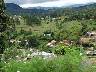
Karandagolla | |
|---|---|
Village | |
| Country | Sri Lanka |
| Province | Central Province |
| Time zone | UTC+5:30 (Sri Lanka Standard Time) |
Karandagolla is a village in Sri Lanka. It is located within Central Province.
Poramadulla Central College was previously located in Karandagolla. It had opened there in 1901. [1]

Kandy is a major city located in the Central Province of Sri Lanka. It was the last capital of the Sinhalese monarchy from 1469 to 1818, under the Kingdom of Kandy. The city is situated in the midst of hills in the Kandy plateau, which crosses an area of tropical plantations, mainly tea. Kandy is both an administrative and religious city and the capital of the Central Province. Kandy is the home of the Temple of the Tooth Relic, one of the most sacred places of worship in the Buddhist world. It was declared a World Heritage Site by UNESCO in 1988. Historically the local Buddhist rulers resisted Portuguese, Dutch, and British colonial expansion and occupation.

Hatton is a major town in the Nuwara Eliya District of Central Province, Sri Lanka governed by the Hatton-Dickoya Urban Council. Hatton is a major centre of the Sri Lankan tea industry.

Kegalle is a large town in Sabaragamuwa Province of Sri Lanka. It is located on the Colombo–Kandy road, approximately 78 km (48 mi) from Colombo, 40 km (25 mi) from Kandy, 32 km (20 mi) from Kurunegala and 46 km (29 mi) from Avissavella. It is the main town in the Kegalle District, which is one of two districts which comprise Sabaragamuwa Province. The town is governed by an Urban Council.

Matale is a major city in Central Province, Sri Lanka. It is the administrative capital and largest urbanised city of Matale District. Matale is also the second largest urbanised and populated city in Central Province. It is located at the heart of the Central Highlands of the island and lies in a broad, green fertile valley at an elevation of 364 m (1,194 ft) above sea level. Surrounding the city are the Knuckles Mountain Range, the foothills were called Wiltshire by the British. They have also called this place as Matelle.

North Western Province is a province of Sri Lanka. It is the fourth-largest province by land area, covering 7,888 km2 (3,046 sq mi), and the fourth-most populated province with a population of over 2,592,000 people. North Western Province is bordered by the North Central Province, Sri Lanka to the north, Central Province, Sri Lanka to the east, Sabaragamuwa Province to the southeast, Western Province, Sri Lanka to the south, and is bounded by the Indian Ocean to the west.

North Central Province is one of the nine provinces of Sri Lanka. The province has an area of 10,472 km2, making it the largest province by area, and a population of 1,266,663, making it the 3rd least populated province. The city of Anuradhapura is the capital of the province.

Kurunegala is a major city in Sri Lanka. It is the capital city of the North Western Province and the Kurunegala District. Kurunegala was an ancient royal capital for 50 years, from the end of the 13th century to the start of the 14th century. It is at the junction of several main roads linking to other important parts of the country. It is about 94 kilometres (58 mi) from Colombo, 42 kilometres (26 mi) from Kandy and 51 kilometres (32 mi) from Matale.

Gampaha is an urban city in Gampaha District, Western Province, Sri Lanka. It is situated to the north-east of the capital Colombo. It is the sixth largest urban area in Western Province, after Colombo, Negombo, Kalutara, Panadura and Avissawella. Gampaha is also the second largest municipal centre in Gampaha district, after Negombo. Gampaha has a land area of 25.8 ha and is home to the offices of 75 government institutions.

Nuwara Eliya District is a district in Central Province, Sri Lanka, centered on the tourist city of Nuwara Eliya.

Kalmunai is a city located in the Ampara District of Eastern Province, Sri Lanka.
The St. John Ambulance Association and Brigade of Sri Lanka is a charitable organisation providing healthcare services to the Sri Lankan public. Its members also perform voluntary first aid coverage duties during national events. The headquarters is located at 65/11, Sir Chittampalam A. Gardiner Mawatha, Colombo 02.
Bandarawela is the second largest town in the Badulla District which is 28 km (17 mi) away from Badulla. Bandarawela is 200 km (120 mi) away from Colombo and about 125 km (78 mi) away from Kandy, the two largest cities of Sri Lanka. Thanks to its higher altitude, compared to surrounding locations, Bandarawela has milder weather conditions throughout the year making it a tourist destination for locals. Bandarawela is within hours reach of surrounding towns and cities by both road and rail. The town is influenced by its colonial history and rests among dense, lush forestation occupying a niche among visitors as a base for tourism.

Balangoda is a town in Ratnapura District, Sabaragamuwa Province, Sri Lanka, governed by an urban council located 143 kilometres (89 mi) away from Colombo and 43 kilometres (27 mi) from Ratnapura on Colombo - Batticaloa Highway(A4). It is one of the largest towns of the Sabaragamuwa Province. According to the 2001 census, Balangoda has a population of 16,875 and area of 16.2 km2.

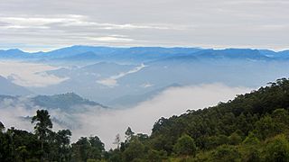
The Central Province is one of the nine provinces of Sri Lanka. The province has an area of 5,674 km2 and a population of 2,421,148, making it the 2nd most populated province. The city of Kandy stands as its capital since 1469.
Janaka Bandara Tennakoon is a Sri Lankan politician, a member of the Parliament of Sri Lanka and a former Cabinet Minister. He was educated at Dharmaraja College, Kandy. He contested as the Group Leader of the Matale District of the Central Province and was elected to the Provincial Council with a majority of Proportional Votes in 1993; Elected as a Member of Parliament with a majority of proportional votes in the General Election of 1994; Elected as a Member of Parliament from the District of Matale with the majority of proportional votes in the general election of 2000. He also previously served as the Minister of Lands and Land Development and Minister of Public Services, Provincial Councils and Local Government.
Rikillagaskada is a village in Sri Lanka. It is located within Central Province.

Deshamanya Edward Lionel Senanayake was a Sri Lankan politician belonging to the United National Party. He was the 12th Speaker of the Sri Lankan Parliament. Senanayake was the Governor of North Central Province and Central Province of Sri Lanka. He was elected to the Sri Lankan Parliament from Mahanuwara in Kandy.
Poramadulla Central College is a public national school in Rikillagaskada, Hanguranketha, Sri Lanka. Flanked by the Diyatalawa mount on one side and the Kandapola area on the other, the school serves as a sports school that helps train children talented in sports to improve and harness their skills.
Walapane is a town located in Nuwara Eliya District of Sri Lanka. It is a high country area with many green mountains. It was called Wathtumulla in the past. The name Watumulla derived from the former tea factory which was located in the heart of the Walapane town and now demolished since the production of Wattumulla Plantation declined. Walapane is administered by the government of *Sri Lanka through *Walapane Divisional Secretariat.
Alawwa is a town and divisional secretariat of the Kurunegala District in the North Western Province of Sri Lanka. The town is considered part of the Coconut Triangle, where most of the country's coconut exports come from. The population was 63,667 according to the 2012 Sri Lankan census.
| | This Kandy District, Central Province, Sri Lanka location article is a stub. You can help Wikipedia by expanding it. |