Related Research Articles

Nepal measures about 880 kilometers (547 mi) along its Himalayan axis by 150 to 250 kilometers across. It has an area of 147,516 km2 (56,956 sq mi).

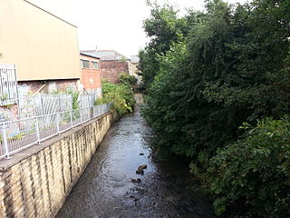
The River Spen, known locally as Spen Beck, in West Yorkshire, England is a tributary of the River Calder. It rises north of Cleckheaton, runs through Liversedge and flows into the Calder to the south of Dewsbury at Ravensthorpe. The average rainfall for the river valley of between 600–1000mm per annum when combined with the steep narrow river channel, makes the Spen susceptible to regular flooding.

The Bagmati River runs through the Kathmandu valley of Nepal, separating the cities of Kathmandu from Patan, before flowing through Province No. 2 of southern Nepal and finally joing the Koshi River in the Indian state of Bihar. It is considered holy by both Hindus and Buddhists. A number of Hindu temples are located on its banks.

Narayani was one of the fourteen zones of Nepal until the restructuring of zones to Provinces, located in the central south of the country. The headquarter of Narayani zone was Hetauda. Narayani Zone is named after the Narayani River which is on the western border of the zone, separating it from the Gandaki and Lumbini zones. Narayani means beloved of Narayan which is Parvati his sister, and Narayan refers to Lord Vishnu in the Hindu religion.

RANgEet

Ghaghara, also called Karnali is a perennial trans-boundary river originating on the Tibetan Plateau near Lake Manasarovar. The Karnali cuts through the Himalayas in Nepal and joins the Sharda River at Brahmaghat in India. Together they form the Ghaghara River, a major left bank tributary of the Ganges. With a length of 507 kilometres (315 mi) it is the longest river in Nepal. The total length of Ghaghara River up to its confluence with the Ganges at Revelganj in Bihar is 1,080 kilometres (670 mi). It is the largest tributary of the Ganges by volume and the second longest tributary of the Ganges by length after Yamuna.

The Gomti, Gumti or Gomati River is a tributary of the Ganges. According to Hindu beliefs, the river is the daughter of Rishi Vashist and bathing in the Gomti on Ekadashi can wash away sins. According to Bhagavata Purana one of Hinduism's major religious works, the Gomti is one of India's transcendental rivers. The rare Gomti Chakra is found there.

The Mithi River is a river on Salsette Island, the island of the city of Mumbai, India. It is a confluence of tail-water discharges of the Powai and Vihar lakes. The river is seasonal and rises during the monsoons. The overflowing lakes also contribute to the river flow, which is stopped by a dam at other times. During this season, the gutter is a favourite with anglers, who can catch large fish that have escaped from the lakes. Chattrapati Shivaji Maharaj International Airport is located right next to the section of river at Andheri (E).

The MeenachilRiver flows through the heart of Kottayam district, Kerala state in southern India. 78km long, the river originates in the Western Ghats near Poonjar, flowing westward through the city of Kottayam and other towns like Poonjar, Teekoy, Erattupetta, Bharananganam, Pala, Mutholy, Cherpunkal, Kidangoor and Kumarakom before emptying into the Vembanad Lake on the shore of the Indian Ocean.

Hetauda is a sub-metropolitan city in the Makwanpur District of Bagmati Province in central Nepal. It is the administrative headquarters of the Makwanpur District and the capital of Bagmati Province as declared by majority Provincial Assembly Members on 12 January 2020. It is one of the largest cities of Nepal. At the time of the 2015 Nepal census, it had a population of 153,875 people.

The Bolečica is a short river in north-central Serbia, a 12 km-long right tributary to the Danube. During its entire flow it runs through the suburban section of Belgrade and despite being short it flows through the three Belgrade's municipalities, next to the half dozen of suburbs of Belgrade with a total population of 35,000 and is a route to important roads.

Mahendra Highway, also called East-West Highway runs across the Terai geographical region of Nepal, from Mechinagar in the east to Bhim Datta in the west, cutting across the entire width of the country. It is the longest highway in Nepal and was constructed by CPWD/PWD Nepali and Indian engineers. The highway runs through all the provinces of Nepal except Karnali Province.
The Inner Terai Valleys of Nepal comprise several elongated river valleys in the southern lowland Terai part of the country. These tropical valleys are enclosed by the Himalayan foothills, viz the Mahabharat Range and the Sivalik Hills farther south.
The Chitwan Valley is an Inner Terai valley in the south of Nepal, encompassing the districts of Makwanpur, Chitwan and Nawalpur. The valley is part of the Terai-Duar savanna and grasslands ecoregion of about 150 km (93 mi) length and 30–48 km (19–30 mi) width.

The Panchganga River is one of the important rivers of India located in Maharashtra. In English, the name translates as "Five Rivers". It is a major tributary of Krishna River, with which it joins at Narsobawadi.

The East Rapti River flows from east to west through the Chitwan Valley in Nepal, forming the northern border of the Chitwan National Park. It joins the Narayani River inside the protected area.

West Rapti drains Rapti Zone in Mid-Western Region, Nepal, then Awadh and Purvanchal regions of Uttar Pradesh state, India before joining the Ghaghara—a major left bank tributary of the Ganges known as the Karnali inside Nepal.

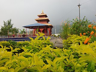
Kushmanda Sarowar Triveni Dham is a sacred Hindu pilgrimage site dedicated to the Goddess Kushmanda Bhagwati. The name Kushmanda is formed by amalgamation of three words, ku meaning ‘a little’, ushma meaning ‘warmth’ and anda meaning ‘the cosmic egg’. Hence, she is considered as the creator of the universe. She is often shown as having eight or ten hands and holds weapons, rosary, etc. and rides a lion. She is also said to be the happy form of goddess Durga, the fourth of the Navadurga worshipped in Dashahara. It is believed that her smile ended the eternal darkness that was present before the existence of any creation. Winter melon (Kubindo) is the favourite offering for the goddess.
References
- ↑ "Let's catch a big fish!". The Himalayan Times. 2016-06-21. Retrieved 2019-08-18.
- 1 2 "Rains inundate Hetauda". The Himalayan Times. 2019-07-25. Retrieved 2019-08-18.
- 1 2 3 Pradhananga, Sadhana (2012). WATER QUALITY STATUS OF KARRA RIVER, HETAUDA, NEPAL (Report). MINISTRY OF ENVIRONMENT, SCIENCE &TECHNOLOGY, GOVERNMENT OF NEPAL. Retrieved 18 August 2019.
Coordinates: 27°25′17″N85°00′44″E / 27.4215°N 85.0123°E