Related Research Articles

Mysore, officially Mysuru, is a city in the southern part of the state of Karnataka, India. Mysore city is geographically located between 12° 18′ 26″ north latitude and 76° 38′ 59″ east longitude. It is located at an altitude of 770 m (2,530 ft) above mean sea level.
The Chamundi Hills are located 13 km east of Mysore, Karnataka, India. The name comes from the Chamundeshwari Temple at the peak. The average elevation is 1,060 metres (3,480 ft).

Mysore division, officially Mysuru division, is an administrative division in the southern Indian state of Karnataka. It is one of four administrative divisions in Karnataka, the others being Bangalore division, Belgaum division, and Gulbarga division. Mysore division comprises eight districts of Karnataka, namely, Chamarajanagar, Chikmagalur, Dakshina Kannada, Hassan, Kodagu, Mandya, Mysore and Udupi district. The city of Mysore is the administrative headquarters of the division. Mysore division covers parts of historical Old Mysore region and southern part of Coastal Karnataka.The total area of the division is 43,503 sq.km. The total population as of 2011 census is 12,563,598.

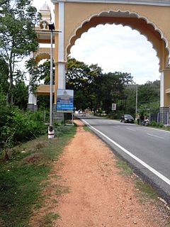
Kushalanagara or Kushalnagar is a city located in the Kodagu district of the Indian state of Karnataka. Surrounded by Kaveri river, it is the gateway to Kodagu district. It also serves as the headquarters of Kushalanagar Taluk. By population, Kushalanagar is the second largest town in Kodagu district after Madikeri and the fastest developing city in the district. Kushalnagar is an important commercial centre in Kodagu.

Mysore Airport, also known as Mandakalli Airport, is a domestic airport serving Mysore, a city in the Indian state of Karnataka. It is located near the village of Mandakalli, 10 kilometres (6.2 mi) south of the city, and is owned and operated by the Airports Authority of India (AAI). As of October 2019, the airport has regular daily flights to Chennai, Hyderabad, Bangalore and Goa.

Hinkal is a Census town situated at the intersection of Hunsur Road aka NH275 and Ring Road aka NH 275K in Mysore city outskirts of Karnataka, India. It is the most populous census town in Mysore district. The nearest railway station located is Mysore Junction railway station.

Mysore City Corporation (MCC) is the administrative body responsible for civic amenities and infrastructural assets of Mysore city in Karnataka, India. It is the third-largest municipal corporation in Karnataka, serving a population of 1,000,000 in an area of 235 km2. The city's boundaries have expanded more than twice between 2010 and 2020.

Chittaranjan Palace is a lesser-known palace at Mysore that was originally built for a princess of the Mysore royal family. It presently houses the "Green Hotel". It is a small hotel with 31 rooms and is eco-friendly. The profits from the hotel are given to charity.
Akshaya Bhandar is a suburb of Mysore in Karnataka, India.

Chamaraja Road or Chamarajendra double Road is an important main street in downtown Mysore city, Karnataka state, India.
Agrahara Circle, officially known as N. Madhava Rao Circle, is one of the suburbs of Mysore city in Karnataka state of India.
Agrahara is an area of the city of Mysore in the state of Karnataka in India. Famous locations in Agrahara include Mysore Palace as well as several gardens and historic temples. The area is bounded by Albert Victor Road to the North, MG Road to the South, Bengaluru-Nilgiri Road to the East, and Cheluvamba Agrahara Road to the West. The term agrahara or agraharam refers to a grant of land and agricultural income made by royalty to Brahmins in pre-independence South India. Though the Mysuru Agrahara is commonly referred to as a single neighbourhood, it is a composite of multiple adjacent smaller settlements built over time.
Lansdowne Building, initially called Range Bazaar, is a commercial complex and a heritage building in Mysore, India.
M. Kantharaj Urs Road is a road in Mysore city, Karnataka state, India.
New Kantharaj Urs Road is a road in Mysore city, Karnataka state, India.
Mirza Road is a road in Mysore city, Karnataka state, India.
Jayalakshmipuram is an urban commercial and residential suburb of Mysore city in Karnataka state, India. Residence of Noted Kannada Poet Javaregowda is located in Jayalakshmipuram.
Chamundipuram is a suburb of Mysore city in Karnataka state, India.
Lakshmipuram is a suburb of Mysore city in Karnataka state, India.
Gayathripuram is a locality of Mysore, city in South Indian state of Karnataka, India.
References
- ↑ "Purams of Mysuru". Star of Mysore. 5 January 2019. Retrieved 8 March 2022.
- ↑ "Mysuru Bishop bereaved". Star of Mysore. 8 July 2021. Retrieved 8 March 2022.
- ↑ "MCC clears encroachment by Karunapura Church". Star of Mysore. 7 December 2021. Retrieved 8 March 2022.
- ↑ "93 religious structures classified as illegal". Star of Mysore. 13 September 2021. Retrieved 8 March 2022.
- ↑ "Wesley Cathedral, Yesu Karunalaya celebrate anniversaries". Star of Mysore. 12 February 2018. Retrieved 8 March 2022.
- ↑ "X-mas celebrated in city". Star of Mysore. 25 December 2021. Retrieved 8 March 2022.
Coordinates: 12°19′25″N76°39′47″E / 12.323692059054965°N 76.66293468922038°E