| Kauaeranga River | |
|---|---|
 | |
 | |
| Location | |
| Country | New Zealand |
| Physical characteristics | |
| Source | |
| • location | The Pinnacles |
| • elevation | 773 m (2,536 ft) |
| Mouth | |
• location | Firth of Thames |
• elevation | 0m |
| Length | 31.2 km (19.4 mi) |
| Basin size | 139 km2 (54 sq mi) |
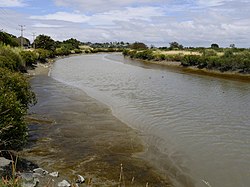
The Kauaeranga River is a river of New Zealand's North Island. One of the main rivers on the Coromandel Peninsula, it rises in the Coromandel Range which forms the backbone of the peninsula, flowing southwest through the Kauaeranga Valley to reach the Firth of Thames at Thames.
Contents
Apart from ammoniacal nitrogen, water quality is generally good. [1]
