Kaup Kāup | |
|---|---|
Village | |
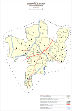 Map of Kaup (#507) in Garhani block | |
 Kaup Location in Bihar, India  Kaup Kaup (India) | |
| Coordinates: 25°22′42″N84°33′17″E / 25.37822°N 84.5546°E [1] | |
| Country | India |
| State | Bihar |
| District | Bhojpur |
| Area | |
• Total | 0.557 km2 (0.215 sq mi) |
| Elevation | 76 m (249 ft) |
| Population (2011) | |
• Total | 4,958 [2] |
| Languages | |
| • Official | Bhojpuri, Hindi |
| Time zone | UTC+5:30 (IST) |
Kaup is a village in Garhani block of Bhojpur district, Bihar, India. As of 2011, its population was 4,958, in 740 households. [2]