
Kuopio is a Finnish city and municipality located in the region of Northern Savonia. It has a population of 122,615, which makes it the 8th most populous municipality in Finland. Along with Joensuu, Kuopio is one of the major urban, economic, and cultural hubs of Eastern Finland. At the end of 2018, its urban area had a population of 89,307.

Karttula is a former municipality of Finland. It was consolidated with the city of Kuopio on 1 January 2011.

Leppävirta is a municipality of Finland. It is located in the Northern Savonia region, 56 kilometres (35 mi) south of Kuopio along the Finnish national road 5. The municipality has a population of 9,153 (28 February 2023) and covers an area of 1,519.64 square kilometres (586.74 sq mi) of which 383.62 km2 (148.12 sq mi) is water. The population density is 8.06 inhabitants per square kilometre (20.9/sq mi).

Perho is a municipality of Finland. It is located in the province of Western Finland and is part of the Central Ostrobothnia region. The distance between Perho and the regional center Kokkola is about 100 kilometres (62 mi). The municipality has a population of 2,648 and covers an area of 775.19 square kilometres (299.30 sq mi) of which 27.25 km2 (10.52 sq mi) is water. The population density is 3.54 inhabitants per square kilometre (9.2/sq mi).

Niirala is a district in the city of Kuopio, Finland, and it has a population of about 3,500. Niirala is now a popular residential area due to its good location between the Kuopio University and the city center. Niirala's main street is Niiralankatu. The neighboring parts of Niirala are Hatsala in the northeast, Haapaniemi in the southeast, and Savilahti in the west.

Haapaniemi is a district in the city of Kuopio, Finland. It is located south of downtown, about a mile from the market square. The district has a population of about 4,000. The northern end of Saaristokatu, which runs to the archipelago city, leads to Haapaniemi, as does the southern ramp leading to the center of the motorway.

Männistö is a district in the city of Kuopio, Finland It is part of the Itkonniemi–Männistö–Linnanpelto division area, which has a population of just over 5,800.

Julkula is a district in the northwest part of the city of Kuopio, Finland. It is located 4-6 km from the city center on the western slope of Puijo. The area has a population of about 2,700 and its residential buildings are mainly small and terraced houses.

Kuopio Market Square is the market square in the Multimäki district in Kuopio, North Savonia, Finland. The market is located about one hundred meters above sea level and the size of the area is 130×174 meters. The cover is made of dice and nubile stone. In the east–west direction, the area is crossed by flat walkways. As a surface, the market is slightly sloping, which poses challenges for use. The structure rests on a 10–15 m deep sand mattress, under which there is a ridge formation starting from Väinölänniemi, which runs under the church towards Puijo. Tulliportinkatu runs along the edges of the square in the north, Puijonkatu in the east, Kauppakatu in the south and Haapaniemenkatu in the west.

Kuopio Market Hall is an Art Nouveau-style market hall on Kuopio Market Square in the Multimäki district in Kuopio, Finland. The market hall has a sales point for 30 companies. It is open all year round six days a week.

Rönö is an island in Lake Kallavesi and also a district in the city of Kuopio, Finland. It is located about 2,5 kilometers southeast of Kuopio Market Square, measured along the street network. Since 1988, the island has been connected to Väinölänniemi by a bridge. Rönö is a sought-after residential area and is one of the most expensive areas in Kuopio, along with the archipelago estates in Saaristokaupunki. Only detached, semi-detached and terraced houses have been built there. Most of the island was built during the boom of art in the 1980s and 1990s, but houses have also been built in the 2000s, and a few estates are still completely undeveloped. By the decision of the city council, tenant houses were once built on the highest point of Rönö.

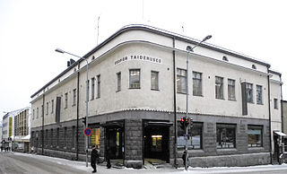
Multimäki is a central district in the heart of Kuopio, Finland. Many of Kuopio's most significant attractions, including the Kuopio's Market Square and Market Hall, Heroes' Park and the Kuopio City Hall, are located in the district. Kuopio Lyceum High School and two kindergartens also operate in the district. Multimäki borders district of Maljalahti in the north, Vahtivuori in the east, Kuopionlahti in the south, and Hatsala in the west. The boundaries of the district are street Minna Canthin katu in the south, Vuorikatu in the east, Suokatu in the north and Puistokatu in the west.

Hiltulanlahti is a rural village and urban area in the southern part of Kuopio, Finland, right next to the European route E63. At the end of 2011, the area had 242 inhabitants.

Puijo is a district of Kuopio, Finland. It is located north of the center of Kuopio, along the European route E63. The area includes, among other things, Puijo Hill with its nature reserves, and the Great Cemetery of Kuopio on the south side of the hill between the five roads and the railroad track. There are many exercise and sports venues in the district.
Vahtivuori is a district in the city of Kuopio, Finland, located between the city center and Lake Kallavesi. The southern boundary of Vahtivuori is Minna Canthin katu, the western boundary is Vuorikatu, the northern boundary is Suokatu and the eastern boundary is formed by Lake Kallavesi. The neighboring parts of Vahtivuori are Maljalahti in the north, Väinölänniemi in the south and Multimäki in the west.

Linnanpelto is a district in the city of Kuopio, Finland, about a kilometer north of the Kuopio Market Square. It is part of the Itkonniemi–Männistö–Linnanpelto division area, which has a population of just over 5,800. Linnanpelto starts immediately on the north side of the railway.

Pirtti is a district of Kuopio, Finland. It belongs to the larger subdivision of Petonen, and it is located about 10 kilometers from the center of Kuopio. At the beginning of 2015, the district had a population of 5,480.
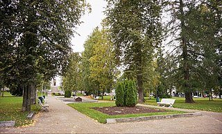
The Snellman Park is the oldest park in the city of Kuopio, Finland, located at the Vahtivuori district in the city center between the Kauppakatu and Minna Canthin katu streets, in the adjacent block of Kuopio Cathedral. The park covers an area of 1.4 hectares. Today, the park and its surroundings are part of the larger Kuopio National City Park, established in late 2017. The park is named after J. V. Snellman (1806–1881), the senator and the Fennoman, who influenced the affairs of the Grand Duchy from Kuopio, among other places.

The Tampere Police Station is a police station located in the Ratina district in Tampere, Finland, and also the administrative center of the Central Finland Police Department. The police station is also used by the Finnish Security Intelligence Service (SUPO). There are about 400 police officers working there and about 50 others. The police station consists of two buildings located near the Tampere Bus Station along the Hatanpää Highway and Sorinkatu streets; due to this, in Tampere colloquially, the police station and its surroundings are also known as Sori by locals.

Hatsala is a district located west of the center of Kuopio, Finland. The eastern boundary of the area is Puistokatu, the southern boundary is Minna Canthin katu and the northern is the Kuopio motorway. The western border first runs along Sairaalakatu and Niiralankatu. From the intersection of Suokatu, the border first runs north, then turns west and passes through the Savonia railway line to the motorway. The border leaves Mustinlammi on the Niirala side and on the Hatsala side of the swimming hall and Kuopio Hall.
