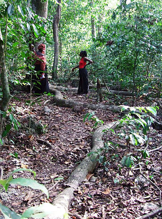
Sacred groves or sacred woods are groves of trees that have special religious importance within a particular culture. Sacred groves feature in various cultures throughout the world.

Mijikenda are a group of nine related Bantu ethnic groups inhabiting the coast of Kenya, between the Sabaki and the Umba rivers, in an area stretching from the border with Tanzania in the south to the border near Somalia in the north. Archaeologist Chapuruka Kusimba contends that the Mijikenda formerly resided in coastal cities, but later settled in Kenya's hinterlands to avoid submission to dominant Portuguese forces that were then in control. Historically, these Mijikenda ethnic groups have been called the Nyika or Nika by outsiders. It is a derogatory term meaning "bush people."
Kaya may refer to:

Kilifi is a town on the coast of Kenya, 56 kilometres (35 mi) northeast by road of Mombasa. The town lies on the Kilifi Creek and sits on the estuary of the Goshi River. Kilifi is the capital of Kilifi County and has a population of 122,899.

The Giriama are one of the nine ethnic groups that make up the Mijikenda.

Mombasa County is one of the 47 counties of Kenya. Its capital is Mombasa. In terms of economy it is second after Nairobi. Initially it was one of the former districts of Kenya but in 2013 it was reconstituted as a county, on the same boundaries. It is the smallest county in Kenya, covering an area of 229.7 km2 excluding 65 km2 of water mass. The county is situated in the south eastern part of the former Coast Province. It borders Kilifi County to the north, Kwale County to the south west and the Indian Ocean to the east. Administratively, the county is divided into seven divisions, eighteen locations and thirty sub-locations.

The Chonyi, also referred to as Achonyi, are one of the smaller tribes of the Mijikenda on the coast of Kenya.

Kilifi County was formed in 2010 as a result of a merger of Kilifi District and Malindi District, Kenya. Its capital is Kilifi and its largest town is Malindi. Kilifi county is one of the five counties that make up the Kenyan Coast. The county has a population of 1,453,787 people following the 2019 census which covers an area of 12,245.90 km2 (4,728.17 sq mi).
Mnyazi wa Menza, also known as Mekatilili Wa Menza or Mekatilili (1860s-1924) was a Kenyan independence activist who led the Giriama people against the colonial administration of Kenya between 1912 and 1915.
Digo (Chidigo) is a Bantu language spoken primarily along the East African coast between Mombasa and Tanga by the Digo people of Kenya and Tanzania. The ethnic Digo population has been estimated at around 360,000, the majority of whom are presumably speakers of the language. All adult speakers of Digo are bilingual in Swahili, East Africa's lingua franca. The two languages are closely related, and Digo also has much vocabulary borrowed from neighbouring Swahili dialects.

The Taita people are an ethnic group in Kenya's Taita-Taveta County. They speak Kidawida or Kitaita, which belongs to the Bantu language family. The West-Bantu migrated to the Taita-Taveta County around 1000-1300.
Bango is a music style created and made popular on the East African coast by Joseph Ngala. It fuses traditional Portuguese music genres, Arabic influenced taarab music, jazz and music genres of local coastal Bantu languages. It resembles easy listening music styles of Latin America such as bossa nova and music styles of many Indian Ocean islands such as Seychelles and Mauritius. Ngala is a renowned Kenyan bango musician who comes from Freretown, Mombasa, and also the founder of the genre. He performed in the past with famous groups such as the Hodi Boys and was also the founder and band leader of the 1960s and 1970s group Bahari Boys. In the band, he was the main composer and inspiration. Mzee Ngala's song "Bango" is the originator of the name bango. The resilience of the name, bango, is testament to the genre created by Ngala.
Mwanzele is a dance style originally performed during funerals by the Mijikenda tribe of the Coast Province of Kenya.
Rabai, also called Rabai Mpya (New Rabai), is a historic location and Sub-County in Kilifi County, Kenya about 12 miles northwest of the city of Mombasa. It is the first place in Kenya where missionaries of the Church Missionary Society (CMS) established a Christian mission.
The Rabai Museum is a museum located in Kenya. The museum is located in the first Christian church building constructed in Kenya. Much of the museum focuses on the work of Johann Ludwig Krapf, who built the church with Johannes Rebmann.

A kaya is a sacred site of the Mijikenda people in the former Coast Province of Kenya. Often located within sacred forests, a kaya is considered to be an intrinsic source of ritual power and the origin of cultural identity; it is also a place of prayer for members of the Mijikenda ethnic group. The settlement, ritual centre, and fortified enclosure associated with the forest are also part of the kaya. In the present day, the kaya is also referred to as a traditional organizational unit of the Mijikenda. Eleven of the approximately 60 separate makaya have been grouped together and inscribed as the Sacred Mijikenda Kaya Forests, a UNESCO World Heritage Site.
Fingo is a protective talisman of the Mijikenda people in Coast Province, Kenya. Fingo are believed to attract guardian spirits (djinns). It is commonly buried in the kaya. Kaya elders take care of the fingo, which is said to have come from Shungwaya, the ancestral home of the Mijikenda. Considered to be interesting objet d'art, many fingo are stolen, while others are lost. The Giriama use large stones as fingo while other Mijikenda use a large pot of medicine. The pottery vessel contains not only medicine but also magic charms. It serves to protect the kaya and its inhabitants, one buried at the entrance and exit of each kaya.
Rabai Thermal Power Station is a 90 megawatt heavy fuel oil-fired thermal power station in Kilifi County, Kenya.
Suswa–Isinya–Rabai High Voltage Power Line is an operational high voltage electricity power line connecting the high voltage substation at Suswa, Kenya to another high voltage substation at Rabai, Kenya.