The Nebraska Department of Transportation (NDOT) is the state government agency charged with building and maintaining the state highways in the U.S. state of Nebraska, as well as the state's airports. The main headquarters of the agency is located in Lincoln, the capital city. There are currently eight NDOT district offices located across the state.

The Lamar Boulevard Bridge is a historic arch bridge carrying Texas State Highway Loop 343 over Lady Bird Lake in downtown Austin, Texas, United States. The bridge features six open-spandrel concrete arches spanning 659 feet (201 m) and carries tens of thousands of vehicles daily across the lake. Completed in 1942, the Lamar Boulevard Bridge was the second permanent bridge to cross the Colorado River, and one of the last Art Deco-style open-spandrel concrete arch bridges built in Texas. The bridge was named an Austin Landmark in 1993 and added to the National Register of Historic Places in 1994.

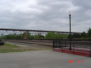
The original Maroon Creek Bridge is a steel trestle along State Highway 82 at the western boundary of Aspen, Colorado, United States. It was designed by George S. Morison in 1888 for the Colorado Midland Railroad, one of the last viaducts in Colorado built for a standard gauge mountain railroad in the 19th century. Of the five steel bridges the Midland built, it is the only one still extant. Due to the later removal of most track and the rail depots, the bridge is the most visible remnant of rail service to Aspen. In 1985 it was listed on the National Register of Historic Places along with other highway bridges in the state, including the Sheely Bridge, also in Aspen.

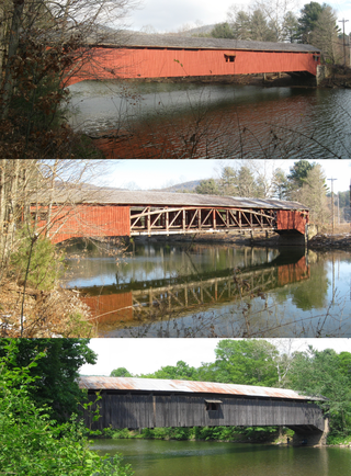
The Cogan House Covered Bridge is a Burr arch truss covered bridge over Larrys Creek in Cogan House Township, Lycoming County, in the U.S. state of Pennsylvania. It was built in 1877 and is 94 feet 2 inches (28.7 m) long. The bridge was placed on the National Register of Historic Places in 1980, and had a major restoration in 1998. The Cogan House bridge is named for the township and village of Cogan House, and is also known by at least four other names: Buckhorn, Larrys Creek, Day's, and Plankenhorn.

The US 77 James C. Nance Memorial Bridge connecting Purcell and Lexington was originally built as a circa 1938 deck truss two-lane bridge and in 2019 rebuilt as a concrete pier four-lane bridge crossing the Canadian River between Purcell and Lexington, Oklahoma. The bridge designated on the list of state highways in Oklahoma carries U.S. Route 77 (US-77) and Oklahoma State Highway 39 (SH-39) from McClain County to Cleveland County. The bridge is named for James C. Nance, longtime community newspaper chain publisher and Speaker of the Oklahoma House of Representatives, President pro tempore of the Oklahoma Senate and member of U.S Uniform Law Commission.

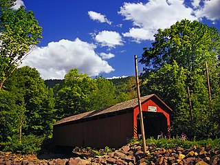
The Sonestown Covered Bridge is a covered bridge over Muncy Creek in Davidson Township, Sullivan County, Pennsylvania built around 1850. It is 110 ft (34 m) long and was placed on the National Register of Historic Places (NRHP) in 1980. It is named for the nearby unincorporated village of Sonestown in Davidson Township, and is also known as the Davidson Covered Bridge. It was built to provide access to a grist mill which operated until the early 20th century.

The Forksville Covered Bridge is a Burr arch truss covered bridge over Loyalsock Creek in the borough of Forksville, Sullivan County, in the U.S. state of Pennsylvania. It was built in 1850 and is 152 feet 11 inches (46.61 m) in length. The bridge was placed on the National Register of Historic Places in 1980. The Forksville bridge is named for the borough it is in, which in turn is named for its location at the confluence or "forks" of the Little Loyalsock and Loyalsock Creeks.

The Hillsgrove Covered Bridge is a Burr arch truss covered bridge over Loyalsock Creek in Hillsgrove Township, Sullivan County, in the U.S. state of Pennsylvania. It was built c. 1850 and is 186 feet (56.7 m) long. In 1973, it became the first covered bridge in the county to be placed on the National Register of Historic Places (NRHP). The bridge is named for the township and nearby unincorporated village of Hillsgrove, and is also known as Rinkers Covered Bridge for an adjoining farm.

U.S. Route 64 is a U.S. highway running from Teec Nos Pos, Arizona east to Nags Head, North Carolina. In the U.S. state of Arkansas, the route runs 246.35 miles (396.46 km) from the Oklahoma border in Fort Smith east to the Tennessee border in Memphis. The route passes through several cities and towns, including Fort Smith, Clarksville, Russellville, Conway, Searcy, and West Memphis. US 64 runs parallel to Interstate 40 until Conway, when I-40 takes a more southerly route.

Chevelon Creek Bridge is a historic road bridge located about 12 miles (19 km) southeast of Winslow, in Navajo County, eastern Arizona, United States. It is a steel Warren Pony truss bridge over Chevelon Creek, built on the first permanent road connecting Holbrook, the seat of Navajo County, and Winslow. When built, the road was regionally important in northern Arizona as well as being a segment of an early national highway at the time automobile traffic was growing and national roads were first being formed. The bridge was listed on the National Register of Historic Places in 1983 for being a rare design in Arizona, part of an early transnational roadway, one of the first bridges built by Arizona after statehood in 1912, and being in nearly original condition.

The South Pointe Drive–Frenchman's Creek Bridge is a bridge located on South Pointe Drive over Frenchman's Creek in Grosse Ile, Michigan. It was listed on the National Register of Historic Places in 2000.

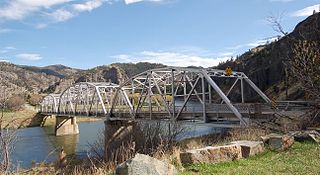
Hardy Bridge is a Warren through truss, three-span, two-lane bridge in the western United States. It crosses the Missouri River and is located at milepost 6 on Old U.S. Route 91, about fourteen miles (23 km) southwest of Cascade, Montana, which is southwest of Great Falls.

The San Luis Bridge, also known as State Bridge or Bridge over Culebra Creek, is a historic open spandrel arch bridge that crosses Culebra Creek in San Luis, Colorado. It was built in 1911 as a road bridge, but now serves pedestrian traffic. It is listed on the National Register of Historic Places.

Ciénega Bridge is an open-spandrel arch bridge which crosses Ciénega Creek and the Union Pacific Railroad near Vail, Arizona. Originally constructed in 1921, the bridge was part of U.S. Route 80, a major transcontinental highway, from 1926 to 1956. Being the oldest bridge of its kind in Arizona, the Ciénega Bridge is listed on the National Register of Historic Places. The bridge also holds the title of being the longest open-spandrel concrete arch bridge within the state. Currently, the bridge carries Marsh Station Road, which is part of Historic U.S. Route 80 as of 2018.

The Sebastian County Road 4G Bridge is a historic bridge in rural Sebastian County, Arkansas, United States. The bridge carries County Road 4 across an unnamed tributary of Sugar Loaf Creek southwest of West Hartford, between County Roads 1 and 243. It has two spans with a total length of 44 feet (13 m). The width is 18 feet (5.5 m) curb-to-curb and 21 feet (6.4 m) overall. The two spans rest on a single center stone pier, and both abutments are also made of stone masonry. The road deck is reinforced concrete with simple concrete railings on the sides. Built in 1940, it is a well-preserved example of a concrete bridge from the World War II era of bridge construction in the state, when steel had become scarce. The bridge was listed on the National Register of Historic Places in 1995.
The Merchants National Bank Building is a two-story, red brick building in Lehigh, Oklahoma, located at the southwest corner of Main Street and Railway Street. It was one of two banks that served Lehigh during the town's mining boom. It is listed on the National Register of Historic Places. It is historically significant because it represents the economic growth and decline of Lehigh and exemplifies Late Victorian Renaissance architecture.

The Lincoln Highway in Greene County, Iowa is a multiple property submission to the National Register of Historic Places, which was approved on March 29, 1993. It includes five individual listings and five historic districts located in Greene County, Iowa, United States. They encompass abandoned sections of dirt roads, paved sections that are now part of other highways, and various sites, objects, structures and pieces of infrastructure that were a part of the Lincoln Highway. The years of historical significance are 1912 to 1928.

The Ocean-to-Ocean Bridge is a through truss bridge spanning the Colorado River in Yuma, Arizona. Built in 1915, it was the first highway crossing of the lower Colorado and is the earliest example of a through truss bridge in Arizona. It is also the only example of a Pennsylvania truss within Arizona. Originally the bridge carried the transcontinental Ocean-to-Ocean Highway and later carried its successor, US 80 until a new bridge was built to the west in 1956. Between 1988 and 2001, the bridge was closed to vehicular traffic and only traversable by pedestrians and bicyclists. After a major restoration, the bridge was rehabilitated and reopened to vehicular traffic in 2002, with a re-dedication by the Quechan nation and Yuma Crossing National Heritage Area. The bridge became part of Historic US 80 in 2018.

Bridge 650 was a limestone-and-concrete bridge in rural Barton County in the state of Kansas in the Midwestern United States. The bridge was built by the Works Projects Administration in 1938–40. It was used into the 21st century, and in 2008 was listed in the National Register of Historic Places. However, it was later found inadequate for the volume and weight of traffic that it carried, and demolished in 2016 or 2017. It was delisted in 2018.
The Black River Bridge near Carrizo, Arizona was funded in 1911 and built in 1912. It was listed on the National Register of Historic Places in 1988. It spans the Black River, bringing an army road, now Indian Route 9, over the river from Fort Apache to the railroad at the former town of Rice, Arizona.


