
Mandya is a town in the Indian state of Karnataka. It is the headquarter of Mandya district and is located 45 kilometres (28 mi) from Mysore and 100 kilometres (62 mi) from Bangalore. Sugar factories contribute to the major economic output. It is also called Sakkare Nadu because sugarcane is a major crop.

Swamimalai is a panchayat town that is a suburb near Kumbakonam in Thanjavur District in the Indian state of Tamil Nadu. It lies on the banks of river Kaveri and is one of the six abodes of the Lord Muruga.

Khetri Nagar is a town in Jhunjhunu district of Rajasthan in India. It is part of the Shekhawati region. Khetri is actually two towns, "Khetri Town" founded by Raja Khet Singhji Nirwan and "Khetri Nagar" which is about 10 km away from Khetri. Khetri Nagar, well known for its Copper Project, was built by and is under the control of Hindustan Copper Limited, a public sector undertaking under the Government of India. Khetri Nagar is also very well known with name of 'Copper'.
Alwarthirunagiri is a panchayat town in Thoothukudi district in the state of Tamil Nadu, India. It is next to Srivaikuntam on the Tirunelveli - Tiruchendur Highway, Tamil Nadu, southern India. It's about 31 km from Tirunelveli and 29 km from Tiruchendur, on the banks of the river Tamirabarani. Alwarthirunagiri is the birthplace of alwar saint Nammalvar. The temple is classified as a "Divya Desam", the 108 temples of Sri Narayana revered by the 12 poet saints, or Alwars.
Arumbavur is a panchayat town in Perambalur district in the state of Tamil Nadu, India. It is also famous for woodensculptures such as temple cars,wooden statues, wooden doors which is done and exported all-over the world

Ayikudi is a panchayat town in Tirunelveli district in the state of Tamil Nadu, India.
Gangavalli is a panchayat town in Salem district in the state of Tamil Nadu, India.
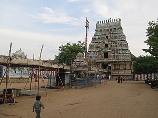
Kayathar is a panchayat town in Thoothukudi district in the Indian state of Tamil Nadu. It is situated along National Highway 7 (NH7) between Tirunelveli and Kovilpatti.
Kilpennathur is a Panchayat Town in Tiruvanamalai district in the Indian state of Tamil Nadu. Kilpennathur is one of the taluks of Tiruvannamalai district and an assembly constituency of Tamil Nadu.The MLA of Kilpennathur assembly constituency is DMK party Mr. K. Pichandi.
Kurumbalur is a panchayat town in Perambalur district in the Indian state of Tamil Nadu.
Musiri is a Panchayat town in the Tiruchirappalli district in the Indian state of Tamil Nadu. It has an average elevation of 82 metres (269 feet).
Nallur (Nalloor) is a panchayat town in Kanniyakumari district in the Indian state of Tamil Nadu.
Papparapatti is a panchayat town in Dharmapuri district in the Indian state of Tamil Nadu. The original name of this town was Pallur Pettai, later it was officially renamed as Papparapatti by the local government. The name Papparapatti was derived from Parpanar petai, which means the place where Brahmin community people lives.
Thevaram is a Town Panchayat in Theni district in the Indian state of Tamil Nadu. Thevaram is located in Tamil Nadu near on border of Kerala at the Eastern side foot-hill of Western Ghats. The State Highway SH-100 passes through this town.
Thirunageswaram is a panchayat town in Thanjavur district in the Indian state of Tamil Nadu. Thirunageswaram is located 6 km east of Kumbakonam. It is the suburban region of business city of Kumbakonam.
Bhuvanagiri is a Taluka in cuddalore district in the state of Tamil Nadu, India.
Sivagiri is a panchayat town in Kodumudi Taluk Erode district in the Indian state of Tamil Nadu.
Uthukottai is a border town and panchayat town in Tamil Nadu, next to Andhra Pradesh, located on the banks of the Arani river. The town features a channel which helps to direct water from the Krishna river for local irrigation.
Kerur is a City in Bagalkot district in Karnataka, which located on NH 218. It has an average elevation of 617 meters (2024 feet). It's a birthplace of Jagadish Shettar, a former Chief Minister of Karnataka. Kerur is a Town Panchayat city in district of Bagalkot, Karnataka. The Kerur city is divided into 16 wards for which elections are held every five years. The Kerur Town Panchayat has population of 19,731 of which 9,929 are males while 9,802 are females as per report released by Census India 2011.
Ulundurpettai is a town panchayat in Ulundurpet taluk of Viluppuram District of Tamil Nadu, India.


