Keila (river)

Last updated
Keila
Keila juga (suvi 2011).jpg
Keila (river)
Location
Country Estonia
Physical characteristics
Source 
  location Loosalu Bog near Juuru
Mouth  
  location
Lohusalu Bay, Gulf of Finland
Length107 km (66 mi)
Basin size682 km2 (263 sq mi)
Discharge 
  average6.4 m3/s (230 cu ft/s)
Drone video of the Keila River, Keila Falls, manor, and hydroelectric power station (June 2022)

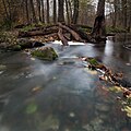
The Keila is a river in northern Estonia. [1] One attraction along the river is Keila Falls (Estonian : Keila juga). [2]

Contents

Keila River Park

Located on the grounds of the former Keila Manor and along the Keila River, [3] Keila River Park (Estonian : Keila Jõepark) dates back to the 17th century. The ruins of a prehistoric sacrificial stone and a small castle can be seen while strolling around the park.

Several bat species [4] also inhabit the vicinity and can be seen soaring through the park on summer nights.

See also

References

  1. "Keila River". memim.com. Retrieved 2021-12-17.
  2. "Keila juga | Harjumaa Turism". www.visitharju.ee. Retrieved 2021-12-17.
  3. "Keila River Park". Mapeirons. Retrieved 2021-12-17.
  4. "About bats". Elfond. Retrieved 2021-12-17.

59°24′12.97″N24°16′48.73″E / 59.4036028°N 24.2802028°E / 59.4036028; 24.2802028