Kelly Field Historic District

Last updated
Kelly Field Historic District
Kellyafb-7jan1995.jpg
Kelly Field Historic District, middle right of the runway
Relief map of Texas.png
Red pog.svg
Kelly Field Historic District
Usa edcp relief location map.png
Red pog.svg
Kelly Field Historic District
Location San Antonio, Texas, US
Coordinates 29°22′57″N98°34′15″W / 29.38250°N 98.57083°W / 29.38250; -98.57083
NRHP reference No. 03000626 [1]
Added to NRHPJuly 10, 2003

The Kelly Field Historic District is located in southwestern San Antonio, Bexar County, Texas. It is the center portion of the base, east of the runways. The boundaries of the 1600 buildings are Billy Mitchell Road on the north, Wagner on the east, England on the south and S. Frank Luke Drive on the west. The 1700 block of officer quarters are bounded on the north by Chennault Street, the east and south by Chennault Circle, and Van Nostrand Drive on the west. The historic district contains 58 contributing and non-contributing buildings, structures, objects and sites, and was added to the National Register of Historic Places in 2003. [2]

Contents

Camp Kelly was established on May 7, 1917, to be a US Army training facility for pilots and support staff during World War I. The first airplanes arrived on April 5, and on April 6 the United States declared war on Germany. [3] The increased training activities necessitated more facilities and the acquisition of additional land. The original field became Kelly Field No. 1. The new facilities became Kelly Field No. 2. Military cut-backs followed the 1918 Armistice with Germany, and the two facilities ceased training pilots but functioned as supply depots. The two fields were re-designated in 1925 as Duncan Field (Kelly No. 1) and Kelly Field (Kelly No. 2). [4] The latter included the Air Service Advanced Flying School where Charles Lindbergh earned his wings, [5] graduating first in his class on March 14, 1925. [6]

In 1926, the Army Air Corps Act authorized a 5-year period of expansion to begin July 1, 1927. [7] As a result, both Kelly No. 1 and No. 2 began being developed as permanent aviator training facilities. [8] During World War II, the facilities were consolidated as San Antonio Air Depot and was the largest maintenance and supply facility in the United States. The property was renamed Kelly Air Force Base after the National Security Act of 1947 established the United States Air Force as a separate branch of the military. [9] Kelly eventually became the largest employer in San Antonio. [8] In 1995, the United States government began realignment of military facilities. Kelly was closed in 2001, partially combined with Lackland Air Force Base. The remainder was taken over by the Greater Kelly Development Authority of the state of Texas and redeveloped as a commercial and military industrial center. [10]

Properties

The development that began between the two world wars, and continued through post-World War II, is the area designated as Kelly Field Historic District. [8]

National Register criteria for which the following properties qualify are two-fold: [2]

The following data is reproduced from Table 1 of NPS Form 10-900 Registration Form dated April 15, 2002. The dates represent the original construction period and subsequent improvements or other alterations to the property. [2]

Contributing

Number/featureSignificant datesNotes
Feature Ac.1940237.5 by 1,100 feet (72.4 m × 335.3 m) esplanade along Goodrich and Mabry drives; Irregularly shaped parcels; Triangular intersection islands
Feature Bc.1940sidewalks
Feature Cc.1940streets
Feature Dc.1940landscaping
16071943weather building, storage
16091942 Norden bombsight storage
16101940, 1955, 1964, 1966, 1970, 1980, 1987Air Corps operations hangar
16181937, 1953, 1973oil storage, pump station
16251935,1960s, 1983miniature range, air conditioning; built by the Works Progress Administration
16271942, 1950, 1967, 1981photo lab
16321940, 1950s, 1960s Quartermaster maintenance
16351940, 1947, 1968signal office, warehouse, Public Affairs Office
16381941water pump house, electric substation
16431942bath house; built by the Works Progress Administration
16441942water filtration building; built by the Works Progress Administration
16451942swimming pool; built by the Works Progress Administration
16501940, 1950s–1980senlisted men's barracks
16761940, 1950s–1980scadet barracks
16801940, 1943, 1960s–1980sacademic building, Air Depot HQ
16811940,1971NCO quarters
1682 though 16891940,1973NCO quarters
1690 through 1694, 16961940NCO quarters
1750, 1752–1753, 1755, 1757–17581940,1973officer's quarters

Non contributing

NumberSignificant datesNotes
16001942, 1942, 1967, 1973, 1982Norden bombsight repair shop
16111951bus stop
16211940, 1953, 1968, 1969, 1971, 1989Air Corps warehouse
16221987bus stop
16231942,1966Quartermaster vehicle repair
16261940, 1950s, 1960s, 1971Quartermaster warehouse
16281942,1994theater, classrooms
16361954dental clinic, counseling office, housing
16371981Base Exchange
16511959electric substation
16541955baseball diamond
16551986heating plant
16691977chapel
16701942, 1960s, 1994temporary barracks, Judge Advocate
16711942, 1960s, 1994temporary barracks, Judge Advocate
16741967telephone equipment
16971972storage shed
16981957flagpole

Related Research Articles

<span class="mw-page-title-main">Fort Sam Houston</span> US Army post in San Antonio, Texas

Fort Sam Houston is a U.S. Army post in San Antonio, Texas. Known colloquially as "Fort Sam," it is named for the U.S. Senator from Texas, U.S. Representative from Tennessee, Tennessee and Texas governor, and first president of the Republic of Texas, Sam Houston.

<span class="mw-page-title-main">Lackland Air Force Base</span> US Air Force base near San Antonio, Texas, part of Air Education and Training Command

Lackland Air Force Base is a United States Air Force (USAF) base located in Bexar County, Texas, United States. The base is under the jurisdiction of the 802d Mission Support Group, Air Education and Training Command (AETC) and an enclave of the city of San Antonio. It is the only site for USAF and United States Space Force enlisted Basic Military Training (BMT).

<span class="mw-page-title-main">Randolph Air Force Base</span> US Air Force base near San Antonio, Texas

Randolph Air Force Base is a United States Air Force base located at Universal City, Texas.

<span class="mw-page-title-main">Texas Air National Guard</span> Military unit

The Texas Air National Guard (TX ANG) is the aerial militia of the State of Texas, United States of America. It is, along with the Texas Army National Guard, an element of the Texas National Guard. No element of the Texas Air National Guard is under United States Air Force command. They are under the jurisdiction of the Governor of Texas through the office of the Texas Adjutant General unless they are federalized by order of the President of the United States. The Texas Air National Guard is headquartered at Camp Mabry, Austin, and its chief of staff is Brigadier General Matthew Barker.

<span class="mw-page-title-main">Brooks Air Force Base</span> Former U.S. military air base in San Antonio, Texas

Brooks Air Force Base was a United States Air Force facility located in San Antonio, Texas, 7 miles (11 km) southeast of Downtown San Antonio.

<span class="mw-page-title-main">Kelly Field</span> Military facility in San Antonio, Texas

Kelly Field is a Joint-Use facility located in San Antonio, Texas. It was originally named after George E. M. Kelly, the first member of the U.S. military killed in the crash of an airplane he was piloting.

<span class="mw-page-title-main">Brooke Army Medical Center</span> US Army medical facility at Fort Sam Houston, San Antonio, Texas

Brooke Army Medical Center (BAMC) is the United States Army's premier medical institution. Located on Fort Sam Houston, BAMC, a 425-bed Academic Medical Center, is the Department of Defense's largest facility and only Level 1 Trauma Center. BAMC is also home to the Center for the Intrepid, an outpatient rehabilitation facility. The center is composed of ten separate organizations, including community medical clinics, centered around the Army's largest in-patient hospital. BAMC is staffed by more than 8,000 Soldiers, Airmen, Sailors, Civilians, and Contractors providing care to wounded Service Members and the San Antonio Community at-large.

<span class="mw-page-title-main">Mitchel Air Force Base</span> US Air Force base on Long Island, New York

Mitchel Air Force Base, also known as Mitchel Field, was a United States Air Force base located on the Hempstead Plains of Long Island, New York, United States. Established in 1918 as Hazelhurst Aviation Field #2, the facility was renamed later that year as Mitchel Field in honor of former New York City Mayor John Purroy Mitchel, who was killed while training for the Air Service in Louisiana.

<span class="mw-page-title-main">Rockwell Field</span> United States historic place

Rockwell Field is a former United States Army Air Corps (USAAC) military airfield, located 1.1 miles northwest of the city of Coronado, California, on the northern part of the Coronado Peninsula across the bay from San Diego, California.

<span class="mw-page-title-main">John K. Cannon</span> United States Air Force general (1892–1955)

General John Kenneth Cannon was a World War II Mediterranean combat commander and former chief of United States Air Forces in Europe for whom Cannon Air Force Base, Clovis, New Mexico, is named.

<span class="mw-page-title-main">Camp Bullis</span>

Camp Bullis Military Training Reservation is a U.S. Army training camp comprising 27,990 acres (113.3 km2) in Bexar County, Texas, USA, just northwest of San Antonio. Camp Bullis provides base operations support and training support to Joint Base San Antonio. The camp is named for Brigadier General John L. Bullis.

<span class="mw-page-title-main">Ellington Field Joint Reserve Base</span> Installation of several military units

Ellington Field Joint Reserve Base is a joint installation shared by various active component and reserve component military units, as well as aircraft flight operations of the National Aeronautics and Space Administration (NASA) under the aegis of the nearby Johnson Space Center. The host wing for the installation is the Texas Air National Guard's 147th Attack Wing. Opened in 1917, Ellington Field was one of thirty-two Air Service training camps established after the United States entry into World War I. It is named for First Lieutenant Eric Ellington, a U.S. Army aviator who was killed in a plane crash in San Diego, California in 1913.

The Edward H. White II Museum of Aerospace Medicine was a museum of the United States Air Force and was located in Hangar 9 at Brooks Air Force Base, San Antonio, Texas. Brooks Air Force Base closed in 2011 under Base Realignment and Closure Commission (BRAC) procedures, and the museum closed at the same time.

<span class="mw-page-title-main">110th Bomb Squadron</span> Missouri Air National Guard unit

The 110th Bomb Squadron is a unit of the Missouri Air National Guard 131st Bomb Wing located at Whiteman Air Force Base, Knob Noster, Missouri. The 110th is equipped with the Northrop Grumman B-2 Spirit.

<span class="mw-page-title-main">Randolph Field Historic District</span> Historic district in Texas, United States

Randolph Field Historic District is a National Historic Landmark District encompassing the central portion of Randolph Air Force Base, near San Antonio, Texas, US. Randolph Field was innovatively designed using Garden city movement principles, and includes a unique and well-preserved assemblage of Mission Revival and Art Deco architecture. Built between 1929 and 1931, it was the first permanent flight training facility of the United States military establishment, then the United States Army Air Corps and later the United States Air Force. It was listed on the National Register of Historic Places in 1996, and was declared a National Historic Landmark in 2001.

<span class="mw-page-title-main">Joint Base San Antonio</span> US military joint service installation near San Antonio, Texas, United States

Joint Base San Antonio (JBSA) is a United States military facility located in San Antonio, Texas, US. The facility is under the jurisdiction of the United States Air Force 502d Air Base Wing, Air Education and Training Command (AETC). The wing's three Mission Support Groups perform the installation support mission at the three bases that form JBSA.

<span class="mw-page-title-main">Henry Post Army Airfield</span> Airport in Fort Sill, Oklahoma

Henry Post Army Airfield is a military use airport located at Fort Sill in Comanche County, Oklahoma, United States. This military airport is owned by United States Army. Established as Post Field in 1917, it was one of thirty-two Air Service training camps established after the United States entry into World War I in April 1917.

<span class="mw-page-title-main">United States Army World War I Flight Training</span>

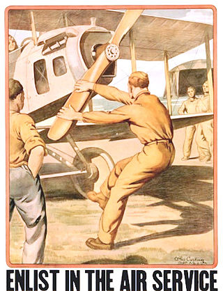
With the purchase of its first airplane, built and successfully flown by Orville and Wilbur Wright, in 1909 the United States Army began the training of flight personnel. This article describes the training provided in those early years, though World War I, and the immediate years after the war until the establishment of the United States Army Air Corps Flight Training Center in San Antonio, Texas during 1926.

<span class="mw-page-title-main">Administration Building (Randolph Air Force Base)</span> United States historic place

The Administration Building at Randolph Air Force Base is headquarters for the 12th Flying Training Wing and located at Universal City, northeast of San Antonio, county of Bexar, in the U.S. state of Texas. The building is referred to as the Taj Mahal, or simply the Taj. It is Building 100 on the base, and was erected in 1931 at a cost of $252,027.50. It was added to the National Register of Historic Places in 1987.

Brooks is a 1,308-acre (529 ha) mixed-use community in the southeast portion of the city of San Antonio, Texas, United States. Brooks was created in 2001 by the United States Congress, the State of Texas and the City of San Antonio to redevelop the former Brooks Air Force Base. Brooks is intended to be a catalyst for economic development, a dynamic mixed-use community and a model for responsible urban planning and development.

References

  1. "National Register Information System". National Register of Historic Places . National Park Service. April 15, 2008.
  2. 1 2 3 "Kelly Field Historic District" (PDF). THC NR Program. Texas Historical Commission. Retrieved April 8, 2014.
  3. "A Joint Resolution of April 6, 1917, Public Resolution 65-1, 40 STAT 1, Declaring that a State of War Exists Between the Imperial German Government and the Government and the People of the United States and Making Provision to Prosecute the Same, 04/06/1917". National Archives and Records Administration. Retrieved April 8, 2014.
  4. "Kelly Field narrative". Texas Historical Commission. Retrieved April 8, 2014.
  5. Leatherwood, Art. "Kelly Air Force Base". Handbook of Texas Online. Texas State Historical Association. Retrieved April 8, 2014.
  6. Wagner, Heather Lehr (2003). Charles Lindbergh (Famous Flyers). Chelsea House Publications. p. 38. ISBN   978-0-7910-7212-7.
  7. "1926 – The U. S. Army Air Corps Act". United States Air Force. Retrieved April 8, 2014.
  8. 1 2 3 "Kelly Field Historic District". National Park Service. Archived from the original on April 8, 2014. Retrieved April 8, 2014.
  9. "1943–1947 Struggle for Air Force Independence". United States Air Force. Retrieved April 8, 2014.
  10. Sasser, Chris (February 15, 2012). "Port San Antonio: Not Just Surviving, Thriving". Texas A&M Transportation Institute. Retrieved April 8, 2014.