Kentucky Route 323

Last updated

Elongated circle 323.svg

Kentucky Route 323
Route information
Maintained by KYTC
Length 23.0 mi [1] [2] (37.0 km)
Southern segment
Length 3.4 mi [1] (5.5 km)
South endElongated circle 566.svg KY 566 in Eve
North end Graham Cemetery Road / H. Milby–Oak Grove Road near Lobb
Northern segment
Length 19.6 mi [2] (31.5 km)
South end Dirt road southeast of Lobb
Major
junctions
Elongated circle 61.svg KY 61 in Summersville
Elongated circle 883.svg KY 883 in Sweeneyville
US 68.svgElongated circle 70.svg US 68 / KY 70 in Campbellsville
North endUS 68.svgElongated circle 55.svgElongated circle 70.svg US 68 / KY 55 / KY 70 in Campbellsville
Location
Counties Green, Taylor
Highway system
Elongated circle 322.svg KY 322 KY 324 Elongated circle 324.svg

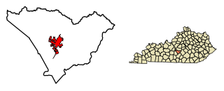
Kentucky Route 323 (KY 323) is a 7.1-mile-long (11.4 km) state highway in the U.S. state of Kentucky. The highway connects mostly rural areas of Green and Taylor counties with Campbellsville.

U.S. state constituent political entity of the United States

In the United States, a state is a constituent political entity, of which there are currently 50. Bound together in a political union, each state holds governmental jurisdiction over a separate and defined geographic territory and shares its sovereignty with the federal government. Due to this shared sovereignty, Americans are citizens both of the federal republic and of the state in which they reside. State citizenship and residency are flexible, and no government approval is required to move between states, except for persons restricted by certain types of court orders. Four states use the term commonwealth rather than state in their full official names.

Kentucky State of the United States of America

Kentucky, officially the Commonwealth of Kentucky, is a state located in the east south-central region of the United States. Although styled as the "State of Kentucky" in the law creating it, (because in Kentucky's first constitution, the name state was used) Kentucky is one of four U.S. states constituted as a commonwealth. Originally a part of Virginia, in 1792 Kentucky became the 15th state to join the Union. Kentucky is the 37th most extensive and the 26th most populous of the 50 United States.

Rural area geographic area that is located outside towns and cities

In general, a rural area or countryside is a geographic area that is located outside towns and cities. The Health Resources and Services Administration of the U.S. Department of Health and Human Services defines the word rural as encompassing "...all population, housing, and territory not included within an urban area. Whatever is not urban is considered rural."

Contents

Route description

Southern segment

KY 323 begins at an intersection with KY 566 (Eve Road) in Eve, within Green County. This intersection is along the southwestern edge of Vance Cemetery. It travels to the south-southeast and curves to the northeast until it meets the northern terminus of its southern segment, an intersection with Graham Cemetery Road, at a point south-southeast of Lobb. Here, the roadway continues as H. Milby–Oak Grove Road. This intersection is on the western bank of Big Brush Creek. [1]

Intersection (road) A road junction where two or more roads either meet or cross at grade

An intersection is an at-grade junction where two or more roads meet or cross. Intersections may be classified by number of road segments, traffic controls, and/or lane design.

Eve, Kentucky Unincorporated community in Kentucky, United States

Eve is an unincorporated community in Green, Kentucky, United States.

Green County, Kentucky County in the United States

Green County is a county located in the U.S. state of Kentucky. As of the 2010 census, the population was 11,258. Its county seat is Greensburg. Green was a prohibition or dry county but has not been since 2015.

Northern segment

KY 323 resumes on the eastern back of the creek, at a dirt road located southeast of Lobb. It travels to the southeast and passes Milby Cemetery before curving to the east-southeast. The highway enters Gabe, where it curves to the northeast. It passes Bennett Cemetery and then enters Summersville, where it intersects KY 61 (Hodgenville Road / Greenburge Road). It curves to the east-northeast and intersects the southern terminus of KY 2763 (Summersville–Coakley Road). The highway curves to the east-southeast and then to the northeast before it crosses over Sand Lick Creek.

Dirt road unpaved road made from the native material of the land surface

A dirt road or track is a type of unpaved road made from the native material of the land surface through which it passes, known to highway engineers as subgrade material. Dirt roads are suitable for vehicles; a narrower path for pedestrians, animals, and possibly small vehicles would be called a dirt track—the distinction is not well-defined. Unpaved roads with a harder surface made by the addition of material such as gravel and aggregate (stones), might be referred to as dirt roads in common usage but are distinguished as improved roads by highway engineers.

Summersville, Kentucky Census-designated place in Kentucky, United States

Summersville is a census-designated place (CDP) and unincorporated community in Green County, Kentucky, United States. As of the 2010 census it had a population of 568.

Kentucky Route 61 is a 151.333-mile (243.547 km) long Kentucky State Highway extending north from the Tennessee state line in Cumberland County to Columbia in Adair County through to Greensburg in Green County. From there, the route traverses LaRue, Hardin and Bullitt counties to terminate in Jefferson County at the junction of U.S. Route 31E in downtown Louisville.

The highway then enters Taylor County. It crosses over Big Pitman Creek before curving to the south to travel through Bengal. KY 323 travels in an easterly direction and curves to the southeast before it crosses over Middle Pitman Creek. It enters Sweeneyville, where it intersects KY 883 (Fairview Road). It crosses over Little Pitman Creek and enters the western part of Campbellsville. The highway intersects US 68/KY 70 (Greensburg Road). It curves to the east-northeast and crosses over KY 55 (New Columbia Road). It passes Brookside Cemetery and Campbellsville High School. It crosses over Buck Horn Creek and turns left, to the north-northwest, onto Columbia Avenue. Two blocks later, it meets its northern terminus, an intersection with US 68/KY 55/KY 70 (East Broadway Street). This intersection is on the southeastern edge of Campbellsville University. At this intersection, the roadway continues as North Columbia Avenue. [2]

Taylor County, Kentucky County in the United States

Taylor County is a county located in the U.S. state of Kentucky. As of the 2010 census, the population was 24,512. Its county seat is Campbellsville. Settled by people from Virginia, Pennsylvania, Maryland, and North Carolina after the American Revolutionary War, the county was organized in 1848 in the Highland Rim region. It is named for United States Army General Zachary Taylor, later President of the United States.

Bengal, Kentucky Unincorporated community in Kentucky, United States

Bengal is an unincorporated community in Taylor County, Kentucky, United States. Located west of the city of Campbellsville, the county seat of Taylor County, it is served by Bengal Road from Campbellsville and by Route 323. Its elevation is 722 feet (220 m).

Campbellsville, Kentucky City in Kentucky, United States

Campbellsville is a city in central Kentucky founded in 1817 by Andrew Campbell. It is known for Campbellsville University, Taylor Regional Hospital health care system, its historic downtown, and the proximity to Green River Lake State Park. Campbellsville is the county seat of Taylor County, with a geographic boundary shaped like a heart. Campbellsville celebrated its bicentennial on July 4, 2017.

Major intersections

CountyLocationmi [1] [2] kmDestinationsNotes
Green Eve 0.00.0Elongated circle 566.svg KY 566 (Eve Road)Southern terminus
3.45.5H. Milby–Oak Grove Road north / Graham Cemetery Road northNorthern terminus of southern segment; southern terminus of Graham Cemetery Road
Gap in route
Green 0.00.0 Dirt road Southern terminus of northern segment
Summersville 5.89.3Elongated circle 61.svg KY 61 (Hodgenville Road / Greenburge Road)
7.411.9Elongated circle 2763.svg KY 2763 north (Summersville–Coakley Road)Southern terminus of KY 2763
Taylor Sweeneyville 15.825.4Elongated circle 883.svg KY 883 (Fairview Road)
Campbellsville 17.728.5US 68.svgElongated circle 70.svg US 68 / KY 70 (Greensburg Road) Greensburg
19.631.5US 68.svgElongated circle 55.svgElongated circle 70.svg US 68 / KY 55 / KY 70 (East Broadway Street) Lebanon, Liberty Northern terminus
1.000 mi = 1.609 km; 1.000 km = 0.621 mi

See also

Related Research Articles

Kentucky Route 191 (KY 191) is a 31.1-mile-long (50.1 km) state highway in the U.S. state of Kentucky. The highway connects Campton and West Liberty with mostly rural areas of Wolfe and Morgan counties.

Kentucky Route 192 (KY 192) is a 40.5-mile-long (65.2 km) state highway in the U.S. state of Kentucky. The highway connects the Somerset area and the London areas with mostly rural areas of Pulaski and Laurel counties.

Kentucky Route 206 (KY 206) is a 23.6-mile-long (38.0 km) state highway in the U.S. state of Kentucky. The highway connects mostly rural areas of Adair and Casey counties with Columbia.

Kentucky Route 207 (KY 207) is a 23.9-mile-long (38.5 km) state highway in the U.S. state of Kentucky. The highway connects mostly rural areas of Carter and Greenup counties with Argillite and Flatwoods.

Kentucky Route 214 (KY 214) is a 15.6-mile-long (25.1 km) state highway in the U.S. state of Kentucky. The highway connects mostly rural areas of Monroe and Cumberland counties.

Kentucky Route 221 (KY 221) is a 42.5-mile-long (68.4 km) state highway in the U.S. state of Kentucky. The highway connects mostly rural areas of Bell, Harlan, Perry, and Leslie counties with the Daniel Boone National Forest.

Kentucky Route 222 (KY 222) is a 15.8-mile-long (25.4 km) state highway in the U.S. state of Kentucky. The highway connects mostly rural areas of Hardin and LaRue counties with Glendale.

Kentucky Route 223 (KY 223) is a 16.7-mile-long (26.9 km) state highway in the U.S. state of Kentucky. The highway travels through mostly rural areas of Knox County. It has a northern loop in the route.

Kentucky Route 228 (KY 228) is a 23.8-mile-long (38.3 km) state highway in the U.S. state of Kentucky. The highway connects mostly rural areas of Meade County with Brandenburg.

Kentucky Route 270 (KY 270) is a 27.5-mile-long (44.3 km) state highway in the U.S. state of Kentucky. The highway travels through mostly rural areas of Union and Webster counties.

Kentucky Route 272 (KY 272) is a 22.9-mile-long (36.9 km) state highway in the U.S. state of Kentucky. The highway connects rural areas of Trigg and Christian counties with Hopkinsville.

Kentucky Route 276 (KY 276) is a 17.7-mile-long (28.5 km) state highway in the U.S. state of Kentucky. The highway connects mostly rural areas of Trigg and Caldwell counties with the extreme eastern part of Cadiz.

Kentucky Route 292 (KY 292) is a 43.2-mile-long (69.5 km) state highway in the U.S. state of Kentucky. The highway connects mostly rural areas of Pike and Martin counties with South Williamson and Warfield. Nearly the entire highway is located near the West Virginia state line.

Kentucky Route 300 (KY 300) is a 16.6-mile-long (26.7 km) state highway in the U.S. state of Kentucky. The highway connects mostly rural areas of Boyle and Lincoln counties with Parksville, Junction City, and Stanford.

Kentucky Route 303 (KY 303) is a 16.9-mile-long (27.2 km) state highway in the U.S. state of Kentucky. The highway connects mostly rural areas of Graves County with the Tennessee state line and Mayfield.

Kentucky Route 305 (KY 305) is a 14.3-mile-long (23.0 km) state highway in the U.S. state of Kentucky. The highway connects mostly rural areas of McCracken County with West Paducah and Paducah.

Kentucky Route 307 (KY 307) is a 28.3-mile-long (45.5 km) state highway in the U.S. state of Kentucky. The highway connects mostly rural areas of Fulton, Hickman, and Carlisle counties with Fulton.

Kentucky Route 324 (KY 324) is a 10.8-mile-long (17.4 km) state highway in the U.S. state of Kentucky. The highway connects mostly rural areas of Mason County with Mays Lick.

Kentucky Route 328 (KY 328) is a 21.708-mile-long (34.936 km) state highway in the U.S. state of Kentucky. The highway connects mostly rural areas of Lincoln, Pulaski, and Rockcastle counties with Waynesburg.

Kentucky Route 330 (KY 330) is a 38.3-mile-long (61.6 km) state highway in the U.S. state of Kentucky. The highway connects mostly rural areas of Owen, Grant, and Pendleton counties with the Corinth and Falmouth areas.

References

  1. 1 2 3 4 Google (June 6, 2016). "Kentucky Route 323's southern section" (Map). Google Maps . Google. Retrieved June 6, 2016.
  2. 1 2 3 4 Google (June 6, 2016). "Kentucky Route 323's northern section" (Map). Google Maps. Google. Retrieved June 6, 2016.