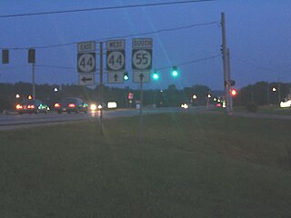
Kentucky Route 55 is a 140.858-mile-long (226.689 km) state highway in the U.S. Commonwealth of Kentucky.
Kentucky Route 1 is a 48.486-mile-long (78.031 km) state highway in the U.S. state of Kentucky. It originates at a junction with KY 3, one mile (1.6 km) east of Cadmus in Lawrence County. The route continues through Grayson in Carter County to terminate at US 23 in Greenup in Greenup County. Part of the highway is co-signed with the Jenny Wiley Trail. Segments of KY 1 are built upon the old Eastern Kentucky Railroad. KY 1 follows parts of the Little Sandy River and parts of a smaller fork of the Little Sandy called the Little Fork upstream of Grayson.
Kentucky Route 7 is a 203.073-mile-long (326.814 km) state highway in the U.S. state of Kentucky.

The Bob Cummings Lincoln Trail Bridge crosses the Ohio River and connects the towns of Cannelton, Indiana and Hawesville, Kentucky. Indiana State Road 237 becomes Kentucky Route 69 upon entering Hawesville.
Kentucky Route 180 is a 2.514-mile-long (4.046 km) state highway in the U.S. state of Kentucky. It serves as a connector route between US 60 and KY 3. It is two lanes from KY 3 to just south of I-64 and four lanes divided from just south of I-64 to US 60.
Kentucky Route 79 (KY 79) is a 104-mile-long (167 km) north–south state highway that traverses five counties in west-central Kentucky. It can be seen as an extension of U.S. Route 79 (US 79), as they have the same number; KY 79 begins in the same city that US 79 ends, and both travel on a northeast–southwest diagonal.
Kentucky Route 2830 (KY 2830) is a two-lane, largely rural highway in northeastern Daviess County, Kentucky. The southern terminus is at KY 144 and the northern terminus is at KY 334. The road serves the community of Maceo.
Kentucky Route 915 is a road that runs from the city limits of Wilder, Kentucky, to just outside Alexandria, Kentucky, where it joins U.S. 27. The road is a windy, curvy road which has many houses along its path.
Kentucky Route 174 (KY 174) is a state highway in Kentucky.
Kentucky Route 91 is a 49.783-mile (80.118 km) state highway that traverses three counties in western Kentucky. It begins in Hopkinsville, Kentucky and ends at the Ohio River, the Kentucky-Illinois state line in northern Crittenden County.
Kentucky Route 189 (KY 189) is a 32.027-mile-long (51.542 km) state highway in Kentucky that runs from Kentucky Route 507 and Flat Rock Road west of Allegre to U.S. Route 62 northeast of Powderly via Fearsville.
Kentucky Route 109 (KY 109) is an 89.6-mile-long (144.2 km) north–south state highway that traverses four counties in Kentucky's Pennyrile region. It traverses Christian, Hopkins, Webster, and Union counties.
Kentucky Route 252 is a 16.093-mile-long (25.899 km) north–south route traversing two counties in south-central Kentucky in the Barren River Lake area. Both its north and south termini are intersections with U.S. Route 31E (US 31E) at two separate locations in two different counties.
Kentucky Route 224 (KY 224) is a 27.024-mile-long (43.491 km) state highway in Kentucky that runs from U.S. Route 62 and Vanmeter Street in Clarkson to Kentucky Route 357 west of Magnolia via Upton.
Kentucky Route 369 is a rural secondary 13.796-mile-long (22.203 km) north–south state highway that traverses two counties in west central Kentucky.
Kentucky Route 261 (KY 261) is a 42.605-mile-long (68.566 km) state highway in Kentucky that runs from Kentucky Route 54 southeast of Fordsville to Kentucky Route 79 and Sandy Hill Road in rural Meade County southwest of Brandenburg via McQuady, Hardinsburg, and Webster.
The Wendell H. Ford Expressway, also known as the Owensboro By-Pass, is a major partial beltway that runs around the outer parts of the city of Owensboro, Kentucky. With a length of 13.057 miles (21.013 km), the expressway includes parts of U.S. Route 60 (US 60) and US 231.
Kentucky Route 295 is a 11.237-mile (18.084 km) state highway in Kentucky that runs from U.S. Route 62, U.S. Route 641, and Kentucky Route 93 north of Kuttawa to Kentucky Route 70 and Walnut Street in Dycusburg.
Kentucky Route 1681 is a 21.448-mile (34.517 km) state highway in Kentucky that runs from Kentucky Route 1659 immediately north of Millville to U.S. Route 60, Kentucky Route 922, and Manchester Street on the northwestern side of downtown Lexington.


