Related Research Articles
Conception Harbour is a town on the Avalon Peninsula in Newfoundland and Labrador, Canada. It is in Division 1 on Conception Bay and can be accessed via Newfoundland and Labrador Route 60.
Division No. 1, Subdivision A is an unorganized subdivision on the Avalon Peninsula in Newfoundland and Labrador, Canada. It is in Division No. 1, and lies between Trinity Bay and Placentia Bay.
Stag Harbour is a designated place in the Canadian province of Newfoundland and Labrador. It is on Fogo Island within the Town of Fogo Island.
Hant's Harbour is an incorporated town located on the east side of Trinity Bay on the Bay de Verde Peninsula in the province of Newfoundland and Labrador, Canada. It has a population of 318 according to the 2021 Canadian census.

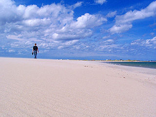
Eastport is a long-popular Newfoundland vacation destination on the Eastport Peninsula. Eastport is located on the north-eastern border of Terra Nova National Park and is known for its sandy beaches, scenery and traditional Newfoundland outport heritage.
Bloomfield is a designated place in the Canadian province of Newfoundland and Labrador. It is on the east coast of the island of Newfoundland, approximately 230 kilometres from the capital city of St. John's and approximately 95 kilometres from Bonavista. Bloomfield is located in a non-tax district which falls underneath the community of Lethbridge.

Open Hall-Red Cliffe is a local service district and designated place in the Canadian province of Newfoundland and Labrador.

Trinity is a small town located on Trinity Bay in Newfoundland and Labrador. The town contains a number of buildings recognized as Registered Heritage Structures by the Heritage Foundation of Newfoundland and Labrador.
Upper Amherst Cove, is a local service district and designated place in the Canadian province of Newfoundland and Labrador. Situated approximately 20 kilometers southeast of Bonavista, it lies just off Route 235.
The Bonavista Peninsula is a large peninsula on the east coast of the island of Newfoundland in the Canadian province of Newfoundland and Labrador. It consists of 50 incorporated towns/unincorporated communities which have a population of 12,176 as of the 2016 Canadian Census. Bonavista is the largest population centre on the peninsula.
Bartlett's Harbour is a local service district and designated place in the Canadian province of Newfoundland and Labrador that is northeast of Pointe Riche on the island of Newfoundland. There was a lobster packing establishment and the Reid-Newfoundland Steamers called weekly by 1911. The village became a Canadian Post Office in 1949, on April 1. It was served by the C.N.R Express after June 1953. It had a population of 50 in 1911, 57 by 1940, 106 in 1951 and 146 in 1956.
Lumsden, formerly known as Cat Harbour, is a community located on the Straight Shore of Newfoundland in Newfoundland and Labrador, Canada, near communities such as Musgrave Harbour and Newtown. Lumsden formerly consisted of two settlements, Lumsden North on the tip of a sandy peninsula and Lumsden South on the main road. Although the harbour in Lumsden is not ideal because it is not sheltered, Lumsden has excellent fishing grounds.
Port Rexton is a small town in the Canadian province of Newfoundland and Labrador. It is located on the East Coast of the island of Newfoundland at the north end of Robinhood Bay, about 10 minutes east of Trinity and 3 hours north of St. John's. The town had a population of 690 in 1940, 449 in 1951, 454 in 1956, 351 in the Canada 2006 Census, 338 in the Canada 2011 Census and most recently 340 in the Canada 2016 Census. The town is part of a group of communities known as the Trinity Bight. The town is home to a few small businesses, including inns and restaurants as well as the Skerwink trail which connects Port Rexton to Trinity Harbour.

Salvage is a town located on the Eastport Peninsula of the Canadian province of Newfoundland and Labrador. The town had a population of 108 in the Canada 2021 Census.
Trinity Bay North is a town in the Canadian province of Newfoundland and Labrador. It is located at the northern tip of Trinity Bay. It was established on January 1, 2005, through the amalgamation of several smaller communities, including Catalina, Port Union, Melrose, and Little Catalina. The town is known for its strong ties to Newfoundland's fishing heritage and its scenic coastal landscapes.
Harbour Round is a designated place in the Canadian province of Newfoundland and Labrador. It is east of Baie Verte.
Bunyan's Cove is a local service district and designated place in the Canadian province of Newfoundland and Labrador.
British Harbour is an abandoned community in Newfoundland and Labrador.
Division No. 1, Subdivision E is an unorganized subdivision on the Avalon Peninsula in Newfoundland and Labrador, Canada. It is in Division 1 and contains the unincorporated communities of Broad Cove, Dildo, Green's Harbour, Harnum Point, Hopeall, New Harbour and Reids Room.

Division No. 1, Subdivision G is an unorganized subdivision on the Avalon Peninsula in Newfoundland and Labrador, Canada. It is in Division 1 and contains the unincorporated communities of Baccalieu Island, Besom Cove, Bradley's Cove, Burnt Point, Caplin Cove, Daniel's Cove, Grates Cove, Gull Island, Job's Cove, Kingston, Long Beach, Lower Island Cove, Low Point, Northern Bay, Ochre Pit Cove, Red Head Cove, Riverhead, Smooth Cove and Western Bay.
References
- ↑ "The Discovery Trail - Hike Discovery". www.thediscoverytrail.org. Archived from the original on 2006-07-24.
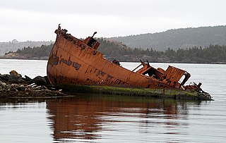
- ↑ "Other Vessels". www.newfoundlandshipwrecks.com. Retrieved 2024-12-08.