Clarington is a lower-tier municipality in the Regional Municipality of Durham in Ontario, Canada. It was incorporated in 1973 as the town of Newcastle with the merging of the town of Bowmanville, the Village of Newcastle and the townships of Clarke and Darlington, and was established on January 1 1974. In 1993, the town was renamed Clarington, a portmanteau of the names of the two former townships. Darlington today is largely suburban, while Clarke remains largely rural. Bowmanville is the largest community in the municipality and is the home of the municipal offices.

100 Mile House is a district municipality located in the South Cariboo region of central British Columbia, Canada.

Quesnel is a city located in the Cariboo Regional District of British Columbia, Canada. Located nearly evenly between the cities of Prince George and Williams Lake, it is on the main route to northern British Columbia and the Yukon. Quesnel is located at the confluence of the Fraser River and Quesnel River. Quesnel's metropolitan area has a population of 23,146 making it one of the largest urban centers between Prince George and Kamloops.

The Okanagan, also called the Okanagan Valley and sometimes the Okanagan Country, is a region in the Canadian province of British Columbia defined by the basin of Okanagan Lake and the Canadian portion of the Okanagan River. It is part of the Okanagan Country, extending into the United States as Okanogan County in north-central Washington. According to the 2016 Canadian census, the region's population is 362,258. The largest populated cities are Kelowna, Penticton, Vernon, and West Kelowna.

Moosehead Lake is a deep, coldwater lake located in Piscataquis County in Northwestern Maine. It is the largest lake in Maine, second-largest lake in New England, and the largest mountain lake in the eastern United States. Situated in the mostly undeveloped Longfellow Mountains, the lake is the source of the Kennebec River. Several rural Townships border the lake. Greenville is by far the largest town on the lake, with a small downtown area that has banks, shops, and restaurants. There are over 80 islands in the lake, the largest being Sugar Island and Deer Island to the west being the second largest.

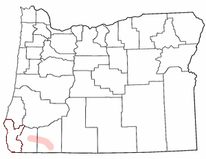
The Rogue Valley is a valley region in southwestern Oregon in the United States. Located along the middle Rogue River and its tributaries in Josephine and Jackson counties, the valley forms the cultural and economic heart of Southern Oregon near the California border. The largest communities in the Rogue Valley are Medford, Ashland and Grants Pass. The most populated part of the Rogue Valley is not along the Rogue proper, but along the smaller Bear Creek tributary. The Rogue Valley is a popular fall destination in Oregon because of the hardwood forests there.

Bridal Veil Falls Provincial Park is a BC Park located on the Trans-Canada Highway just east of Rosedale, British Columbia, Canada, part of the City of Chilliwack. The community of Bridal Falls is located adjacent to the falls and park as well as the interchange between the Trans-Canada and BC Highway 9 and has a variety of highway-based tourism services. Access to the falls requires a short hike from the parking lot and well groomed trails, taking most groups 15-25 minutes.

The Cariboo Regional District spans the Cities and Districts of Quesnel, Williams Lake, 100 Mile House, and Wells in the Central Interior of British Columbia.
Butler Ridge Provincial Park is a provincial park in British Columbia, Canada. Located on the northern shore of the Peach Reach arm of Williston Lake, 20 km northwest of Hudson's Hope, the park covers an area of 6,694 ha. Within the Peace Foothills ecosection, it includes three biogeoclimatic zones: the Engelmann Spruce-Subalpine Fir, the Sub-Boreal Spruce, and the Black and White Boreal Spruce zones. This cold and moist area is used as winter ranges by caribou, Stone's sheep, moose, and elk. It is recognized by the province and the Treaty 8 Tribal Association as an area that has traditionally been used by First Nations people. The park is used for fishing, hunting, trapping, hiking, and wildlife/nature viewing, cross-country skiing. There is a boat launch for Williston Lake, and motorized recreation.
Peawanuck is an isolated Cree community in the Kenora District, Ontario, Canada. It is located near the confluence of the Winisk and Shamattawa rivers, about 35 km from the Winisk River's end in Hudson Bay. Its population is 237.
Clear Creek is a hamlet in southwestern Norfolk County, Ontario, Canada.
Soda Creek is a rural subdivision 38 km north of Williams Lake in British Columbia, Canada. Located on the east bank of the Fraser River, Soda Creek was originally the home of the Xat'sull First Nation. Soda Creek Indian Reserve No. 1 is located on the left (E) bank of the Fraser River, one mile south of the Soda Creek BCR (CN) station, 431.10 ha. 52°19′00″N122°16′00″W
Talpa is an unincorporated community in Coleman County, Texas, United States. According to the Handbook of Texas, the community had an estimated population of 127 in 2000.

Apex is a small community in Iqaluit located on Baffin Island in Nunavut, Canada. It is about 5 km (3.1 mi) southeast of Iqaluit on a small peninsula separating Koojesse (Kuujussi) Inlet from Tarr Inlet. Historically Apex was the place where most Inuit lived when Iqaluit was a military site and off-limits to anyone not working at the base. The community is accessed by bridge or causeway, and bordered by a local creek (kuujuusi) and waterfall (kugluktuk). Located here are the women's shelter, a church, Nanook Elementary School, and a bed-and-breakfast, along with housing for about 60 families.
Clark is a community located approximately 30 miles (50 km) north of Cody on Wyoming Highway 120, in Park County, Wyoming, United States. Clark is unincorporated, and has no specific central "town site" per se, or town services. It is included in the Powell Zip Code area, which is approximately 30 miles (50 km) away, but has no other formal connection to Powell except the school district.

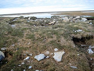
Igloolik Island is a small island in the Qikiqtaaluk Region of Nunavut, Canada. It is located in the Foxe Basin, very close to the Melville Peninsula, and it is often thought to be a part of the peninsula. It forms part of the Arctic Archipelago.
Chilanko Forks is an unincorporated settlement as well as a First Nations community of the Tsilhqot'in people, located on the north bank of the Chilanko River just northeast of Tatla Lake, and immediately south of Puntzi Lake, in the Chilcotin District of the Central Interior of British Columbia. Chilanko Forks is the location of the offices of the Alexis Creek First Nation.

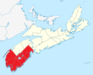
Southern Nova Scotia or the South Shore is a region of Nova Scotia, Canada. The area has no formal identity and is variously defined by geographic, county and other political boundaries. Statistics Canada, defines Southern Nova Scotia as an economic region, composed of Lunenburg County, Queens County, Shelburne County, Yarmouth County, and Digby County. According to Statistics Canada, the region had the highest decrease of population in Canada from 2009 to 2010, with a population decrease of 10.2 residents per thousand. The region also has the second-highest median age in Canada at 47.1 years old.
McLeese Lake is an unincorporated community on British Columbia Highway 97 in the Cariboo region of the Central Interior of British Columbia, Canada. It is named for the lake of the same name, which itself was named for Robert McLeese, a pioneer storekeeper, hotelier and steamboat owner and also politician.

Tangle Ridge is a 3,001-metre (9,846 ft) mountain summit located in Jasper National Park, in the Canadian Rockies of Alberta, Canada. Tangle Ridge is situated south of Beauty Creek and north of Tangle Creek, in the Sunwapta River valley. Topographic relief is significant as the summit rises 1,200 metres (3,937 ft) above Beauty Creek in 2 km (1.2 mi). Views from the top of Tangle Ridge provide photographers with an opportunity to capture the peaks surrounding the Columbia Icefield, some of which, such as Mount Columbia and Mount Alberta, are otherwise hidden from view along the Icefields Parkway.


