
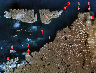
Akimiski Island is the largest island in James Bay, Canada, which is part of the Qikiqtaaluk Region of the territory of Nunavut. It has an area of 3,001 km2 (1,159 sq mi), making it the 163rd largest island in the world, and Canada's 29th largest island. Akimiski Island is only 19 km (12 mi) from the province of Ontario. From the western side of the island, one can see the Ontario coastline.

Southampton Island is a large island at the entrance to Hudson Bay at Foxe Basin. One of the larger members of the Canadian Arctic Archipelago, Southampton Island is part of the Kivalliq Region in Nunavut, Canada. The area of the island is stated as 41,214 km2 (15,913 sq mi) by Statistics Canada. It is the 34th largest island in the world and Canada's ninth largest island. The only settlement on Southampton Island is Coral Harbour, called Salliq in Inuktitut.

Akpatok Island is one of the uninhabited Canadian Arctic islands in the Qikiqtaaluk Region of Nunavut, Canada. It is the largest island in Ungava Bay on the northern coast of Quebec. The island is named for the Akpat, the thick-billed murre, which live on ledges along the limestone cliffs surrounding the island.

Coburg Island is an uninhabited island in Qikiqtaaluk, Nunavut, Canada. It is one of the members of Queen Elizabeth Islands located in Baffin Bay's Lady Ann Strait. It is separated from Ellesmere Island by Glacier Strait; Devon Island is to the south.
The Inglefield Mountains are a mountain range in southeastern Ellesmere Island, Nunavut, Canada. The mountain range is mostly covered by ice fields, with granitic nunataks reaching a height of 1,500 m (4,921 ft) above sea level. Rocky cliffs border the coastal areas. Like most other mountain ranges in the Canadian Arctic, the Inglefield Mountains are part of the Arctic Cordillera.

Beverly Lake is a lake in the Kivalliq Region, Nunavut, Canada. It is located north of the Arctic tree line about 150 km (93 mi) northwest of Baker Lake, Nunavut. The western half of the lake is within Thelon Wildlife Sanctuary. The Thelon River, at the confluence with the Dubawnt River, empties into the lake's southwestern bank. The Kazan River empties into the Thelon River at Beverly Lake's southeastern bank, between Beverly and Aberdeen Lakes. A delta occurs on the Beverly Lake's southern edge, which includes the Isarurjuaq Peninsula.

The Great Plain of the Koukdjuak is located in the Qikiqtaaluk Region, Nunavut within the Canadian Arctic. It is the namesake of the Koukdjuak River in western Baffin Island on the southeastern coast of Foxe Basin. It stretches from Cory Bay to Hantzsch Bay, and then inland.

Garry Lake is a lake in sub-Arctic Kivalliq Region, Nunavut, Canada. As a portion of the Back River waterway, Garry Lake originates directly east of Lake Pelly and drains to the east by the Back River. A set of rapids separate Buliard Lake from Garry Lake. Two other sets of rapids separate Garry Lake's three sections which are also differentiated by elevation. Garry Lakes are isolated from nearby communities.
The Twin Islands are similarly shaped Arctic islands in the Qikiqtaaluk Region of Nunavut, Canada. They are located in central James Bay, 56 km (35 mi) north east of Akimiski Island, and 58 km (36 mi) west of Quebec. The group includes North Twin and South Twin islands.
The uninhabited Plover Islands are an archipelago, members of the Canadian Arctic Archipelago and the Ungava Bay Archipelago, in the Qikiqtaaluk Region of Nunavut, Canada. They are located in western Ungava Bay, just northeast of the Arnaud River and the community of Kangirsuk on Quebec's Ungava Peninsula.
Scott Inlet is a body of water in the Qikiqtaaluk Region of Nunavut, Canada. It is an arm of Baffin Bay. Scott Island lies in its middle. At its south end, it splits into Clark and Gibbs Fiords. The Inuit community of Clyde River is approximately 120 km (75 mi) to the southeast.
Digges Sound is a Canadian Arctic waterway in Qikiqtaaluk, Nunavut, Canada. The sound is located at the juncture where the Hudson Strait meets northeastern Hudson Bay close to the northern tip of the Ungava Peninsula, between Digges Islands and Cape Wolstenholme. Ivujivik, Quebec, the northernmost settlement in any Canadian province, is located on the south coast of the sound.

Tahiryuaq, formerly Tahiryuak Lake, is a lake located in the Canadian Arctic's Northwest Territories. It is situated in northcentral Victoria Island, north of Prince Albert Sound, southeast of Minto Inlet.
The Kagloryuak River is located on Victoria Island in Northern Canada, commencing in Nunavut and ending in the Northwest Territories. Starting from the central plains, it flows west into Prince Albert Sound.
The uninhabited Payne Islands are an archipelago, members of the Canadian Arctic Archipelago and the Ungava Bay Archipelago, in the Qikiqtaaluk Region of Nunavut, Canada. They are located in Payne Bay, a waterway in western Ungava Bay, just east of the Arnaud River and the community of Kangirsuk on Quebec's Ungava Peninsula.

The Akimiski Island Migratory Bird Sanctuary is a migratory bird sanctuary in Qikiqtaaluk, Nunavut, Canada. It is located on Akimiski Island within James Bay. The sanctuary, established by the Canadian government on 1 January 1941, has federal conservation status. Taking up the eastern two-thirds of the island, it is 3,367 km2 (1,300 sq mi) in overall size, including a 1,664 km2 (642 sq mi) marine area. It includes marine, intertidal, and subtidal components and is rated Category IV by the International Union for Conservation of Nature.

The Prince Leopold Island Migratory Bird Sanctuary is a migratory bird sanctuary in Qikiqtaaluk, Nunavut, Canada. It is located on Prince Leopold Island within Lancaster Sound at the junction of Prince Regent Inlet and Barrow Strait. It was established in 1992 and is classified Category IV by the International Union for Conservation of Nature. It is 31,100 hectares in size,and has a flat, rocky surface with vertical exposed sedimentary rock cliffs nearly all the way around the island.
Nirjutiqavvik National Wildlife Area is a National Wildlife Area on Coburg Island within Qikiqtaaluk, Nunavut, Canada. It is located in Baffin Bay's Lady Ann Strait between Ellesmere Island, to the north, and Devon Island to the south. The NWA includes Coburg Island and its surrounding marine area.
The Kendall Island Migratory Bird Sanctuary (KIBS) is a migratory bird sanctuary in the Northwest Territories, Canada. It is located on Kendall Island and its surrounding area in Mackenzie Bay at the northern tip of the Mackenzie River Delta. A seasonal sanctuary for more than 60,000 shorebirds. it is one of five bird sanctuaries within the Inuvialuit Settlement Region. The area that is now known as the KIBS is a traditional Inuvialuit whaling site.
Cape Parry is a headland in Canada's Northwest Territories. Located at the northern tip of the Parry Peninsula, it projects into Amundsen Gulf. The nearest settlement is Paulatuk, 100 km (62 mi) to the south, and Fiji Island is located 9 km (5.6 mi) to the west. Cape Parry was formerly accessible through Cape Parry Airport that was located at the Distant Early Warning Line. The airport was listed as abandoned after the closure of the DEW line site.