
The River Avon is an English river in the south west of the country. To distinguish it from a number of other rivers of the same name, this river is often also known as the Bristol Avon. The name ‘Avon’ is a cognate of the Welsh word afon, ‘river’.

Salisbury Plain is a chalk plateau in the south western part of central southern England covering 300 square miles (780 km2). It is part of a system of chalk downlands throughout eastern and southern England formed by the rocks of the Chalk Group and largely lies within the county of Wiltshire, but stretches into Berkshire, Hampshire and a small part of Somerset.

Keynsham is a town and civil parish located between Bristol and Bath in Somerset, England. It has a population of 16,000. It was listed in the Domesday Book as Cainesham, which is believed to mean the home of Saint Keyne.
The Avon Gorge is a 1.5-mile (2.5-kilometre) long gorge on the River Avon in Bristol, England. The gorge runs south to north through a limestone ridge 1.5 miles (2.4 km) west of Bristol city centre, and about 3 miles (5 km) from the mouth of the river at Avonmouth. The gorge forms the boundary between the unitary authorities of North Somerset and Bristol, with the boundary running along the south bank. As Bristol was an important port, the gorge formed a defensive gateway to the city.
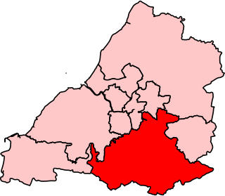
Wansdyke was a county constituency represented in the House of Commons of the Parliament of the United Kingdom. It elected one Member of Parliament (MP) by the first past the post system of election.

Wansdyke was a non-metropolitan district within the County of Avon west of England from 1974 to 1996.

Bookham Commons are two commons, situated just to the north of the villages of Great Bookham and Little Bookham, in Surrey, England, 154.7 hectares in extent; the individual parts are named Great Bookham Common and Little Bookham Common. A group of dwellings known as the Isle of Wight is situated within the site, and a track, Common Road, leads to it from the northwest. Little Bookham Common lies south and west of this track, whereas Great Bookham Common lies to the east.

Warmley is a village in South Gloucestershire, England.
Greater Bristol is a term used for the conurbation which contains and surrounds the city of Bristol in the South West of England. There is no official "Greater Bristol" authority, but the term is sometimes used by local, regional and national authorities, and others as a synonym for either the "Bristol Urban Area" or a wider area of the former County of Avon, and by some, TfGB, to refer to the Province of Bristol as defined by C. B. Fawcett (1919) or Derek Senior (1969). The Bristol post town covers a wider area than the city of Bristol.

Leigh Woods is a 2-square-kilometre (0.77 sq mi) area of woodland on the south-west side of the Avon Gorge, close to the Clifton Suspension Bridge, within North Somerset opposite the English city of Bristol and north of the Ashton Court estate, of which it formed a part. Stokeleigh Camp, a hillfort thought to have been occupied from the third century BC to the first century AD and possibly also in the Middle Ages, lies within the reserve on the edge of the Nightingale Valley. On the bank of the Avon, within the reserve, are quarries for limestone and celestine which were worked in the 18th and 19th centuries are now derelict.

The A4174 is a major ring road in England which runs around the northern and eastern edge of Bristol, mainly in South Gloucestershire, and through the southern suburbs of the city. When it was first conceived it was planned to circle the whole of Bristol, and is commonly referred to as the "Avon Ring Road", or less accurately the "Bristol Ring Road", on road signs. The road does not circle the whole city, instead covering roughly half of the route. It is broken in part where it is concurrent with the A4. Part of the dual carriageway north of Mangotsfield occupies the alignment of the former Midland railway line which closed in 1966.

The North Somerset Levels is a coastal plain, an expanse of low-lying flat ground, which occupies an area between Weston-super-Mare and Bristol in North Somerset, England. The River Banwell, River Kenn, River Yeo and Land Yeo are the three principal rivers draining the area.
North Common is a village just outside Warmley, Bristol, in South Gloucestershire, England. Historically this was a rural hamlet surrounded by farmland. The residents are fortunate enough that to the east of the village is attractive rolling countryside, with views of lansdown, and the surrounding hills. The village is on the eastern outskirts of Bristol and approximately halfway between Bristol city centre and the neighbouring city of Bath.

Winterbourne Down is a village in South Gloucestershire, England, located on the north-eastern outskirts of Bristol. It is also part of the Civil Parish of Winterbourne. It is demarcated by the Avon Ring Road to the south. The Parish's annual May Day carnival is held here.
Weston Big Wood is a 37.48 hectare woodland west of the town of Portishead, North Somerset, England. It is a nature reserve and biological Site of Special Scientific Interest, notified in 1971. The wood takes its name from the nearby village of Weston-in-Gordano.

Max Bog is a 10.6 hectare biological Site of Special Scientific Interest in North Somerset, notified in 1988.

Camp Down is a 7.3-hectare (18-acre) biological Site of Special Scientific Interest in Wiltshire in South West England. It was designated as such in 1965.

Keynsham Lock is a canal lock situated on the River Avon at Keynsham, England.
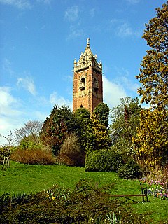
Brandon Hill, also known as St Brandon's Hill, is a hill close to Bristol city centre, between the districts of Clifton and Hotwells, in south west England.

Somerdale was a chocolate factory located in Keynsham near Bristol in south west England, closed by Kraft foods in 2011. It was the home of a Cadbury plc's production facility, and was originally built by the Fry family when they expanded through consolidation of a number of existing facilities located in the centre of Bristol.
