Kosivska Poliana is a village in the Rakhiv Raion (district) of Zakarpattia Oblast (province) of western Ukraine, located at 47°57′13″N024°03′42″E.

Kiwanis Ravine is an 8.7-acre (3.5 ha) public park a block east of Discovery Park in the Magnolia neighborhood of Seattle, Washington. Purchased by the Kiwanis Club in the 1950s and donated to Seattle Parks Department, it is home to the largest nesting colony of great blue herons in the city.
Březno is a village in the Ústí nad Labem Region of the Czech Republic. It has around 1,200 inhabitants.
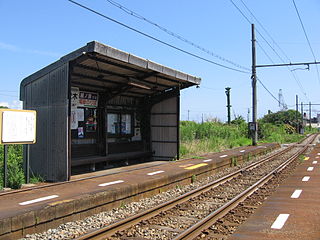
The Naka Fushiki Station is a city tram station on the Takaoka Kidō Line located in Takaoka, Toyama Prefecture, Japan.
Dębówka is a village in the administrative district of Gmina Radziłów, within Grajewo County, Podlaskie Voivodeship, in north-eastern Poland.
Łozowo-Kolonia is a settlement in the administrative district of Gmina Dąbrowa Białostocka, within Sokółka County, Podlaskie Voivodeship, in north-eastern Poland.
Ostrowie-Kolonia is a settlement in the administrative district of Gmina Dąbrowa Białostocka, within Sokółka County, Podlaskie Voivodeship, in north-eastern Poland.

Denkówek is a village in the administrative district of Gmina Bodzechów, within Ostrowiec County, Świętokrzyskie Voivodeship, in south-central Poland. It lies approximately 2 kilometres (1 mi) south of Ostrowiec Świętokrzyski and 56 km (35 mi) east of the regional capital Kielce.
Budziszynek is a village in the administrative district of Gmina Chynów, within Grójec County, Masovian Voivodeship, in east-central Poland. It lies approximately 6 kilometres (4 mi) south of Chynów, 14 km (9 mi) east of Grójec, and 40 km (25 mi) south of Warsaw.
Żakówek is a village in the administrative district of Gmina Siennica, within Mińsk County, Masovian Voivodeship, in east-central Poland.

San Hui is one of the MTR Light Rail stops. It is located at ground level at Castle Peak Road next to San Hui Village in Tuen Mun District. It began service on 2 February 1992 and belongs to Zone 2. It serves San Hui Village and Kau Hui San Village.
Kawęczyn is a village in the administrative district of Gmina Września, within Września County, Greater Poland Voivodeship, in west-central Poland.
Wyrówno is a village in the administrative district of Gmina Lipusz, within Kościerzyna County, Pomeranian Voivodeship, in northern Poland. It lies approximately 5 kilometres (3 mi) south-east of Lipusz, 13 km (8 mi) south-west of Kościerzyna, and 64 km (40 mi) south-west of the regional capital Gdańsk.
Sadowo Pierwsze is a settlement in the administrative district of Gmina Malbork, within Malbork County, Pomeranian Voivodeship, in northern Poland. It lies approximately 7 kilometres (4 mi) north-east of Malbork and 47 km (29 mi) south-east of the regional capital Gdańsk.
Velká Chmelištná is a village and municipality in Rakovník District in the Central Bohemian Region of the Czech Republic.

Alpu Dam is a dam in Tokat Province, Turkey, built between 1998 and 2002.
Allikalahe is a village in Saaremaa Parish, Saare County in western Estonia.

Arriens Glacier is a small Antarctic glacier, south of Casey Point in the Mawson Escarpment, flowing west to reach Lambert Glacier. It was plotted from ANARE aerial photographs taken in 1956, 1960 and 1973, and named by the Australian Antarctic Names and Medals Committee after P. Arriens, geochronologist with the ANARE Prince Charles Mountains survey party in 1973.
Pashbard is a village in Melkari Rural District, Vazineh District, Sardasht County, West Azerbaijan Province, Iran. At the 2006 census, its population was 49, in 6 families.

Adelfas is a ward (barrio) of Madrid belonging to the district of Retiro.


