Khawr al Baydah is a bay in Umm al Quwain. [1]
Khawr al Baydah is a bay in Umm al Quwain. [1]

The Arctic Archipelago, also known as the Canadian Arctic Archipelago, is a group of islands north of the Canadian mainland.
The Khasi Hills are part of the Garo-Khasi range in the Indian state of Meghalaya, and is part of the Patkai range and of the Meghalaya subtropical forests ecoregion. In older sources in particular, the alternative transcription Khasia Hills is seen.

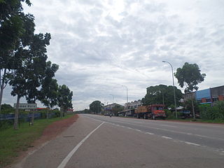
Gemas Baru is a small town in the Segamat District, Johor, Malaysia. The town is located about 1 km from the Johor-Negeri Sembilan border. The original town centre of Gemas is located just within the Negeri Sembilan state side of the border.

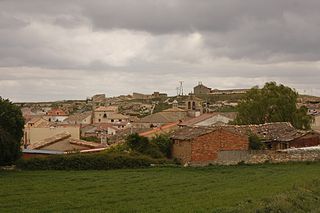
Fuentelcésped is a municipality located in the province of Burgos, Castile and León, Spain. According to the 2004 census (INE), the municipality has a population of 194 inhabitants.
Tân Trụ is a rural district of Long An Province in the Mekong Delta region of Vietnam.
Hưng Nguyên is a rural district of Nghệ An Province in the North Central Coast region of Vietnam. As of 2003 the district had a population of 120,720. The district covers an area of 162 km². The district capital lies at Hưng Nguyên.

Ransol is a village in Andorra, located in the parish of Canillo. The Ransol valley is particularly noted for the diversity of its flora and fauna. In 2006, the village had 188 inhabitants.
Balia, Bangladesh may refer to the following locations in Bangladesh:

Saczkowce is a village in the administrative district of Gmina Kuźnica, within Sokółka County, Podlaskie Voivodeship, in north-eastern Poland, close to the border with Belarus. It lies approximately 9 kilometres (6 mi) north of Kuźnica, 23 km (14 mi) north-east of Sokółka, and 61 km (38 mi) north-east of the regional capital Białystok.

Soból is a village in the administrative district of Gmina Tyszowce, within Tomaszów Lubelski County, Lublin Voivodeship, in eastern Poland. It lies approximately 7 kilometres (4 mi) south-west of Tyszowce, 22 km (14 mi) north-east of Tomaszów Lubelski, and 105 km (65 mi) south-east of the regional capital Lublin.

Baborówko is a village in the administrative district of Gmina Szamotuły, within Szamotuły County, Greater Poland Voivodeship, in west-central Poland. It lies approximately 4 kilometres (2 mi) south-east of Szamotuły and 28 km (17 mi) north-west of the regional capital Poznań.
Sagevere is a village in Türi Parish, Järva County in central Estonia.
Nava is a village in Jõgeva Parish, Jõgeva County in eastern Estonia.

Finley Glacier is a tributary glacier which drains the northwest slopes of Mount Monteagle and flows north into the upper part of Icebreaker Glacier, in the Mountaineer Range, Victoria Land, Antarctica. It was mapped by the United States Geological Survey from surveys and U.S. Navy air photos, 1960–64, and was named by the Advisory Committee on Antarctic Names for Russell H. Finley, an aviation boatswain's mate with Squadron VX-6 during U.S. Navy Operation Deep Freeze, 1966, 1967 and 1968.
Dubovsky or Dubovskoy, Dubovskaya, or Dubovskoye is the name of several rural localities in Russia.

The Srautas is a river of Kėdainiai district municipality, Kaunas County, central Lithuania.
Katagon is an arrondissement in the Ouémé department of Benin. It is an administrative division under the jurisdiction of the commune of Akpro-Missérété. According to the population census conducted by the Institut National de la Statistique Benin on February 15, 2002, the arrondissement had a total population of 12173.
German submarine U-541 was a Type IXC U-boat of Nazi Germany's Kriegsmarine during World War II.
Butyrsky, Butyrskaya, or Butyrskoye is the name of several rural localities in Russia:
Coordinates: 25°35′N55°38′E / 25.583°N 55.633°E

A geographic coordinate system is a coordinate system that enables every location on Earth to be specified by a set of numbers, letters or symbols. The coordinates are often chosen such that one of the numbers represents a vertical position and two or three of the numbers represent a horizontal position; alternatively, a geographic position may be expressed in a combined three-dimensional Cartesian vector. A common choice of coordinates is latitude, longitude and elevation. To specify a location on a plane requires a map projection.
| This United Arab Emirates location article is a stub. You can help Wikipedia by expanding it. |