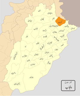
Gujranwala Division is an administrative division of Punjab Province, Pakistan and is considered the largest division of the Punjab province, taking into accounts its area and population. The division, headquartered at the city of Gujranwala, covers an area of 17,206 km2. According to the 1981 census, the population was 7,522,352, and rose by almost four 4 million to 11,431,058 according to the 1998 census.
The University of Gujrat (UOG) is a public university located in Gujrat, Punjab, Pakistan. It was established under the Act IX of 2004 by Provincial Assembly of the Punjab on 23 February 2004 to cater for the higher education needs of the population of Central Punjab which includes districts of Gujrat, Sialkot and Gujranwala in addition to cities of Wazirabad and Jhelum.
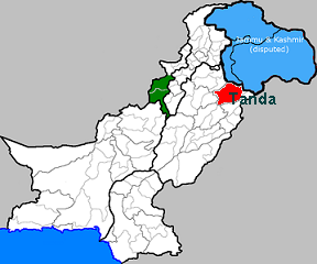
Tanda is a town in Gujrat District in the Pakistani province of Punjab. It is a Union council, an administrative subdivision of Gujrat Tehsil.
Mohla Khurd or Mohlān Khurd is a village of Gujrat District, Punjab, Pakistan It is located at 32°30'5N 74°4'10E. - 8 km away from the district capital Gujrat also 1.5 km north from river Chenab.
Marala, also known as Murala, is town in Gujrat District of Punjab province, Pakistan. It is located at 32°38'60N 74°30'0E and has an altitude of 234 metres.

Achh is a village and union council of Gujrat District, in the Punjab province of Pakistan. It is part of Kharian Tehsil and is located at 32°52'0N 74°8'0E with an altitude of 311 metres.
Ajnala is a town and union council of Gujrat District, in the Punjab province of Pakistan. It is located at 32°48'0N 74°15'0E with an altitude of 277 metres.
Bareela Sharif is a town and union council of Gujrat District, in the Punjab province of Pakistan. It is located at 32°45'0N 74°24'0E with an altitude of 273 metres.
Chopala is a town and union council of Gujrat District, in the Punjab province of Pakistan. It is located at 32°38'0N 74°20'0E with an altitude of 229 metres.
Deona is a town and union council of Gujrat District, in the Punjab province of Pakistan. It is located at 32°38'0N 74°0'0E with an altitude of 231 metres.
Miana Chak is a town and union council of Gujrat District, in the Punjab province of Pakistan. It is part of Kharian Tehsil and is located at 32°43'20N 74°8'0E with an altitude of 247 metres.
Khokhar is a village in the Gujrat Tehsil of the Gujrat District, Punjab, Pakistan, located approximately 5 miles north of City Gujrat.
Barila Sharif is a village in Gujrat District, Punjab, Pakistan. It is one of the oldest villages in Gujrat.

Ibn-e-Imam Degree Science College or Ibn-e-Imam Science College is a college located at Jalalpur Jattan, Punjab, Pakistan. The college is affiliated with the Board of Intermediate and Secondary Education, Gujranwala and University of Gujrat.
Deona Juliani railway station is located in Deona Juliani village, Gujrat district of Punjab province, Pakistan.
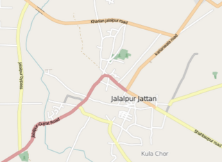
Kulachor is a town adjacent to Jalalpur Jattan in the district of Gujrat, Pakistan. It is situated about 16 kilometers in north east of Gujrat. It was built as a city by Chandragupta Maurya in 300 BC.
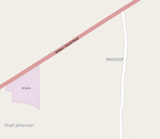
Maroof is a village situated alongside Jalalpur–Gujrat road in the district of Gujrat, Pakistan.
Sook Kalan is a village situated near Beowali in the district of Gujrat, Pakistan. It is about 5 kilometers in the north of Gujrat.
Bharaj is a village situated near Mangowal Sharqi in the district of Gujrat, Pakistan. Its on Karianwala Road approximately 15 Kilo Meters from Gujrat. It's an old village and is inhabited by Gujjar Cast. It has an ancient grave of "Baba Naala " who is believed to be the elder of all the Gujjars settled in Gujrat District. It also caters jatt community of pakisthan, Punjab. And in Gujarat we have other village with name of bharaj.

The Jalalpur–Gujrat Road is a highway running between the Pakistani cities of Gujrat and Jalalpur Jattan. It connects Gujrat with Jalalpure Jattan, Tanda, Chamb Azad Kashmir.