Khirbet Beit Lei or Beth Loya is an archaeological tell in the Judean lowlands of Israel. It is located about 5.5 km southeast of Tel Lachish and ten miles west-northwest of Hebron, on a hill 400 m above sea level.
'Ara is a village in the Haifa District in northern Israel, located in the Wadi Ara valley. Since 1985, 'Ara has been part of the Ar'ara local council. It is located north of highway 65, between Ar'ara and Kfar Qara. Its population of 4,600 is almost entirely Muslim.

Khirbet Sharta is an ancient tell in northern Israel, northeast of Kiryat Atta, that covers two hills.

Jish is a local council in Upper Galilee, located on the northeastern slopes of Mount Meron, 13 kilometres (8.1 mi) north of Safed, in Israel's Northern District. In 2022, it had a population of 3,216, which is predominantly Maronite Catholic and Melkite Greek Catholic Christians (63%), with a Sunni Muslim Arab minority.

Ilut, also spelt ʿAilut, is an Arab local council in the Northern District of Israel. It was declared a local council in 1991. In 2022 its population was 8,863.

Al-Tira was a Palestinian village in the Ramle Subdistrict. It was depopulated during the 1948 Arab–Israeli War on July 10, 1948, by the Alexandroni and Armored (Eighth) brigades under Operation Dani. It was located 12 km northeast of Ramla. al-Tira was mostly destroyed with the exception of a few houses survived destruction.

Khirbat Zakariyya was a Palestinian village in the Ramle Subdistrict of Mandatory Palestine. It was depopulated during the 1948 Arab–Israeli War on July 12, 1948, under the second stage of Operation Dani. It was located 9 km (5.6 mi) east of Ramla.
Ir Ganim is a neighborhood in southwest Jerusalem, bordering Kiryat Menachem.

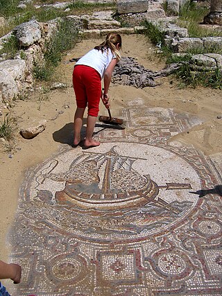
Khirbet Qana, is an archaeological site in the Lower Galilee of Israel. It has remains of a settlement from the Hellenistic period to the Early Arab period. Findings including Hasmonean coins and ostraca using the Jewish script indicate its population in ancient times was predominantly Jewish.

Adullam-France Park, also known as Parc de France-Adoulam, is a sprawling park of 50,000 dunams (ca. 12,350 acres) in the Central District of Israel, located south of Beit Shemesh. The park, established in 2008 for public recreation, features two major hiking and biking trails, and four major archaeological sites from the Second Temple period. It stretches between Naḥal Ha-Elah, its northernmost boundary, to Naḥal Guvrin, its southernmost boundary. To its west lies the Beit Guvrin-Beit Shemesh highway, and to its east the "green line" – now territories under joint Israeli-Palestinian Arab control – which marks its limit.

Khirbet Jurish is an archaeological site 30 kilometres (19 mi) southwest of Jerusalem. At the site that is protected by the Israel Nature and Parks Authority remains of a Jewish village were found, dating to the Second Temple period. The ruins of the site stand on a hill to the west of Tzur Hadassa, on a mountain now called Har Kitron, along regional highway 375.
Tel Hashash or Tell el-Hashash is an archaeological site in the heart of the Bavli neighborhood of Tel Aviv. It is one of the ancient sites along the Yarkon River, located 800 meters south of the river, overlooking Tell Qasile on the northern bank of the river. The site was excavated in the 1960s by Jacob Kaplan on behalf of the Old Jaffa Museum of Antiquities, and in the 1980s by Haya Ritter Kaplan of the Israel Antiquities Authority. The excavations exposed remains of the first century CE and the late Byzantine period.

'En Esur, also En Esur or Ein Asawir, is an ancient site located on the northern Sharon Plain, at the entrance of the Wadi Ara pass leading from the Coastal Plain further inland. The site includes an archaeological mound (tell), called Tel Esur or Tell el-Asawir, another unnamed mound, and two springs, one of which gives the site its name.
Abattoir Hill, pronounced in Hebrew as Giv'at Bet Hamitbahayim, is an archaeological site in Tel Aviv, Israel, located near the southern bank of the Yarkon River. The site is a natural hill made of Kurkar, a local type of sandstone. In 1930 ancient burials and tools were discovered upon the construction of an abattoir on top of the hill, hence its name. Between 1950 and 1953, Israeli archaeologist Jacob Kaplan studied the site, ahead of the construction of new residential units and streets on it. He discovered the remains of burials and small settlements spanning from the Chalcolithic period to the Persian period. In 1965 and 1970 Kaplan conducted two more excavations next to the slaughterhouse and discovered settlement remains from the Bronze Age and the Persian period. In February 1992 a salvage excavation was conducted by Yossi Levy after antiquities were damaged by development works. Two burial tombs dated between the Persian period and the Early Arab period were discovered. In June 1998 another salvage excavation was conducted by Kamil Sari after ancient remains were damaged by work of the Electric Corporation. Two kilns were unearthed, similar to two found by Kaplan.

Khirbet Kurkush is an archeological site in the West Bank. It lies between the Israeli settlements of Bruchin and Ariel and near the Palestinian town of Bruqin, in the Salfit Governorate of the State of Palestine.
Khirbet Kheibar or Tell Kheibar is an archaeological site located in the western outskirts of the Sanur Valley, West Bank. A fortified tell, it includes the remains of an ancient walled city that for some periods grew beyond the walls. At the site, pottery from the Middle Bronze Age and the Medieval period, peaking in the Iron Age, has been found, along with bowls and figurine fragments.

Khirbat Din‘ila is an archaeological site and former village in the Upper Galilee in the north region of Israel. The village was established in the Roman period, with activity at the site in the Byzantine and medieval eras.
Beit Qufa is an archaeological site in the Lod Valley, near the modern Israeli settlement of Beit Nehemia in Israel's Central District.

Khirbet el-Qutt is an archaeological site occupied from the Early Bronze Age through the Byzantine and Early Muslim periods. The site is located on and around a hill between the present-day village of Al-Lubban ash-Sharqiya and Israeli settlement Ma'ale Levona. The discovery of subterranean hiding complexes and mikvahs in the 20th and 21st century indicated that the site had become a Jewish settlement during the Second Temple period, and that its inhabitants were participants in the Bar Kokhba revolt.

Umm el-Umdan or Khirbet Umm el-Umdan is a Jewish archaeological site within the municipal boundaries of the Israeli city of Modi'in, between the city of Modi'in and Latrun. Archaeological excavations at the site discovered the remains of a Jewish village. The findings show that the place was inhabited during the Persian, Hellenistic, Roman, Byzantine, and Early Muslim periods. The village was destroyed during the Bar Kokhba revolt.
