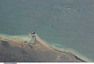
Khor Angar | |
|---|---|
 | |
| Country | |
Khor Angar is an Administrative sub-prefecture in the northwest of Djibouti. [1] [2]
Khor Angar | |
|---|---|
 | |
| Country | |
Khor Angar is an Administrative sub-prefecture in the northwest of Djibouti. [1] [2]

The Bab-el-Mandeb, the Gate of Grief or the Gate of Tears, is a strait between Yemen on the Arabian Peninsula and Djibouti and Eritrea in the Horn of Africa. It connects the Red Sea to the Gulf of Aden and by extension the Indian Ocean.

Djibouti is divided into five administrative regions and one city. The regions are divided into twenty administrative sub-prefectures.
ʽAlaili Dadda is a town in northern Djibouti. It is situated about 68 kilometers north of Obock, at an elevation of 1,263 feet from sea level. The town sprawls on a wide basin surrounded by granitic mountains on all sides. It is located in the Alaili Dadda sub-prefecture of the Obock region. N16 road is located on. to the nearest settlements, Khor Angar, Dadda'to and Obock. The capital city Djibouti to quite far, but close to the city outside the two major Dadda'to. Is the capital of Obock region. Khor Angar the second largest city in the region. Dadda Alaile the 4th largest in the region or 5th.

Khôr ʽAngar is a town in the northern Obock Region of Djibouti. It is situated on the west coast of the Bab el Mandeb Strait. The town is served by Herkale Airport, a desert airstrip 7 kilometres (4 mi) northwest.
Herkale Airport is an airstrip 7 kilometres (4 mi) northwest of the hamlet of Khôr ‘Angar in Djibouti. Khôr ‘Angar is by the Bab-el-Mandeb strait, the entrance to the Red Sea.

Fagal is a coastal location in eastern Djibouti. It lies north of Obock. It lies along the N15 road, connected to the Eritrean border at Rahayta to the north. The peninsula strip nearby is called the Ras Siyyan. Just to the south is Herkale Airport and the village of Khor `Angar.

The Djiboutian Navy is the naval service branch of the Djibouti Armed Forces. It is responsible for securing Djibouti's territorial waters and 314-kilometre (195 mi) seaboard as well as supporting army operations. The primary objective of the navy is to safeguard the nation's maritime borders, act to deter or defeat any threats or aggression against the territory, people or maritime interests of Djibouti, both in war and peace. Through joint exercises and humanitarian missions, including disaster relief, the Djiboutian Navy promotes bilateral relations between nations. It has a fleet of gunboats, fast missile boats and support, training, which can be deployed to defend the territorial waters and coastline of Djibouti as well as protect tankers passing through the Bab-el-Mandeb strait.
Moulhoule is a town in the northern Obock region of Djibouti. It is situated on the west coast of the Red Sea, at its southern entrance. It is located on the RN-15 National Highway, which connects it to Obock, located some 70 kilometres to the south and is 15 kilometres south of the border with Eritrea.

Moulhoule is an Administrative sub-prefecture in the Obock Region of Djibouti.

As Eyla is an Administrative sub-prefecture in Djibouti.

`Adaylou is an Administrative sub-prefecture in Djibouti.

Balho is an Administrative sub-prefecture in Djibouti.

Galafi is an Administrative sub-prefecture in Djibouti.

Ali Adde is an Administrative sub-prefecture in the Ali Sabieh Region of Djibouti.

Mousa Ali is an Administrative sub-prefecture in Djibouti.

Randa is an Administrative sub-prefecture in Djibouti.

Holhol is an Administrative sub-prefecture in Djibouti.

Yoboki is an Administrative sub-prefecture in Djibouti.
Events in the year 2024 in Djibouti.