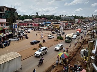
Kabale District is a district in the Western Region of Uganda. Kabale hosts the district headquarters. It was originally part of Kigezi District, before the districts of Rukungiri, Kanungu, Kisoro, Rubanda and Rukiga were excised to form separate districts. Kabale is sometimes nicknamed "Kastone" as in the local language Rukiga, a "kabale" is a small stone.

Kanungu District is a district in the Western Region of Uganda. The town of Kanungu is the site of the district headquarters. The Bwindi Impenetrable Forest in Kanungu District is among the sites shown in aerial footage in the movie Black Panther.

Kisoro District is a district in the Western Region of Uganda. The town of Kisoro is the site of the district headquarters.
Kisoro is a town in the Western Region of Uganda. It is the chief town of Kisoro District and the site of the district headquarters.
Rukungiri is a town in Rukungiri District of the Western Region of Uganda. It is the site of the district headquarters.
Kamwenge is a town in the Western Region of Uganda. It is the site of the Kamwenge District headquarters.
Kanungu is a town in the Western Region of Uganda. It is the location of the district headquarters for Kanungu District.

Kibaale is a town in the Western Region of Uganda. It is the main municipal, administrative, and commercial center of Kibaale District, and the district headquarters are located there.
Ntungamo is a town in the Western Region of Uganda. It is the largest town in Ntungamo District and the site of the district headquarters.

Mukono Town is a municipality in Mukono District in the Central Region of Uganda. The town is administered by the Mukono Town Council. The district headquarters are located in this town.
Kyotera is a town in the southern part of the Central Region of Uganda. It is a municipality in Kyotera District. However, the district headquarters are located at Kasaali.
Kalisizo is a town in the southern part of the Central Region of Uganda. Although it is the leading commercial center in Kyotera District, the administrative headquarters of the district are in Kasaali.
Kagadi is a town in the Western Region of Uganda. It is the commercial and administrative headquarters of Kagadi District.
Ishasha border point is a border crossing station and customs post in the Kanungu District in the Western Region of Uganda. It is inset approximately 350 metres (1,150 ft) from the Ishasha River, which is the Uganda-Democratic Republic of the Congo (DRC) border locally, and is 1.3 kilometres (0.81 mi) from the town of Ishasha, Democratic Republic of the Congo, across the river in the DRC.
Rukungiri–Kihihi–Ishasha–Kanungu Road is a road in southwestern Uganda, connecting the town of Rukungiri in Rukungiri District and the town of Ishasha in Kanungu District, at the International border between Uganda and the Democratic Republic of the Congo. A spur of the road runs south from Kihihi to Kanungu.
The Mbarara–Ntungamo–Kabale–Katuna Road in Western Uganda connects the city of Mbarara, in Mbarara District, with the towns of Ntungamo, Kabale and Katuna at the international border with the Republic of Rwanda.
Kambuga General Hospital, also Kambuga Hospital is a government-owned hospital in the Western Region of Uganda.

Rubanda District is a district in the Western Region of Uganda. The largest town in the district, Rubanda, serves as the main administrative and commercial center in the district.
Muhanga is a town in the Western Region of Uganda. It is the main commercial centre and largest town of Rukiga District. However, the district headquarters are located at Mparo.
Great Lakes Regional University (GLRU) is a private university in Uganda. The university is accredited by the Uganda National Council for Higher Education (UNCHE).


