Related Research Articles
Creagh is an Irish surname derived from the Gaelic Craobhach, meaning "branch". The Creagh family was first found in County Clare, where they held a family seat from ancient times. It is also the name of several locations throughout the island of Ireland, for example:

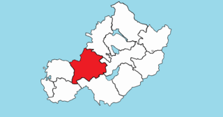
Moylagh is a civil parish and townland in the northwest of County Meath, Ireland. The townland Moylagh lies within the Roman Catholic parish of Oldcastle and Moylagh.

Costello is one of the ancient baronies of Ireland. Unusually for an Irish barony, it straddles two counties: County Mayo and County Roscommon. It comprises the modern day districts of Kilkelly, Kilmovee, Killeagh, Kilcolman, and Castlemore.

Forgney is a civil parish and townland in County Longford, Ireland. Evidence of ancient settlement in the area include a number of ringfort and holy well sites in Forgney townland.
Brickeens is a very small townland in County Longford, Ireland. It is about five kilometres north of Keenagh and eight kilometres south of Longford town. Brickeens townland has an area of approximately 146 acres (0.2 sq mi), and had a population of 21 people as of the 2011 census. Evidence of ancient settlement in the townland include two ringforts.

Cogaula is a townland in the civil parish of Islandeady, County Mayo, Ireland. The townland has an area of approximately 1.5 square kilometres (0.58 sq mi), and had a population of 74 people as of the 2011 census.
Bornacoola is an Ecclesiastical parish in the Roman Catholic Diocese of Ardagh and Clonmacnoise, Ireland. It is located at the southern extremity of County Leitrim in the civil parish of Mohill. Some of its townlands lie in neighbouring County Longford. The nearest large towns are Longford and Carrick-on-Shannon.

Magheracross is a townland and civil parish in County Fermanagh, Northern Ireland. It extends in area from just north of Enniskillen to the border with County Tyrone. There is also a small enclave in County Tyrone.

Sheean, Irish An Sián is a townland in the parish of Islandeady, barony of Burrishoole, electoral district of Clogher, in County Mayo, Ireland. It has an area of 0.6 square miles and borders the townlands of Cogaula, Doon, Dooncastle, Derrygorman, Drummindoo, and Carrownaclea. The eponymous settlement is located on a hill.
Knocks is a townland to the east of Lisnaskea in County Fermanagh, Northern Ireland. It is situated in the historic barony of Magherastephana and the civil parish of Aghalurcher and covers an area of 193 acres.

Moygoish is a barony in north County Westmeath, in the Republic of Ireland, formed by 1672. It is bordered by County Longford to the west and four other Westmeath baronies: Corkaree, Fore, Moyashel and Magheradernon and Rathconrath to the south–west.

Moyashel and Magheradernon is a barony in the centre of County Westmeath, in the Republic of Ireland, formed by 1672. It is bordered by eight other baronies: Corkaree and Fore, Delvin and Farbill, Fartullagh and Moycashel and Rathconrath and Moygoish.
Rathconrath, previously the barony of Rathcomyrta, before that Daltons country, is a barony in the west of County Westmeath, in the Republic of Ireland. It was formed by 1542. It is bordered by County Longford to the north–west and five other Westmeath baronies: Moygoish to the north, Moyashel and Magheradernon to the east, Moycashel and Clonlonan to the south and Kilkenny West to the west. Note that the village of Rathconrath is not synonymous with the barony of the same name.

Kilkenny West, previously Maherquirke or Dillons country, is a barony in west County Westmeath, Ireland. It was formed by 1542. It is bordered by County Longford to the west; it is also bordered by three other Westmeath baronies: Rathconrath, Brawny and Clonlonan. The largest centre of population in the barony is the village of Glassan.

Farbill is a barony in east County Westmeath, in the Republic of Ireland. It was formed by 1672. It is bordered by County Meath to the south and east and three other baronies: Fartullagh, Moyashel and Magheradernon and Delvin. The largest centre of population in the barony is the town of Kinnegad.

Delvin is a barony in north-east County Westmeath, in the Republic of Ireland. It was formed by 1672. It is bordered by County Meath to the east and three other baronies: Fore, Moyashel and Magheradernon and Farbill. The largest centre of population is Delvin.
Kilmacnevan is a civil parish in County Westmeath, Ireland. It is located about 15.81 kilometres (10 mi) west–north–west of Mullingar.
Street is a civil parish in County Westmeath, Ireland. It is located about 19.39 kilometres (12 mi) north–north–west of Mullingar.
Noughaval is a civil parish which spans the counties of Longford and Westmeath in Ireland. It is located about 30.02 kilometres (19 mi) west of Mullingar and 21.61 kilometres (13 mi) south of Longford.
Martinstown Castle is a ruined castle located in the townland of Martinstown, south of Delvin, County Westmeath, Ireland. The ruin consists of a three-story tower with an interior staircase. Due to similarities with Talbot's Castle in Trim, County Meath, the castle is believed to date back to the 15th Century.
References
Coordinates: 53°36′06″N7°48′48″W / 53.6018°N 7.8133°W
| | This article related to the geography of County Longford, Ireland is a stub. You can help Wikipedia by expanding it. |