
Boonah is a rural town and locality in the Scenic Rim Region, Queensland, Australia. In the 2016 census, the locality of Boonah had a population of 2,484 people.

Caboolture is a town and suburb in the City of Moreton Bay, Queensland, Australia. In the 2021 census, the suburb of Caboolture had a population of 29,534 people. It is located on the northern side of the Caboolture River.

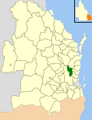
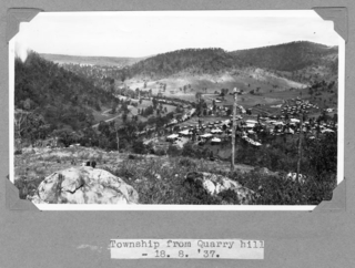
Kilcoy is a rural town and locality in the Somerset Region, Queensland, Australia. In the 2021 census, the locality of Kilcoy had a population of 1,996 people.

Laidley is a rural town and locality in the Lockyer Valley Region, Queensland, Australia. In the 2016 census, the locality of Laidley had a population of 3,808 people.

Red Hill is an inner northern suburb in the City of Brisbane, Queensland, Australia. In the 2016 census, Red Hill had a population of 5,560 people.

Mossman is a rural town and locality in the Shire of Douglas, Queensland, Australia. It is the administrative centre for the Douglas Shire Council In the 2016 census, the locality of Mossman had a population of 1,937 people.

Woodford is a rural town and locality in the City of Moreton Bay, Queensland, Australia. In the 2016 census, the locality of Woodford had a population of 3,458 people.
The Shire of Kilcoy was a local government area in South East Queensland, Australia, about 95 kilometres (59 mi) northwest of Brisbane along the D'Aguilar Highway, not far from the Sunshine Coast. The shire covered an area of 1,445.2 square kilometres (558.0 sq mi), and existed from 1912 until its merger with the Shire of Esk to form the Somerset Region on 15 March 2008.
The Shire of Esk was a local government area in South East Queensland, Australia, located about 90 kilometres (56 mi) west - northwest of Brisbane. It stretched from the Lockyer Valley north and west to the Great Dividing Range and up the valley of the Brisbane River. Esk covered an area of 3,936.2 square kilometres (1,519.8 sq mi), and existed from 1879 until its merger with the Shire of Kilcoy to form the Somerset Region on 15 March 2008.
The Shire of Cooloola was a local government area located about 170 kilometres (106 mi) north of Brisbane – the state capital of Queensland, Australia. The shire covered an area of 2,968.8 square kilometres (1,146.3 sq mi), and was the product of a merger in 1993 between the City of Gympie and the Shire of Widgee, which had both existed since 1879–1880. It merged with several other LGAs to form the Gympie Region on 15 March 2008.

The Shire of Woocoo was a local government area located in the Wide Bay–Burnett region of Queensland, Australia, containing the rural residential area to the west of the town of Maryborough, and surrounding countryside. The shire covered an area of 2,007.9 square kilometres (775.3 sq mi), and existed as a local government entity from 1914 until 2008, when it was amalgamated with the City of Maryborough, City of Hervey Bay and the 1st and 2nd divisions of the Shire of Tiaro to form the Fraser Coast Region.

The Somerset Region is a local government area located in the West Moreton region of South East Queensland, Australia, about 100 kilometres (62 mi) northwest of Brisbane and centred on the town of Esk. It was created in 2008 from a merger of the Shire of Esk and the Shire of Kilcoy. It is commonly known as the Brisbane Valley, due to the Brisbane River which courses through the region, although significant parts of the region lie outside the hydrological Brisbane Valley itself.

Crows Nest is a rural town and locality in the Toowoomba Region, Queensland, Australia. The town is located in the Darling Downs on the New England Highway, 158 kilometres (98 mi) from the state capital, Brisbane and 43 kilometres (27 mi) from the nearby city of Toowoomba. In the 2016 census, Crows Nest had a population of 2160 people.

Mount Mee is a rural town and locality in the City of Moreton Bay, Queensland, Australia. In the 2021 census, Mount Mee had a population of 519 people.

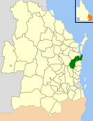
Villeneuve is a rural town and locality in the Somerset Region, Queensland, Australia. In the 2021 census, the locality of Villeneuve had a population of 193 people.

Mount Delaney is a rural locality in the City of Moreton Bay, Queensland, Australia. In the 2016 census Mount Delaney had a population of 85 people.

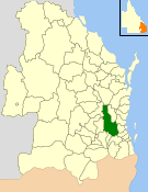
Mount Kilcoy is a rural locality in the Somerset Region, Queensland, Australia. In the 2021 census, Mount Kilcoy had a population of 277 people.
Winya is a rural locality in the Somerset Region, Queensland, Australia. In the 2016 census, Winya had a population of 72 people.
Netherdale is a rural locality in the Mackay Region, Queensland, Australia. In the 2016 census Netherdale had a population of 111 people.
Somerset Dam is a rural town and locality in the Somerset Region, Queensland, Australia. In the 2016 census, Somerset Dam had a population of 69 people. When first being planned, it was unofficially known as the Stanley River township.


