
Creswell Crags is an enclosed limestone gorge on the border between Derbyshire and Nottinghamshire, England, near the villages of Creswell and Whitwell. The cliffs in the ravine contain several caves that were occupied during the last ice age, between around 43,000 and 10,000 years ago. Its caves contain the northernmost cave art in Europe. The evidence of occupation found in the rich series of sediments that accumulated over many thousands of years is regarded as internationally unique in demonstrating how prehistoric people managed to live at the extreme northernmost limits of their territory during the Late Pleistocene period.

Thomas Crofton Croker was an Irish antiquary, best known for his Fairy Legends and Traditions of the South of Ireland (1825–1828), and who also showed considerable interest in Irish song and music.

The Jeita Grotto is a system of two separate, but interconnected, karstic limestone caves spanning an overall length of nearly 9 kilometres (5.6 mi). The caves are situated in the Nahr al-Kalb valley within the locality of Jeita, 18 kilometres (11 mi) north of the Lebanese capital Beirut. Though inhabited in prehistoric times, the lower cave was not rediscovered until 1836 by Reverend William Thomson; it can only be visited by boat since it channels an underground river that provides fresh drinking water to more than a million Lebanese.

Ballintemple is a suburb of Cork city, Ireland. The village is situated on the east side of the city with its limits extending to the River Lee and the village of Blackrock further to the east. Originally, Ballintemple was a separate village but today it has been enclosed by the city.
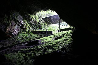
Dunmore Cave is a limestone solutional cave in Ballyfoyle, County Kilkenny, Ireland. It is formed in Lower Carboniferous (Viséan) limestone of the Clogrenan Formation. It is a show cave open to the public, particularly well known for its rich archaeological discoveries and for being the site of a Viking massacre in 928.

Killavullen is a village on the river Blackwater, in County Cork, Ireland. The village is located just south of the N72 road, between Mallow and Castletownroche. It is 10 km (6.2 mi) east of Mallow and 32 km (20 mi) north of Cork city. The census of 2002 put the population at 224. The parish of Killavullen & Annakissa contains close to 1500 people.
Dukart's Canal was built to provide transport for coal from the Drumglass Collieries to the Coalisland Canal in County Tyrone, Ulster, Ireland. It opened in 1777, and used three inclined planes, rather than locks, to cope with changes in level. There is little evidence that it was ever used, as the planes could not be made to work properly, and they were dismantled in 1787.
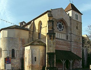
Sorde-l'Abbaye is a commune, in the department of Landes and the region of Nouvelle-Aquitaine in southwestern France.

The Church of St Anne is a Church of Ireland church located in the Shandon district of Cork city in Ireland. Built between 1722 and 1726, it is situated on a hill overlooking the River Lee. The church tower is a noted landmark and symbol of the city, and the church bells were popularised in a 19th century song.

Parc Cwm long cairn, also known as Parc le Breos burial chamber, is a partly restored Neolithic chambered tomb, identified in 1937 as a Severn-Cotswold type of chambered long barrow. The cromlech, a megalithic burial chamber, was built around 5850 years before present (BP), during the early Neolithic. It is about seven 1⁄2 miles (12 km) west south–west of Swansea, Wales, in what is now known as Coed y Parc Cwm at Parc le Breos, on the Gower Peninsula.

Carrigogunnell Castle is a medieval Irish fortification near the village of Clarina, on the banks of the River Shannon in County Limerick.

Mummy Cave is a rock shelter and archeological site in Park County, Wyoming, United States, near the eastern entrance to Yellowstone National Park. The site is adjacent to the concurrent U.S. Routes 14/16/20, on the left bank of the North Fork of the Shoshone River at an altitude of 6,310 feet (1,920 m) in Shoshone National Forest.

Raymonden is a prehistoric cave near Chancelade in the French département Dordogne. The cave was inhabited during the Upper Paleolithic and contained, besides many artefacts, a human skeleton.
John (Jack) Cristopher Coleman (1914–1971) was a respected Irish geographer, archaeologist, speleologist and mountaineer. He devoted much of his life to the study of the caves of Ireland, the product of which were his many contributions to scientific journals in Ireland and the United Kingdom, his founding of the Speleological Society of Ireland and the publishing of his book, The Caves of Ireland.
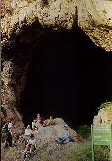
Mugharet el-Zuttiyeh is a prehistoric archaeological site in Upper Galilee, Israel. It is situated 800 m (2,600 ft) from the Nahal Amud outlet, approximately 30 m (98 ft) above the wadi bed. It was found to house a fossil today known as the "Galilee skull" and "The Palestinian Man".
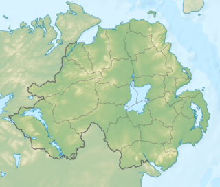
Portbraddon Cave is a relict sea cave located near Portbraddon, County Antrim on the north coast of Northern Ireland. Its location 5 m (16 ft) above the present-day high water mark makes it important archaeologically, as it would have been inhabited as far back as the Mesolithic.
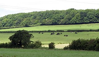
Goldsland is a small hamlet and farm in the Vale of Glamorgan in south Wales. It is located near the boundary of the Wenvoe Castle Golf Club in the parish of Wenvoe. It lies to the east of Dyffryn and south of St Lythans and the road leading from the west passes through the farms of Old and New Wallace. Goldsland Brook flows through here. A sub-manor was reportedly held at Goldsland by a Mathew of Llandaff under the manor of Wenvoe in 1583.
Fermoy is a barony in County Cork in Ireland. It is bordered by the baronies of Orrery and Kilmore to the north-west; Duhallow to the west; Barretts to the south-west; Barrymore to the south; Condons and Clangibbon to the east; and Coshlea, County Limerick to the north. It is bounded to the south by the Nagle Mountains and the valley of the Munster Blackwater. The Ballyhoura Mountains mark the northern boundary. A tributary of the Blackwater, the Awbeg has two branches in its upper stretches; one branch forms the northern boundary while the other near Buttevant, forms the western limit. To the east, lies another Blackwater tributary, the Funcheon. Anomalously, the namesake town of Fermoy is actually in the barony of Condons and Clangibbon. The town with the greatest population in the barony is Mallow.
The Soul Cages is a fairy tale invented by Thomas Keightley, originally published as a piece of genuine Irish folktale in T. Crofton Croker's Fairy Legends and Traditions of the South of Ireland (1825–28). It features a male merrow (merman) inviting a local fisherman to his undersea home. The 'soul cages' in the title refer to a collection of human souls that the merman kept in his home.

Arago cave is a prehistoric site in the community of Tautavel, in the department of Pyrénées-Orientales. It is a large cavity overlooking a perennial stream called the Verdouble. Human remains attributed to the Tautavel Man and the lithic remnants of the Lower Paleolithic were discovered in the cave.


