Kilmuckridge-Tinnaberna Sandhills

Last updated

Kilmuckridge-Tinnaberna Sandhills
Ireland adm location map.svg
Red pog.svg
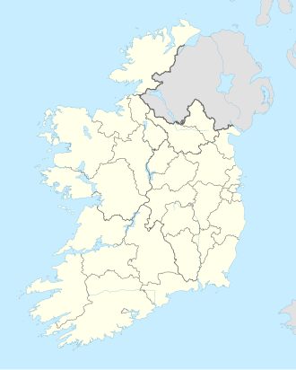
Location County Wexford, Ireland
Nearest city Kilmuckridge
Coordinates 52°29′34″N6°15′39″W / 52.4927°N 6.2607°W / 52.4927; -6.2607 Coordinates: 52°29′34″N6°15′39″W / 52.4927°N 6.2607°W / 52.4927; -6.2607 [1]
www.npws.ie/protectedsites/specialareasofconservationsac/kilmuckridge-tinnabernasandhillssac/

The Kilmuckridge-Tinnaberna Sandhills are a system of clay cliffs, sand dunes, wet woodland, and gently undulating fixed dunes, known as sand hills, in County Wexford, Ireland. The area was surveyed and described [2] during the 1990s and was designated a Special Area of Conservation. The site was considered to be the best example of grey dunes for lichen diversity in the country.
Contents

Damage

Damaged area March 2011, some restoration progress evident. Tinnaberna-Damage.jpg
Damaged area March 2011, some restoration progress evident.

As at 2011 the National Parks and Wildlife Service is attempting to reverse degradation of a large portion of the site (11 ha) that has been damaged by overgrazing and bulldozing. [3] Human-induced damage was first reported to the authorities in 2002. [4] Damage continued for a further eight years before the area was made subject to a Ministerial Direction to restore it to its prior condition, [5] issued under relevant Irish legislation. [6]

Related Research Articles

<span class="mw-page-title-main">Mungo National Park</span> Protected area in New South Wales, Australia

Mungo National Park is a protected national park that is located in south-western New South Wales, in eastern Australia. The 110,967-hectare (274,210-acre) national park is situated approximately 875 kilometres (544 mi) west of Sydney in the Balranald Shire. Mungo National Park is the traditional meeting place of the Muthi Muthi, Nyiampaar and Barkinji Aboriginal Nations. People are no longer able to climb the sand dunes by themselves as stricter rules have been enforced, all visitors groups need to be accompanied by an accredited tour guide to access the sand dunes.

<span class="mw-page-title-main">Holkham National Nature Reserve</span> Nature reserve in the United Kingdom

Holkham National Nature Reserve is England's largest national nature reserve (NNR). It is on the Norfolk coast between Burnham Overy Staithe and Blakeney, and is managed by Natural England with the cooperation of the Holkham Estate. Its 3,900 hectares comprise a wide range of habitats, including grazing marsh, woodland, salt marsh, sand dunes and foreshore. The reserve is part of the North Norfolk Coast Site of Special Scientific Interest, and the larger area is additionally protected through Natura 2000, Special Protection Area (SPA) and Ramsar listings, and is part of both an Area of Outstanding Natural Beauty (AONB) and a World Biosphere Reserve. Holkham NNR is important for its wintering wildfowl, especially pink-footed geese, Eurasian wigeon and brant geese, but it also has breeding waders, and attracts many migrating birds in autumn. A number of scarce invertebrates and plants can be found in the dunes, and the reserve is one of the only two sites in the UK to have an antlion colony.

<span class="mw-page-title-main">Great Sand Dunes National Park and Preserve</span> American national park in Colorado

Great Sand Dunes National Park and Preserve is an American national park that conserves an area of large sand dunes up to 750 feet (230 m) tall on the eastern edge of the San Luis Valley, and an adjacent national preserve in the Sangre de Cristo Range, in south-central Colorado, United States. The park was originally designated Great Sand Dunes National Monument on March 17, 1932, by President Herbert Hoover. The original boundaries protected an area of 35,528 acres. A boundary change and redesignation as a national park and preserve was authorized on November 22, 2000, and then established on September 24, 2004. The park encompasses 107,342 acres while the preserve protects an additional 41,686 acres for a total of 149,028 acres. The recreational visitor total was 527,546 in 2019.

<span class="mw-page-title-main">Natterjack toad</span> Species of amphibian

The natterjack toad is a toad native to sandy and heathland areas of Europe. Adults are 60–70 mm in length, and are distinguished from common toads by a yellow line down the middle of the back and parallel paratoid glands. They have relatively short legs, which gives them a distinctive gait, contrasting with the hopping movement of many other toad species.

<span class="mw-page-title-main">Saltee Islands</span> Two islands in Ireland

The Saltee Islands are a pair of small islands lying 5 kilometres off the southern coast of County Wexford in Ireland. The two islands are Great Saltee and Little Saltee. They have been largely unoccupied since the early 20th century and have been privately owned by the Neale family since 1943. Together the islands cover an area of 1.2 square kilometers.

<span class="mw-page-title-main">Assateague Island National Seashore</span> Barrier island operated by the National Park Service of the United States

Assateague Island National Seashore is a unit of the National Park Service system of the U.S. Department of the Interior. Located on the East Coast along the Atlantic Ocean in Maryland and Virginia, Assateague Island is the largest natural barrier island ecosystem in the Middle Atlantic states region that remains predominantly unaffected by human development. Located within a three-hour drive to the east and south of Richmond, Washington, Baltimore, Wilmington, Philadelphia major metropolitan areas plus north of the several clustered smaller cities around Hampton Roads harbor of Virginia with Newport News, Hampton, Norfolk, Portsmouth, Chesapeake and Virginia Beach. The National Seashore offers a setting in which to experience a dynamic barrier island and to pursue a multitude of recreational opportunities. The stated mission of the park is to preserve and protect “unique coastal resources and the natural ecosystem conditions and processes upon which they depend, provide high-quality resource-based recreational opportunities compatible with resource protection and educate the public as to the values and significance of the area”.

<span class="mw-page-title-main">Guadalupe-Nipomo Dunes</span> Dune system in California

Guadalupe-Nipomo Dunes is the largest remaining dune system south of San Francisco and the second largest in the U.S. state of California. It encompasses an 18-mile (29 km) stretch of coastline on the Central Coast of California and extends from southern San Luis Obispo County to northern Santa Barbara County.

<span class="mw-page-title-main">Lough Yganavan and Lough Nambrackdarrig</span> Body of water

Lough Yganavan and Lough Nambrackdarrig are two lakes of ecological importance in County Kerry, Ireland. In 1988, Lough Nambrackdarrig and the southern half of Lough Yganavan were designated as National Nature Reserves. Since 1998, the lakes have been included in a Special Area of Conservation (SAC) of 271.6 hectares (3 km2), which protects land in private ownership and the two state-owned nature reserves. The habitats in the SAC include fixed dunes, a type of machair.

<span class="mw-page-title-main">Karin Dubsky</span> German-Irish marine ecologist and environmentalist

Karin Dubsky is a German-Irish marine ecologist working in Trinity College Dublin, notable as an environmental activist, the coordinator and co-founder of Coastwatch Europe, an environmental NGO and a member of the European Environmental Bureau.

Natural Heritage Area is a conservation designation denoting a protected area in Ireland. The Wildlife (Amendment) Act 2000 makes legal provision for the designation and protection of a national network of Natural Heritage Areas (NHAs).

<span class="mw-page-title-main">North Devon's Biosphere Reserve</span> UNESCO biosphere reserve in North Devon, England

North Devon's Biosphere Reserve is a UNESCO biosphere reserve in North Devon. It covers 55 square miles (140 km2) and is centred on Braunton Burrows, the largest sand dune system (psammosere) in England. The boundaries of the reserve follow the edges of the conjoined catchment basin of the Rivers Taw and the Torridge and stretch out to sea to include the island of Lundy. The biosphere reserve is primarily lowland farmland, and includes many protected sites including 63 Sites of Special Scientific Interest which protect habitats such as culm grassland and broadleaved woodlands. The most populous settlements in its buffer area are Barnstaple, Bideford, Northam, Ilfracombe, and Okehampton.

<span class="mw-page-title-main">Yumbarra Conservation Park</span> Protected area in South Australia

Yumbarra Conservation Park, formerly the Yumbarra National Park, is a protected area in the Australian state of South Australia located about 55 kilometres north of the town centre of Ceduna.

<span class="mw-page-title-main">Aldinga Scrub Conservation Park</span> Protected area in South Australia

Aldinga Scrub Conservation Park is a protected area in the Australian state of South Australia located in the suburb of Aldinga Beach about 46 kilometres south by west of the state capital of Adelaide.

Beatrice Islets are pair of islets in the Australian state of South Australia located in Nepean Bay on the north coast of Kangaroo Island about 4 kilometres east of Kingscote. The islets and adjoining intertidal areas are notable as habitat for bird life. The islet pair has enjoyed protected area status since 1909 and since at least 1972, have been part of the Beatrice Islet Conservation Park. During either the 1960s or the 1970s, the islets were extensively damaged by an exercise to remove an infestation of South African boxthorn.

Busby Islet is an islet in the Australian state of South Australia located in Nepean Bay on the north coast of Kangaroo Island about 2 kilometres north of the municipal seat of Kingscote. The islet and adjoining areas are notable as habitat for bird life. The islet has enjoyed protected area status since 1909 and since at least 1972, have been part of the Busby Islet Conservation Park.

Aberdour Conservation Park is a protected area in the Australian state of South Australia located in the state's south-east in the locality of Willalooka about 226 kilometres (140 mi) south-east of the state capital of Adelaide and about 35 kilometres (22 mi) south of the town of Keith.

<span class="mw-page-title-main">Sitka Sedge State Natural Area</span> Natural area in Tillamook County, Oregon, United States

Sitka Sedge State Natural Area is an estuary and beach on the north coast of the U.S. state of Oregon in Tillamook County. Sitka Sedge consists of 357 acres (144 ha) of tidal marsh, mudflats, dunes, forested wetlands, and uplands at the south end of the Sand Lake estuary, north of Tierra Del Mar.

<span class="mw-page-title-main">Limeburners Creek National Park</span> Protected area in New South Wales, Australia

Limeburners Creek National Park is a protected national park on the Mid North Coast of New South Wales, Australia. The 91.2 km national park is located 5 km (3.1 mi) to the north of Port Macquarie and exists across both the Kempsey Shire and Port Macquarie-Hastings Council local government areas, but is chiefly managed by National Parks and Wildlife Service. The area was originally erected as a nature reserve but this reservation was revoked when it became formally recognised as a national park in 2010 under the National Parks and Wildlife Act (1974). Many threatened ecological habitats and species of fauna and flora are found within this park, alongside several heritage sites of cultural significance, particularly to the local Birpai and Dunghutti people upon whose land the park exists. The protected status of this national park is largely owing to the ecological and cultural value of the area, in addition to the value of the ecosystems to further scientific research.

<span class="mw-page-title-main">Ballyteigue Burrow</span>

Ballyteigue Burrow is a series of coastal habitats of international importance, and national nature reserve of approximately 561 acres (2.27 km2) in County Wexford. It is also a Special Area of Conservation.

<span class="mw-page-title-main">The Raven Nature Reserve</span> Nature reserve in County Wexford, Ireland

The Raven Nature Reserve is a Ramsar site and national nature reserve of approximately 1,455.5 acres (5.890 km2) located in County Wexford, Ireland. It is managed by the Irish National Parks & Wildlife Service.

References

  1. National Parks and Wildlife Services Map Viewer Archived 20 October 2014 at the Wayback Machine Site Code Number 001741
  2. "Site Synopsis" (PDF). Archived from the original (PDF) on 23 April 2014. Retrieved 19 September 2011.
  3. NPWS enforcement file, Site code 1741, available at NPWS, Ely Place, Dublin 2 for photocopying
  4. McDonald, Frank (30 July 2010). "Intensive cattle farming causing severe damage to protected Wexford dunes]". The Irish Times . Retrieved 12 February 2020.
  5. Fintan Lambe, article Archived 1 August 2012 at archive.today , Gorey Guardian
  6. section 19.1 of the EC (NATURAL HABITATS) Regulations, 1997 (see S.I. No. 94/1997 EC (NATURAL HABITATS) Regulations)

Photographs of undamaged and damaged areas.