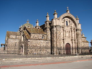
Lampa province is a province of the Puno region in Peru. Its population is about 40,856. The capital is Lampa.

The Yarowilca Province is the smallest of eleven provinces of the Huánuco Region in Peru. The capital of this province is Chavinillo.

The Dos de Mayo Province is one of eleven provinces of the Huánuco Region in Peru. The capital of this province is the city of La Unión.

The Huamalíes Province is one of eleven provinces of the Huánuco Region in Peru. The capital of this province is the city of Llata.
Pichirhua District is one of the nine districts of the Abancay Province in Peru.
Marías District is one of nine districts of the province Dos de Mayo in Peru.

Llata District is one of eleven districts of the Huamalíes Province in Peru.
Pariauccro or Pariaucro is a massif in the Huayhuash mountain range in the Andes of Peru. This mountain has two summits, the highest one reaching an altitude of 5,572 m (18,281 ft). It is located in the Lima Region, Cajatambo Province, Cajatambo District. Pariauccro lies on a sub-range west of the main range, north of Mitopunta and northeast of Huacshash.

Ukrupata is a mountain in the Andes of Peru, about 5,300 m (17,388 ft) high. It is situated in the Lima Region, Huarochirí Province, on the border of the districts of Chicla and Carampoma. Ukrupata lies northwest of Millpu and east of Wamp'ar and the two lakes named Wamp'arqucha and Wachwaqucha.
Nina Ukru is a mountain in the Paryaqaqa or Waruchiri mountain range in the Andes of Peru, about 5,400 metres (17,717 ft) high. It is situated in the Lima Region, Huarochirí Province, Quinti District. Nina Ukru lies southwest of Qullqip'ukru and west of Paryaqaqa.
Hatun Ukru is a mountain in the Cordillera Central in the Andes of Peru, about 4,800 m (15,748 ft) high. It is situated in the Lima Region, Huarochirí Province, Quinti District. Hatun Ukru lies southwest of a lake named P'itiqucha.
Kinwa Ukru is a 5,006-metre-high (16,424 ft) mountain in the Andes of Peru. It is located in the Lima Region, Oyón Province, Oyón District. Kinwa Ukru lies west of a mountain named Aququcha.
Hatun Ukru is a 4,650-metre-high (15,260 ft) mountain in the Andes of Peru. It is located in the Pasco Region, Pasco Province, Ticlacayan District, northwest of the Waqurunchu mountain range.
Wank'a Ukru Punta is a 4,410-metre-high (14,470 ft) mountain in the Andes of Peru. It is located in the Huánuco Region, Dos de Mayo Province, Marías District. Wank'a Ukru Punta lies northwest of Tikti Punta and north of a lake named Saqsaqucha.
Tikti Punta is a 4,944-metre-high (16,220 ft) mountain in the Andes of Peru. It is located in the Huánuco Region, Dos de Mayo Province, Marías District. Tikti Punta lies southeast of Wank'a Ukru Punta and northeast of a lake named Saqsaqucha.
Wayta Hirka Punta is a mountain in the Andes of Peru which reaches a height of approximately 4,400 m (14,400 ft). It is located in the Huánuco Region, Dos de Mayo Province, Marías District. Wayta Hirka Punta lies south of Tikti Punta and southeast of a lake named Saqsaqucha.
Tuqtuqucha Punta is a mountain in the Andes of Peru which reaches a height of approximately 4,400 m (14,400 ft). It is located in the Huánuco Region, Huánuco Province, Santa María del Valle District, and in the Yarowilca Province, on the border of the districts of Aparicio Pomares and Chavinillo. It lies north of a lake named Tuqtuqucha.
Ukru Ukru is a mountain in the Cordillera Central in the Andes of Peru which reaches a height of approximately 4,800 metres (15,748 ft). It is located in the Lima Region, Yauyos Province, Tanta District. Ukru Ukru lies northwest of Paqarin Pawka and Saqsa and north of Muki at a lake named Pawqarqucha.
Sankha Ukru is a mountain in the Cordillera Central in the Andes of Peru which reaches a height of approximately 4,600 metres (15,092 ft). It is located in the Lima Region, Yauyos Province, Huancaya District.
Artisa Ukru is a mountain in the Andes of Peru which reaches a height of approximately 4,400 m (14,436 ft). It is located in the Huánuco Region, Huamalíes Province, Llata District.


