Kimsaqucha (Puno)

Last updated
Kimsaqucha
Peru physical map.svg
Red pog.svg
Kimsaqucha
Location Peru
Puno Region, Carabaya Province
Coordinates 13°52′25″S70°15′48″W / 13.87361°S 70.26333°W / -13.87361; -70.26333 Coordinates: 13°52′25″S70°15′48″W / 13.87361°S 70.26333°W / -13.87361; -70.26333

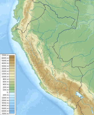
Kimsaqucha (Quechua kimsa three, qucha lake, [1] "three lakes", hispanicized spelling Quimsacocha) is a group of three lakes in Peru located in the Puno Region, Carabaya Province, Ituata District. The lakes lie north-east of the Kallawaya mountain range, at the foot of the mountain Yana Wayllayuq (Quechua for "the one with a black meadow", hispanicized Yana Huayllayoc). [2]

The lakes are connected by an intermittent stream. It flows to the little lake Sallaqucha (Sallaccocha) where it turns to the south-east to reach the river Yuraq Kancha (Yurac Cancha) whose waters flow to the Inambari River.
Related Research Articles

Carabaya Province Province in Puno, Peru

Carabaya Province is a province of the Puno Region in the southern part of Peru. It is bounded on the north by the Madre de Dios Region, on the east by the Sandia Province, on the south by the provinces of Azángaro, Melgar and Putina and on the west by the Cusco Region. The capital of the province is the city of Macusani.

Yanaqucha (Junín)

Yanaqucha is a lake in the Junín Region in Peru. It is situated in the Junín Province, in the north of the Carhuamayo District, north of the mountain Yanahirka.

Yanaqucha may refer to:

Chichicapac mountain in Peru

Chichicapac is a mountain in the Andes of Peru. It is one of the highest peaks of the Carabaya mountain range rising up to 5,614 metres (18,419 ft). Chichicapac is located in the Puno Region, Carabaya Province, on the border of the districts of Ayapata and Macusani. It lies southeast of the higher mountains Huaynaccapac and Allincapac and northeast of the lake Chaupicocha.

Lake Chaupicocha (Puno)

Lake Chaupicocha is a lake in Peru located in the Puno Region, Carabaya Province, Macusani District. It lies in the Carabaya mountain range, south of Allincapac and southwest of Chichicapac.

Kunka mountain in Peru

Kunka is a mountain in the La Raya mountain range in the Andes of Peru. It is situated at the La Raya Pass and the road and rail which connect Cusco with Lake Titicaca. It is located in the Cusco Region, Canas Province, Layo District, and in the Puno Region, Melgar Province, Santa Rosa District, and about 5,200 metres (17,060 ft) high. Kunka lies southwest of the mountains Yana Khuchilla and Chimpulla. Other neighboring mountains are Huch'uy K'uchu north of it and Hatun Ichhuna Kunka in the south. Between the road and the mountain there is a little lake named Q'umirqucha.

Yanaqucha (Ambo)

Yanaqucha is a lake in the Andes of Peru located in the Huánuco Region, Ambo Province, Ambo District. It is situated between the mountains Yanahirka in the southwest and Yanaqucha in the northeast.

Macho Ritti mountain in Peru

Macho Ritti is a mountain in the Vilcanota mountain range in the Andes of Peru, about 5,200 metres (17,060 ft) high. It is located in the Puno Region, Carabaya Province, on the border of the districts Corani and Ollachea. Macho Ritti lies north-west of the lakes Mancacocha and Jomercocha and north of the mountain Ananta.

Riti Huasi mountain in Peru

Riti Huasi is a mountain in the Vilcanota mountain range in the Andes of Peru, about 5,000 metres (16,404 ft) high. It is situated in the Puno Region, Carabaya Province, on the border of the districts Corani and Ollachea.

Qillwaqucha Urqu mountain in Peru

Qillwaqucha Urqu is a mountain in the Andes of Peru, about 4,174 metres (13,694 ft) high. It is situated in the Puno Region, Carabaya Province, on the border of the districts Ollachea and San Gaban. Qillwaqucha Urqu lies north of the river Khichumayu whose waters flow to the Inambari River.

Llusca Ritti (Corani) mountain in Peru

Llusca Ritti is a mountain in the Vilcanota mountain range in the Andes of Peru, about 5,200 metres (17,060 ft) high. It is located in the Puno Region, Carabaya Province, Corani District. Llusca Ritti lies southeast of the mountains Taruca Sayana and Quello Sallayoc, southwest of the mountain Riti Huasi and north of the mountain Yana Sallayoc.

Quello Sallayoc mountain in Peru

Quello Sallayoc is a mountain in the Vilcanota mountain range in the Andes of Peru, about 5,000 metres (16,404 ft) high. It is located in the Puno Region, Carabaya Province, on the border of the districts Corani and Ollachea. Quello Sallayoc lies south-east of the mountains Llusca Ritti (Cusco-Puno), Jori Pintay and Taruca Sayana, west of the mountain Riti Huasi and northwest of the mountains Yana Sallayoc and Llusca Ritti. Its ridge stretches to the northeast.

Yana Sallayoc mountain in Peru

Yana Sallayoc is a mountain in the Vilcanota mountain range in the Andes of Peru, about 5,000 metres (16,404 ft) high. It is lies in the Puno Region, Carabaya Province, Corani District. Yana Sallayoc is situated south of the mountains Quello Sallayoc and Llusca Ritti, east of the mountain Tica Pallana and west of the mountain Viscachani.

Yurac Salla mountain in Peru

Yurac Salla is a mountain in the Vilcanota mountain range in the Andes of Peru, about 5,000 metres (16,404 ft) high. It is lies in the Puno Region, Carabaya Province, Ollachea District. Yurac Salla is situated north-east of the mountains Jori Pintay, Taruca Sayana and Quello Sallayoc.

Yanaqucha (Carabaya) mountain in Peru

Yanaqucha is a mountain at a small lake of the same name in the Willkanuta mountain range in the Andes of Peru, about 5,000 metres (16,404 ft) high. The mountain is located in the Puno Region, Carabaya Province, on the border of the districts Corani and Ollachea. It lies southeast of the mountain Rit'i Wasi, northeast of the mountain T'ika Pallana and east of the mountain Llusk'a Rit'i and the lake Khichu Suytuqucha (Quicho Suytococha).

Yanacocha (Carabaya-Melgar) mountain in Peru

Yanacocha is a mountain in the Vilcanota mountain range in the Andes of Peru, about 5,000 metres (16,404 ft) high. The mountain is located in the Puno Region, Carabaya Province, Macusani District, and the Melgar Province, Nuñoa District. Yanacocha lies south of the river Ninahuisa.

Jatun Quenamari mountain in Peru

Jatun Quenamari is a mountain in the Vilcanota mountain range in the Andes of Peru, about 5,400 metres (17,717 ft) high. It is situated in the Puno Region, Carabaya Province, Corani District. Jatun Quenamari lies east of the large glaciated area of Quelccaya, southwest of Cuncunani.

Hatun Mayu river in the Puno Region, Peru

Hatun Mayu which upstream is called Qinamari(Quenamari) and downstream successively is named Nuñoa and Río Grande is a river in Peru. It is a right tributary of the Crucero River whose waters flow to Lake Titicaca. It is located in the Puno Region, Azángaro Province, Asillo District, and in the Melgar Province, in the districts Nuñoa and Orurillo.

Jollpajaja (Marcapata) mountain in Peru

Jollpajaja is a mountain in the Vilcanota mountain range in the Andes of Peru, about 4,600 metres (15,092 ft) high. It is located in the Cusco Region, Quispicanchi Province, Marcapata District. It is situated southwest of Vizcachani and north of Yana Orjo. West of Jollpajaja and Yana Orjo there is a small lake named Mullopunco.

Quellhuacotarriti mountain in Peru

Quellhuacotarriti is a mountain in the Carabaya mountain range in the Andes of Peru, about 5,200 m (17,100 ft) high. It is located in the Puno Region, Carabaya Province, Macusani District. Quellhuacotarriti lies southwest of Allincapac and south of Vela Cunca.

References

  1. Teofilo Laime Acopa, Diccionario Bilingüe, Iskay simipi yuyay k'ancha, Quechua – Castellano, Castellano – Quechua (Quehcua-Spanish dictionary)
  2. escale.minedu.gob.pe - UGEL map of the Carabaya Province (Puno Region)