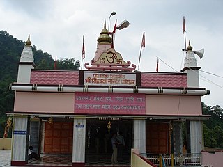
Garhwal is the western region and administrative division of the Indian state of Uttarakhand which is home to the Garhwali people. Lying in the Himalayas, it is bounded on the north by Tibet, on the east by Kumaon region, on the south by Uttar Pradesh state, and on the northwest by Himachal Pradesh state. It includes the districts of Chamoli, Dehradun, Haridwar, Pauri Garhwal, Rudraprayag, Tehri Garhwal, and Uttarkashi. The people of Garhwal are known as Garhwali and speak the Garhwali language. The administrative center for Garhwal division is the town of Pauri. The Divisional Commissioner is the administrative head of the Division, and is a senior Indian Administrative Service officer. As the administrative head of the division, the Commissioner is overall incharge of the 7 districts in the Garhwal region of Uttarakhand, and is aided in his duties by an Additional Commissioner and the District Magistrates. Vinod Sharma is currently the Divisional Commissioner of the Garhwal Division.

Devprayag is a town and a nagar panchayat (municipality) in Tehri Garhwal district in the state of Uttarakhand, India, and is one of the Panch Prayag of Alaknanda River where Alaknanda and Bhagirathi rivers meet and take the name Ganga.

Lansdowne, is a cantonment town in Pauri Garhwal district in the Indian state of Uttarakhand.

Dugadda, sometimes spelled Dogadda is a small city and a municipal board in Pauri Garhwal district in the state of Uttarakhand, India. Dugadda is a small city which is surrounded by mountains and situated at the bank of Khoh

Gauchar is a Hill Town located in Karnaprayag tehsil within Chamoli district of Uttarakhand state in India. Gauchar is situated on the left bank of river Alaknanda and is en route the celebrated holy destination of Badrinath. Situated at an altitude of 800 metres (2,620 ft) above the sea level, Gauchar is surrounded by seven mountains. Gauchar is well known for its historic trade fair. This quiet little town is unique in terms of its geographical location and topography. Gauchar is located on one of the largest pieces of flatland in this mountainous region of Uttarakhand.

Kashirampur is a census town in Pauri Garhwal District in the Indian state of Uttarakhand.

Kotdwar is a tehsil in Pauri Garhwal district in Indian state of Uttarakhand. Its old name was Khohdwar, which means the gateway of the river Khoh: as Kotdwar is located on the bank of river Khoh so it was named Kotdwar. It is situated in the south-western part of state and is one of the main entrance points in the state of Uttarakhand. Kotdwar Railway station, established in 1890 by the Britishers is one of the oldest railway stations of the country. Being the gateway of Himalayan Region, Kotdwar rail route was used for timber transportation from Himalayan Region. First Passenger train ran in the year 1901.
Naudiyal (नौडियाल) is a surname of North Indian Brahmans of Hill state Uttarakhand. Naudiyal were called the Brahmans of Village Naudi, Patti Dhaijuli, Pauri Garhwal District of Dev bhoomi Uttarakhand. Adi Gaud Bhardwaj Gotriya Naudiyals are migrated from Bhring and Rajasthan in late eighth century.
"Uchch Shiksha avam uchch sanskar" is slogan of Naudiyal Brahman.

Not to be confused with another Srinagar, the summer capital of Jammu and Kashmir
Ramganga is a tributary of the river Ganga, originating in Uttarakhand state, India.

Hemwati Nandan Bahuguna was a Congress Party leader and former Chief Minister of Uttar Pradesh; he later joined Bharatiya Lok Dal and worked with Charan Singh.
Ganga Bhogpur also known as "Kodia" is a village in Yamkeshwar block in Pauri Garhwal District in the Indian state of Uttarakhand.

Matkunda is a village in the Thalisain tehsil of Bironkhal block in Pauri Garhwal district, Uttarakhand, India.

Thalisain is a town and tehsil of Pauri Garhwal district in the North Indian state of Uttarakhand. At an altitude of 1690 metres from sea level, it is situated on a gentle slope above the right bank of Nayaar (East) river. It is in the southwestern foothills of Dudhatoli Range and at a distance of 83 kilometers from Pauri town and 95 kilometers from Gairsain, the future capital of Uttarakhand.

Veer Chandra Singh Garhwali Uttarakhand University of Horticulture & Forestry, formerly Uttarakhand University of Horticulture and Forestry (UUHF), is a state university located in north Indian state of Uttarakhand. University has two campuses, one is in Bharsar town of Pauri Garhwal district and other is in Ranichauri town of Tehri Garhwal district.

Badol Gaon is a small village in Kotdwara tehsil, Pauri Garhwal district in Uttarakhand State of India. Village has barely 13 houses with a population of 45 (mostly belonging to Kala community. It is administered by a Sarpanch who is an elected head of the village.

Juee is a village in the Pauri Garhwal district of the Indian state of Uttarakhand. It lies approximately 60 kilometres (37 mi) of the district headquarters town of Lansdowne, India. As of the 2011 Census of India, the village had a total population of 172 of which 85 were male and 87 female.


