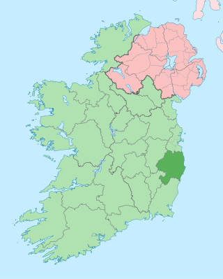
County Wicklow is a county in Ireland. The last of the traditional 32 counties, having been formed as late as 1606, it is part of the Eastern and Midland Region and the province of Leinster. It is bordered by the Irish Sea to the east and the counties of Wexford to the south, Carlow to the southwest, Kildare to the west, and South Dublin and Dún Laoghaire–Rathdown to the north.
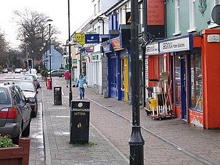
Shankill is an outlying suburb of Dublin, Ireland, on the southeast of County Dublin, close to the border with County Wicklow. It is in the local government area of Dún Laoghaire–Rathdown and had a population of 14,257 as of the 2016 census. It runs from the coast, between Loughlinstown and Bray, inland towards the foothills of the Dublin Mountains. Shankill borders Rathmichael, as well as Loughlinstown, Killiney, Ballybrack and Bray in County Wicklow. It is part of the civil parish of Rathmichael and contains the formerly separate district of Shanganagh, and in its southern parts, the locality of Crinken.

Greystones is a coastal town and seaside resort in County Wicklow, Ireland. It lies on Ireland's east coast, 3.5 km (2.2 mi) south of Bray and 24 km (15 mi) south of Dublin city centre and has a population of 22,009, according to the 2022 census. The town is bordered by the Irish Sea to the east, Bray Head to the north and the Wicklow Mountains to the west. It is the second largest town in County Wicklow.

Bray is a coastal town in north County Wicklow, Ireland. It is situated about 20 km (12 mi) south of Dublin city centre on the east coast. It has a population of 33,512 making it the tenth largest urban area within Ireland. Bray is home to Ardmore Studios, and some light industry is located in the town, with some business and retail parks on its southern periphery. Commuter links between Bray and Dublin are provided by rail, Dublin Bus and the M11 and M50 motorways. Parts of the town's northern outskirts are in County Dublin. The town is in a townland and civil parish of the same name.

The Wicklow Mountains form the largest continuous upland area in Ireland. They occupy the whole centre of County Wicklow and stretch outside its borders into the counties of Dublin, Wexford and Carlow. Where the mountains extend into County Dublin, they are known locally as the Dublin Mountains. The highest peak is Lugnaquilla at 925 metres.
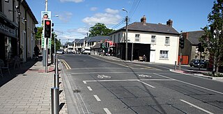
Cabinteely is a suburb of Dublin's southside. It is in Dún Laoghaire–Rathdown, County Dublin, Ireland. The population of all electoral divisions labelled as Cabinteely was 15,864 as of the 2022 census.
Carrickmines Castle is an archaeological site in Carrickmines, County Dublin, in eastern Ireland. The castle was built in the Middle Ages to protect the English-ruled Pale around Dublin. The mostly subsurface ruins lay in the path of the M50 motorway, completed in 2005. Sections of the medieval walls and some sections of the castle's defensive structures were preserved within or under M50 roundabouts.

Fiach mac Aodha Ó Broin was Chief of the Name of Clann Uí Bhroin and Lord of Ranelagh during the Elizabethan wars against the Irish clans.

Glenmalure is a 20-kilometre long U-shaped glacial valley in the Wicklow Mountains in Ireland. Glenmalure is an important base for climbing in the Wicklow mountains, and particularly accessing the massif of Lugnaquilla, and contains one of the earliest An Óige youth hostels in Ireland. Glenmalure was also an important historical area and the site of the Battle of Glenmalure in 1580, as well as various events in the Irish Rebellion of 1798.
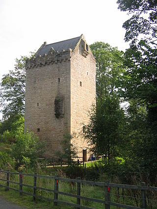
The Tower of Hallbar, also known as Hallbar Tower and Braidwood Castle, is a 16th-century tower house, located to the west of the River Clyde in South Lanarkshire, Scotland. The tower is situated above the Braidwood Burn, 3.5 km (2.2 mi) south-west of Carluke, and 1.5 km (0.93 mi) east of Crossford. It has been restored and is let out as holiday accommodation.

Delgany is a small rural village in County Wicklow in Ireland, located on the R762 road which connects to the N11 road at the Glen of the Downs.

Killincarrig is a village between Greystones and Delgany in North County Wicklow. It lies at the crossroads of the R762 and the R761 roads. Like neighbouring Delgany it has been steadily built up over the past 40 years and now forms part of the continuous urban area of Greystones.
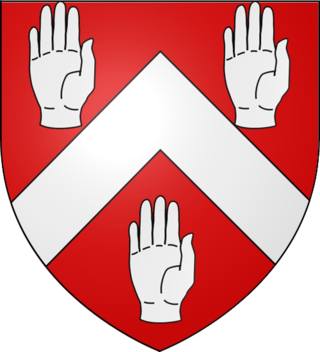
The O'Byrne family is an Irish clann that descend from Bran mac Máelmórda, King of Leinster, of the Uí Faelain of the Uí Dúnlainge. Before the Norman invasion of Ireland they began to colonise south Wicklow. There are many famous people with this Irish last name. This includes Anna O’Byrne, an Australian singer and actress, and Anna Marie O’Byrne, an American model.

Rathdown is the south-easternmost barony in County Dublin, Ireland. It gives its name to the county of Dún Laoghaire–Rathdown. Before County Wicklow was shired in 1606, Rathdown extended further south: it was named after a medieval settlement which grew up around Rathdown Castle, at a site subsequently deserted and now in County Wicklow in the townland of Rathdown Upper, north of Greystones. The Wicklow barony of Rathdown corresponds to the portion transferred to the new county; although both divisions were originally classed as "half baronies", in the nineteenth century the distinction between a barony and a half barony was obsolete.

Rathmore, a village, civil parish and District electoral division in County Kildare, Ireland, is located at the western edge of the Wicklow Mountains in the barony of Naas North. The original settlement was at the southwest corner of the English Pale, serving an important function as a border fortress during the medieval period.
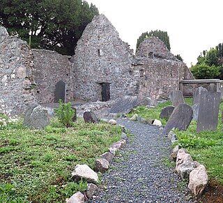
Kilcoole Church, also called Old Kilcoole Church, is a medieval church and National Monument in Kilcoole, County Wicklow, Ireland.

Clara Castle is a tower house (caiseal) located in County Kilkenny, Ireland.

Athenry Castle is a tower house and National Monument located in Athenry, Ireland.

Dunmore Castle is a castle and National Monument located in County Galway, Ireland.
Rathdown Castle is a ruined castle and ancient settlement site located in County Wicklow, Ireland.


