An obelisk is a tall, four-sided, narrow tapering monument which ends in a pyramid-like shape or pyramidion at the top. Originally they were called tekhenu by their builders, the Ancient Egyptians. The Greeks who saw them used the Greek term obeliskos to describe them, and this word passed into Latin and ultimately English. Ancient obelisks are monolithic; that is, they consist of a single stone. Most modern obelisks are made of several stones.

Tikal is the ruin of an ancient city, which was likely to have been called Yax Mutal, found in a rainforest in Guatemala. It is one of the largest archaeological sites and urban centers of the pre-Columbian Maya civilization. It is located in the archaeological region of the Petén Basin in what is now northern Guatemala. Situated in the department of El Petén, the site is part of Guatemala's Tikal National Park and in 1979 it was declared a UNESCO World Heritage Site.

Quiriguá is an ancient Maya archaeological site in the department of Izabal in south-eastern Guatemala. It is a medium-sized site covering approximately 3 square kilometres (1.2 sq mi) along the lower Motagua River, with the ceremonial center about 1 km (0.6 mi) from the north bank. During the Maya Classic Period (AD 200–900), Quiriguá was situated at the juncture of several important trade routes. The site was occupied by 200, construction on the acropolis had begun by about 550, and an explosion of grander construction started in the 8th century. All construction had halted by about 850, except for a brief period of reoccupation in the Early Postclassic. Quiriguá shares its architectural and sculptural styles with the nearby Classic Period city of Copán, with whose history it is closely entwined.

Aksum or Axum, is a historical town in Tigray Region, Ethiopia and the site of the historic capital of the Aksumite Empire. It was a tourist town until the Tigray Conflict started in November 2020 with a population of 66,800 residents.

The Obelisk of Axum is a 4th-century CE, 24-metre-tall (79-feet) phonolite stele/obelisk, weighing 160 tonnes, in the city of Axum in Ethiopia. It is ornamented with two false doors at the base and features decorations resembling windows on all sides. The obelisk ends in a semi-circular top, which used to be enclosed by metal frames.

Seibal, known as El Ceibal in Spanish, is a Classic Period archaeological site of the Maya civilization located in the northern Petén Department of Guatemala, about 100 km SW of Tikal. It was the largest city in the Pasión River region.

A stele, or occasionally stela, when derived from Latin, is a stone or wooden slab, generally taller than it is wide, erected in the ancient world as a monument. The surface of the stele often has text, ornamentation, or both. These may be inscribed, carved in relief, or painted.
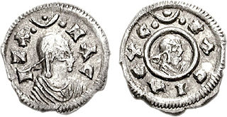
Ezana was ruler of the Kingdom of Aksum an ancient kingdom centered in what is now Eritrea and the Tigray Region of northern Ethiopia.. He himself employed the style "king of Saba and Salhen, Himyar and Dhu-Raydan". Tradition states that ‘Ezana succeeded his father Ella Amida (Ousanas) while still a child and his mother, Sofya served as regent. He conquered the Kingdom of Kush around the year 350 AD.

Calakmul is a Maya archaeological site in the Mexican state of Campeche, deep in the jungles of the greater Petén Basin region. It is 35 kilometres (22 mi) from the Guatemalan border. Calakmul was one of the largest and most powerful ancient cities ever uncovered in the Maya lowlands.

Hawulti is a pre-Aksumite or early Aksumite period obelisk located in Matara, Eritrea. The monument bears the oldest known example of the ancient Ge'ez script.

The Ezana Stone is a stele in Aksum, the capital of the ancient Kingdom of Aksum. The stone monument documents the conversion of King Ezana to Christianity and his conquest of various neighboring areas, including Meroë.

Ixkun is a pre-Columbian Maya archaeological site, situated in the Petén Basin region of the southern Maya lowlands. It lies to the north of the town of Dolores, in the modern-day department of Petén, Guatemala. It is a large site containing many unrestored mounds and ruins and is the best known archaeological site within the municipality of Dolores.
The Kingdom of Aksum, also known as the Kingdom of Axum or the Aksumite Empire, was an ancient kingdom centered in Eritrea and Northern Ethiopia Aksumite rulers styled themselves as King of kings, king of Aksum, Himyar, Raydan, Saba, Salhen, Tsiyamo, Beja and of Kush. Ruled by the Aksumites, it existed from approximately 80 BC to AD 825. The polity was centered in the city of Aksum and grew from the proto-Aksumite Iron Age period around the 4th century BC to achieve prominence by the 1st century AD. Aksum became a major player on the commercial route between the Roman Empire and Ancient India. The Aksumite rulers facilitated trade by minting their own Aksumite currency, with the state establishing its hegemony over the declining Kingdom of Kush. It also regularly entered the politics of the kingdoms on the Arabian Peninsula and eventually extended its rule over the region with the conquest of the Himyarite Kingdom. The Manichaei prophet Mani regarded Aksum as one of the four great powers of his time, the others being Persia, Rome and China. It ruled the South Arabia of Yemen for half a century in the 6th century.
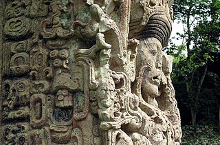
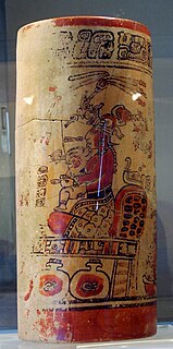
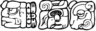
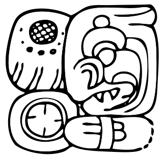
Maya stelae are monuments that were fashioned by the Maya civilization of ancient Mesoamerica. They consist of tall, sculpted stone shafts and are often associated with low circular stones referred to as altars, although their actual function is uncertain. Many stelae were sculpted in low relief, although plain monuments are found throughout the Maya region. The sculpting of these monuments spread throughout the Maya area during the Classic Period, and these pairings of sculpted stelae and circular altars are considered a hallmark of Classic Maya civilization. The earliest dated stela to have been found in situ in the Maya lowlands was recovered from the great city of Tikal in Guatemala. During the Classic Period almost every Maya kingdom in the southern lowlands raised stelae in its ceremonial centre.
Sacul is an archaeological site of the Maya civilization located in the upper drainage of the Mopan River, in the Petén department of Guatemala. The city occupied an important trade route through the Maya Mountains. The main period of occupation dates to the Late Classic Period. In the late 8th century AD through to the early 9th century, Sacul was one of the few kingdoms in the southeastern Petén region to use its own Emblem Glyph, together with Ixtutz and Ucanal.
Kʼinich Yoʼnal Ahk I, also known as Ruler 1, was an ajaw of Piedras Negras, an ancient Maya settlement in Guatemala. He ruled during the Late Classic Period, from 603–639 AD. It has been proposed that he began a new dynasty at Piedras Negras, following years of ineffective kings. As to how Kʼinich Yoʼnal Ahk I came to power, a consensus has not yet been reached, although it is known that he waged several successful wars against Palenque and Sak Tzʼiʼ. He was succeeded by his son, Itzam Kʼan Ahk I, in 639 AD and left behind several monuments, including stelae at Piedras Negras and a large mortuary temple now known as Pyramid R-5.

A twin-pyramid complex or twin-pyramid group was an architectural innovation of the Maya civilization of ancient Mesoamerica. Twin-pyramid complexes were regularly built at the great city of Tikal in the central Petén Basin of Guatemala to celebrate the end of the 20-year kʼatun cycle of the Maya Long Count Calendar. A twin-pyramid complex has been identified at Yaxha, a large city that was 30 kilometres (19 mi) to the southeast of Tikal. Another has been mapped at Ixlu, and Zacpeten appears also to possess at least one twin-pyramid complex and possibly two. These examples outside of Tikal itself indicate that their cities were closely linked to Tikal politically.
Haʼ Kʼin Xook, also known as Ruler 6, was an ajaw of Piedras Negras, an ancient Maya settlement in Guatemala. He ruled during the Late Classic Period, from 767–780 AD. Haʼ Kʼin Xook was a son of Itzam Kʼan Ahk II, and he ascended the throne following the death of his brother, Yoʼnal Ahk III. Haʼ Kʼin Xook's reign ended with either his death or his abdication in favor of his brother Kʼinich Yat Ahk II; archaeologists and Mayanists have not arrived at a clear consensus. Haʼ Kʼin Xook left behind several monuments, including stelae at Piedras Negras and a stone fragment from El Porvenir. In addition, a stone seat known as Throne 1 and erected by Kʼinich Yat Ahk II records either the death or abdication of Haʼ Kʼin Xook.

Caracol is the name given to a large ancient Maya archaeological site, located in what is now the Cayo District of Belize. It is situated approximately 40 kilometres south of Xunantunich and the town of San Ignacio Cayo, and 15 kilometers away from the Macal River. It rests on the Vaca Plateau at an elevation of 500 meters above sea-level, in the foothills of the Maya Mountains. Long thought to be a tertiary center, it is now known that the site was one of the most important regional political centers of the Maya Lowlands during the Classic Period. Caracol covered approximately 200 square kilometers, covering an area much larger than present-day Belize City and supported more than twice the modern city's population.

