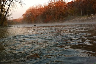
Des Plaines Fish and Wildlife Area is an Illinois state park on 5,000 acres (2,023 ha) in Will County, Illinois, United States. It is located on floodplain adjacent to the confluence of the Des Plaines River and the Kankakee River to form the Illinois River.
Jasper-Pulaski Fish and Wildlife Area is a hunting & fishing wildlife area administered by the Indiana Department of Natural Resource's Division of Fish & Wildlife. The Division of Fish & Wildlife is dedicated to providing a quality hunting & fishing area while maintaining 8,142 acres of wetland, upland and woodland game habitat.

Chester F. Phelps Wildlife Management Area is a 4,539-acre (18.37 km2) Wildlife Management Area located in Fauquier and Culpeper counties, Virginia. It contains over 1,000 acres (4 km2) of open land previously used for agriculture; additional open areas may be found within the forests on the property. Most of the terrain is rolling, low, and shallow; the steepest land can be seen near the Rappahannock River, which forms a large part of the property's western border. A number of small streams cross the land, and a three-acre (12,000 m2) pond is located near its center. The forests on the property contain both pine and hardwood.

Chickahominy Wildlife Management Area is a 5,217-acre (21.11 km2) Wildlife Management Area (WMA) in Charles City County, Virginia. It is the only WMA located in the coastal plain of tidewater Virginia consisting primarily of forested uplands with a lesser amount of wetland habitat. The area's namesake is the Chickahominy River, a tidal river which forms its eastern boundary. Morris Creek flows through the property, forming its southern boundary; other smaller creeks and marshes are also present. The forests mainly consist of mixed hardwoods and pines. The preserve is nearly level, with elevations ranging from 25 to 50 feet above sea level.

Clinch Mountain Wildlife Management Area is a 25,477-acre (103.10 km2) Wildlife Management Area (WMA) in Virginia. It is the second-largest WMA in the Commonwealth, covering portions of Smyth, Washington, Russell, and Tazewell counties.

T. M. Gathright Wildlife Management Area is a 13,428-acre (54.34 km2) Wildlife Management Area (WMA) in Bath County, Virginia. The property's mountainous terrain includes elevations ranging from 1,400 to 3,600 feet above sea level, and is divided by 2,530-acre (10.2 km2) Lake Moomaw. The northwest boundary is marked at the crest of Allegheny Mountain, along the border between Virginia and West Virginia; additional mountains include Bolar Mountain to the west of the lake, and Coles Mountain to its east. A number of streams flow eastward from the summit, terminating at Mill Creek. The primary habitat is upland hardwood forest including mixed stands of oak and hickory, with tulip poplar in some of the more fertile areas. Small non-forested openings are also maintained for the benefit of wildlife.

Havens Wildlife Management Area is a 7,190-acre (29.1 km2) Wildlife Management Area in Roanoke County, Virginia. Located in the Appalachian Highlands and occupying a part of Fort Lewis Mountain, it is steep and generally inaccessible; elevations in the area range from 1,500 to 3,200 feet above sea level. Save for a few intermittent streams and watering holes created for wildlife, there is little water present; in addition, the area's soils are generally shallow and poor. The area was previously used for timber production, and today hosts a mixture of oaks, hickories, and pine.

Hidden Valley Wildlife Management Area is a 6,400-acre (26 km2) Wildlife Management Area in Washington County, Virginia, along its border with Russell County. The area is typified by mountainous mature hardwood forests that have regenerated on land logged in the early twentieth century; a number of small openings which are also maintained as habitat for local wildlife. Its elevation ranges from 2,000 to 4,000 feet above sea level. At the head of the valley is the 60-acre (24 ha) Hidden Valley Lake, which serves as the source of Brumley Creek.

White Oak Mountain Wildlife Management Area is a 2,748-acre (11.12 km2) Wildlife Management Area (WMA) in Pittsylvania County, Virginia, United States. More a plateau than a mountain, the area's topography contains elevations ranging from approximately 550 to 900 feet above sea level. The property is nearly two-thirds forest, with timber types including pines and various examples of hardwoods, such as several species of oak. Forest management, annual and perennial plantings, and controlled burns are used to enhance wildlife habitat within the area. The land is dotted with ponds ranging in size from one to five acres, and its northwest boundary is formed by the Banister River.

Chief Cornstalk Wildlife Management Area is located on 11,772 acres (4,764 ha) in Mason County near Southside, West Virginia. Second growth oak-hickory and mixed hardwoods forests cover much of the rolling and moderately steep slopes. Chief Cornstalk WMA can be reached either on Nine Mile Creek Road off US 35 near Southside, or by Crab Creek Road from State Route 2, south of Gallipolis Ferry.

Conaway Run Lake Wildlife Management Area is located on 630 acres (250 ha) in Tyler County near Middlebourne, West Virginia. Mixed hardwoods forests and brush cover much of the hillsides surrounding the 30-acre Conaway Run Lake. Conaway Run Lake WMA can be reached on Conaway Run Road off West Virginia Route 18, about 10 miles (16 km) south of Middlebourne.

Green Bottom Wildlife Management Area is located on former plantation lands of U.S. Congressman and Confederate General Albert G. Jenkins. The 1,096 acres (444 ha) in Cabell County and Mason County are located along the banks of the Ohio River about 16 miles (26 km) north of Huntington, West Virginia. The Green Bottom WMA land is a mixture of farmland, mixed hardwood forest, wetlands, and open water. The Jenkins Plantation Museum is located on Corps of Engineers land adjacent to the WMA. The museum is located in the original 1835 Green Bottom Plantation House, and is operated by the West Virginia Division of Culture and History.

Lewis Wetzel Wildlife Management Area (WMA) is located in Wetzel County, West Virginia, USA, about 0.75 miles (1.21 km) south of Jacksonburg on County Route 82. It is located on 13,590 acres (5,500 ha) of steep terrain with narrow valleys and ridgetops. The WMA second growth mixed hardwoods and hemlock with a thick understory of mountain laurel and rhododendron.

McClintic Wildlife Management Area, known locally as the "TNT area", is located in Mason County about 5 miles (8 km) north of Point Pleasant, West Virginia. Located on 3,655 acres (1,479 ha) of former wartime industrial land, the WMA is occupied by farmland, woodlands, and wetlands encompassing 31 ponds. The area still contains stored explosives.
Willow Slough Fish and Wildlife Area is an area dedicated to providing hunting and fishing opportunities while maintaining 9,956 acres (40.29 km2), 1,800 of which are open water, marshes, and flooded crop land. It is located at 2042 S. 500 W., Morocco, Indiana.
Charlie Elliot Wildlife Center is a nature preserve located near Mansfield, Georgia, United States. Named after Charles Newton Elliott (1906–2000), the nature preserve has 6,400 acres (26 km2) of forests, lakes, and fields, which are managed by Georgia Department of Natural Resources. The Wildlife Center includes Marben Public Fishing area, the Charlie Elliott Conference Center and Banquet Hall, Visitors' Center and Museum, and Clybel Wildlife Management Area.

Winamac Fish and Wildlife Area is a protected area dedicated to providing hunting and fishing opportunities while maintaining 4,770 acres (1,930 ha) of oak forest and upland fields. It is located on U.S. Route 35, north of Winamac, Indiana.

Tri-County Fish and Wildlife Area is a protected area that covers 3,569 acres (1,444 ha) and is dedicated to providing hunting and fishing opportunities for the public. It is located between Indiana State Road 13 and State Route 5, northeast of Warsaw, IN.

Pigeon River Fish and Wildlife Area is a protected area that covers 12,134 acres (4,910 ha) and is dedicated to providing hunting and fishing opportunities. The area includes 529 acres (214 ha) of lakes and 17 miles (27 km) along the Pigeon River. It is located on Indiana State Road 3, near Mongo in Lagrange County, Indiana. The Fish and Wildlife Area contains Tamarack Bog Nature Preserve, a 150-acre (61 ha) wetland parcel that has been designated as a National Natural Landmark.

J.E. Roush Fish and Wildlife Area is an area dedicated to providing hunting and fishing opportunities while maintaining 8,217 acres (3,325 ha), 870 acres (350 ha) of which are water of J.E. Roush Lake. It is located along U.S. Route 224 east of Huntington, Indiana. Water levels of the flood control reservoir are maintained by the U.S. Army Corps of Engineers.


