Uruashraju or Verdecocha is a mountain in the Cordillera Blanca of the Andes of Peru, about 5,722 metres (18,773 ft) high. It is located in the Ancash Region, Huaraz Province, Olleros District, and in the Huari Province, Chavín de Huantar District. Uruashraju lies south of Huantsán, east of Cashán and Shacsha, and southeast of Lake Tararhua.
Warahirka or Wara Hirka is a mountain with an archaeological site of the same name in Peru. It is situated in the Huánuco Region, Yarowilca Province, Pampamarca District, about 1.5 km from Pampamarca, near La Florida and Warahirka (Huarajirca).
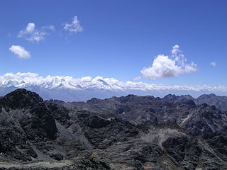
Hatun Machay is a rock forest with archaeological remains in Peru. It was declared a National Cultural Heritage by Resolución Directoral No. 944/INC-2010 on May 7, 2010. Hatun Mach'ay is situated on the western side of the Cordillera Negra in the Ancash Region, Recuay Province, Pampas Chico District, at a height of about 4,200 metres (13,780 ft).
Santón is a 5,238-metre-high (17,185 ft) mountain in the southern Cordillera Blanca in the Andes of Peru. It is located in the Ancash Region, Recuay Province, Catac District. It is situated northeast of Caullaraju and north of Challhua. Santón lies south of Pumapampa River, a right tributary of the Santa River.
Pucarajo is a mountain in the southern part of the Cordillera Blanca in the Andes of Peru, about 5,000 metres (16,404 ft) high. It is situated in the Ancash Region, Recuay Province, Catac District. The peaks of Pucarajo lies southeast, south and southwest of Mururaju.
Yana Kunkush is a mountain in the southern part of the Cordillera Negra in the Andes of Peru, about 4,600 metres (15,092 ft) high. It is situated in the Ancash Region, Aija Province, Aija District, and in the Recuay Province, Catac District. Yana Kunkush lies southeast of Sach'a Hirka and east of a lake of that name.
Pumahuaín is a 5,008-metre-high (16,430 ft) mountain in the southern part of the Cordillera Blanca in the Andes of Peru. It is situated in the Ancash Region, Recuay Province, Catac District. Puma Wayin lies southwest of Mururahu and Kunkush and northwest of Pukarahu.

Ichic Jeulla is a 5,091-metre-high (16,703 ft) mountain in the southern part of the Cordillera Blanca in the Andes of Peru. It is located in the Ancash Region, Recuay Province, Catac District. Ichic Jeulla lies southeast of Caullaraju.
Qiwlla Hirka is a mountain in the southern part of the Cordillera Blanca in the Andes of Peru, about 5,000 m (16,000 ft) high. It is located in the Ancash Region, Recuay Province, Catac District. Qiwlla Hirka lies northeast of Qiwllarahu and Challwa, near Pastu Ruri.
Auqui is a mountain in the Cordillera Blanca in the Andes of Peru, about 4,800 m (15,748 ft) high. It is situated in the Ancash Region, Huari Province, Huari District. Auqui lies southeast of Jacabamba.

Rocotopunta is a mountain in the Cordillera Blanca in the Andes of Peru, about 4,400 m (14,436 ft) high. It is located in the Ancash Region, Recuay Province, Ticapampa District, northeast of Lake Querococha. Rocotopunta lies between Yanamarey Creek to the north and Conde Creek to the south.
Minapata is a mountain in the southern part of the Cordillera Blanca in the Andes of Peru, about 5,400 m (17,700 ft) high. It is located in the Ancash Region, Bolognesi Province, Aquia District, and in the Recuay Province, Catac District. Minapata lies south of Challwa and northeast of Qiwllarahu.
Kuntur Qaqa is a mountain in the Cordillera Negra in the Andes of Peru, about 4,600 metres (15,092 ft) high. It is situated in the Ancash Region, Recuay Province, Marca District.
Puca Allpa or Puka Allpa is a mountain in the Cordillera Negra in the Andes of Peru, about 4,800 m (15,700 ft) high. It is situated in the Ancash Region, Aija Province, Aija District, and in the Recuay Province, on the border of the districts of Recuay and Ticapampa. Puca Allpa lies between Wank'ap'iti in the southeast and Pucairca in the northwest.
Hatun Kunka is a mountain in the Cordillera Negra in the Andes of Peru which reaches a height of approximately 4,400 m (14,436 ft). It is located in the Ancash Region, Huaylas Province, Pamparomas District, and in the Yungay Province, Quillo District.
Inca Huagansa or Inka Waqanqa is a mountain in the Andes of Peru which reaches a height of approximately 4,000 m (13,000 ft). It is located in the Ancash Region, Bolognesi Province, Cajacay District. It lies south of a place named Inca Huacanca.
Qulluta is a mountain in the Cordillera Negra in the Andes of Peru which reaches a height of approximately 4,600 m (15,092 ft). It is located in the Ancash Region, Recuay Province, on the border of the districts of Huayllapampa and Marca.
Kuntur Wayin is a mountain in the Cordillera Negra in the Andes of Peru which reaches a height of approximately 4,200 m (13,800 ft). It lies in the Ancash Region, Recuay Province, Catac District. Kuntur Wayin is also the name of an intermittent stream which originates west of the mountain. It is a left affluent of the Santa River.
Qullpa Hirka is a mountain in the Cordillera Negra in the Andes of Peru which reaches a height of approximately 4,400 m (14,400 ft). It lies in the Ancash Region, Recuay Province, in the northern part of the Cotaparaco District.
Kunkush Kancha is a mountain in the Cordillera Negra in the Andes of Peru which reaches a height of approximately 4,600 m (15,100 ft). It is located in the Ancash Region, Huarmey Province, Malvas District, and in the Recuay Province, Cotaparaco District.