
Tanzania comprises many lakes, national parks, and Africa's highest point, Mount Kilimanjaro. Northeast Tanzania is mountainous, while the central area is part of a large plateau covered in grasslands. The country also contains the southern portion of Lake Victoria on its northern border with Uganda and Kenya.

Iringa is a city in Tanzania with a population of 151,345. It is situated at a latitude of 7.77°S and longitude of 35.69°E. The name is derived from the Hehe word lilinga, meaning fort. Iringa is the administrative capital of Iringa Region. Iringa Municipal Council is the administrative designation of the Municipality of Iringa. Iringa has been one of the coldest regions in Tanzania due to its geographical location but that has attracted a lot of tourists from colder regions abroad especially Western Europe. Iringa also hosts one of Africa’s largest national parks the Ruaha National Park.

Mtwara Region is one of Tanzania's 31 administrative regions. The regional capital is the municipality of Mtwara. Mtwara Region is home to one of the most infuluencial people in Tanzania, the Makonde. Mtwara is home to Tanzania's 4th president Benjamin Mkapa and is home to a number of influential artists. The boundary with Mozambique to the south is formed by the Ruvuma River. To the west, Mtwara is bordered by Ruvuma Region, to the north by Lindi Region, and to the east is the Indian Ocean.

Kagera Region is one of Tanzania's 31 administrative regions. The region covers an area of 35,686 km2 (13,778 sq mi). The region is comparable in size to the land area of the Netherlands. Kagera Region is bordered to the east by Lake Victoria, Mwanza Region and Mara Region. The region is bordered to the south by Geita Region and Kigoma Region. Lastly, Kagera borders Rwanda to the west, Uganda to the north and Burundi to the south west. The regional capital city is Bukoba. According to the 2022 national census, the region had 2,989,299, and 2012 the region had a population of 2,458,023.

The kipunji, also known as the highland mangabey, is a species of Old World monkey that lives in the highland forests of Tanzania. The kipunji has a unique call, described as a 'honk-bark', which distinguishes it from its relatives, the grey-cheeked mangabey and the black crested mangabey, whose calls are described as 'whoop-gobbles'.

Mbeya is a city located in south west Tanzania, Africa. Mbeya's urban population is 620,000 according to the 2022 census. Mbeya is the capital of the surrounding rural Mbeya region.
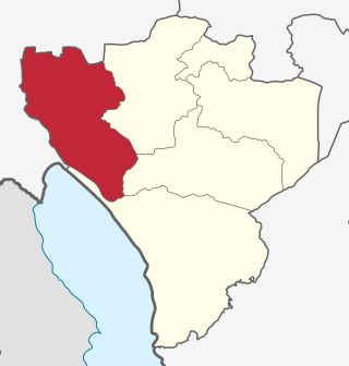
Mbeya Region is one of Tanzania's 31 administrative regions. The region covers an area of 35,954 km2 (13,882 sq mi). The region is comparable in size to the combined land area of the nation state of Guinea Bissau. Mbeya Region is bordered to the east by Singida Region, Iringa Region and Njombe Region. The region is bordered to the south by Malawi and Lake Nyasa. To the north the region borders southern Tabora Region. Lastly, Mbeya is bordered to the west by Songwe Region. The regional capital is the city of Mbeya. According to the 2012 national census, the region had a population of 2,707,410.
The Kipengere Range, also known as the Livingstone Mountains, lies entirely in Njombe Region in southwest Tanzania at the northern end of Lake Nyasa. Near Lake Nyasa they are known as the Kinga Mountains. It is a plateau-like ridge of mountains running southeastwards from the basin of the Great Ruaha River in the north to that of the Ruhuhu River in the south, and forms part of the eastern escarpment of the East African Rift. The range is mostly clad in montane grasslands, renowned for their botanical diversity and displays of flowers, with montane evergreen forests mostly in stream valleys.
Makete District is one of the six districts of Njombe Region of Tanzania. Its administrative seat is the town of Iwawa. It is bordered to the north and west by the Mbeya Region, to the east by the Njombe District and to the south by the Ludewa District. It is divided into six divisions and 17 wards. Makete District was founded in 1979 with the policy of the Ujamaa. Before, this part of Iringa Region belonged to Njombe District. The district is known for growing apples due to the favorable climate.

Tanzania is a country with many tourist attractions. Approximately 38 percent of Tanzania's land area is set aside in protected areas for conservation. There are 17 national parks, 29 game reserves, 40 controlled conservation areas and marine parks. Tanzania is also home to Mount Kilimanjaro, the highest point in Africa.

Kitulo National Park is a protected area of montane grassland and montane forest on the Kitulo Plateau in the southern highlands of Tanzania. The park is at an elevation of 2,600 metres (8,500 ft) between the peaks of the Kipengere and Poroto mountains and covers an area of 412.9 square kilometres (159.4 sq mi), lying in Mbeya Region and Njombe Region. The park is administered by Tanzania National Parks (TANAPA) and is the first national park in tropical Africa to be established primarily to protect its flora.

Uwanda Game Reserve, also known as Uwanda Rukwa Game Reserve, is a reserve of the Rukwa Valley of southwestern Tanzania. It is an extension of Katavi National Park and covers an area of 4100 square kilometres. It includes almost half of Lake Rukwa. This reserve was established in 1971.
The Southern Highlands is a highland region in southwestern Tanzania, at the northern end of Lake Malawi. The highlands include portions of Mbeya, Njombe, Rukwa, Ruvuma, and Songwe regions, bordering Malawi, Mozambique, and Zambia. Mbeya is the largest city in the highlands.

Tanzania contains some 20 percent of the species of Africa's large mammal population, found across its reserves, conservation areas, marine parks, and 17 national parks, spread over an area of more than 42,000 square kilometres (16,000 sq mi) and forming approximately 38 percent of the country's territory. Wildlife resources of Tanzania are described as "without parallel in Africa" and "the prime game viewing country". Serengeti National Park, the country's second largest national park area at 14,763 square kilometres (5,700 sq mi), is located in northern Tanzania and is famous for its extensive migratory herds of wildebeests and zebra while also having the reputation as one of the great natural wonders of the world. The Ngorongoro Conservation Area, established in 1959, is a UNESCO World Heritage Site and inhabited by the Maasai people. Its Ngorongoro Crater is the largest intact caldera in the world.
Katavi Region is one of Tanzania's 31 administrative regions. The region covers an area of 45,843 km2 (17,700 sq mi). The region is comparable in size to the combined land area of the nation state of Estonia. Kagera Region is bordered to the east by Tabora Region. The region is bordered to the south by Rukwa Region and Songwe Region. Lastly, Katavi borders DRC on Lake Tanganyika to the west. The region derives its name from Katavi, the spirit of lake Tanganyika. The regional capital city is Mpanda. According to the 2012 national census, the region had a population of 564,604.

Njombe Region is one of Tanzania's 31 administrative regions. The region covers a land area of 21,347 km2 (8,242 sq mi). The region is comparable in size to the combined land area of the nation state of El Salvador. Njombe Region is bordered to the north by the Iringa Region and Mbeya Region, to the east by Morogoro Region, to the south by the Ruvuma Region and to the west by Lake Nyasa. The regional capital is the municipality of Njombe. According to the 2012 national census, the region had a population of 702,097.
The Tanzania National Parks Authority commonly known as TANAPA is responsible for the management of Tanzania's national parks. TANAPA is a parastatal corporation and all its income is reinvested into the organization. It is governed by a number of instruments including the National Parks Act, Chapter 282 of the 2002 and the Wildlife Conservation Act No. 5 of 2009. TANAPA manages the nation's 22 National parks which covers approximately 15% of the land area and has the mandate to conserve and manage the wildlife in Tanzania, and to enforce the related laws and regulations in this industry. It manages the biodiversity of the country, protecting and conserving the flora and fauna. The organization does not have a mandate over the game reserves such as the Selous Game Reserve which is managed by the Tanzanian Wildlife Division and the Ngorongoro Conservation Area managed by the Ngorongoro Conservation Authority.

The South Malawi montane forest-grassland mosaic is a montane grasslands and shrublands ecoregion of Tanzania, Malawi, Mozambique, and Zambia.
The Rungwe dwarf galago is a newly identified species of eastern dwarf galago. Specimens were first collected in the 1930s, but were identified as different species. A formal description of the species is presently being made.

Itigi District is a district council in the Singida Region of central Tanzania established in 2015. The district lies in the south-western portion of the Singida Region with 123,515 people and encompasses a large area mostly made up of protected game reserves.
