Monroe is the largest city and county seat of Monroe County in the U.S. state of Michigan. Monroe had a population of 20,733 in the 2010 census. Located on the western shores of Lake Erie, the city is bordered on the south by Monroe Charter Township, but the two are administered autonomously. Monroe is located approximately 14 miles (23 km) north of Toledo, Ohio and 25 miles (40 km) south of Detroit. The U.S. Census Bureau lists Monroe as the core city in the Monroe Metropolitan Statistical Area, which is conterminous with Monroe County and had a population of 152,021 in 2010. Monroe is officially part of the Detroit–Ann Arbor–Flint combined statistical area.

The River Raisin is a river in southeastern Michigan, United States, that flows through glacial sediments into Lake Erie. The area today is an agricultural and industrial center of Michigan. The river flows for almost 139 miles (224 km), draining an area of 1,072 square miles (2,780 km2) in the Michigan counties of Lenawee, Washtenaw, Jackson, Hillsdale, and Monroe County, where its mouth at Lake Erie is located. French settlers named it as La Rivière aux Raisins because of the wild grapes growing along its banks, the French word for grape being raisin. The French term for "raisin" is raisin sec.
M-52 is a north–south state trunkline highway in the US state of Michigan. The southern terminus is on the Ohio border, where it continues as State Route 109. The highway passes through communities like Adrian, where it intersects US Highway 223 (US 223), Chelsea and Webberville along its 127.3-mile-long (204.9 km) course. It crosses some major rivers, including the River Raisin and the Shiawassee. The section of the highway between M-50 and Manchester was built as a limited-access highway. M-52's northern terminus is at M-46, nine miles (14 km) west of Saginaw.
M-5, commonly referred to as Grand River Avenue and the northern section as the Haggerty Connector, is a 20.807-mile-long (33.486 km) state trunkline highway in the Metro Detroit area of the US state of Michigan. The highway runs through suburbs in Oakland and Wayne counties in addition to part of Detroit itself. It starts in Commerce Township as a north–south divided highway and freeway called the Haggerty Connector and connects with Interstate 96 (I-96) in Novi. The freeway then turns southeasterly to bypass the suburb of Farmington as an east–west highway. The freeway ends on the southeast side of Farmington, and M-5 follows Grand River Avenue as boulevard into Detroit. The eastern terminus is at the five-way intersection between Grand River Avenue, Cass Avenue, and Middle Street in Downtown Detroit, where it had been extended to in May 2016 from an interchange with I-96 on the northwest side of the city. The trunkline passes between suburban residential subdivisions and along urban commercial areas while serving 17,200–68,800 vehicles on average each day.
Interstate 275 (I-275) is an Interstate in the US state of Michigan that acts as a western bypass of the Detroit metropolitan area. The Michigan Department of Transportation (MDOT) maintains the highway as part of the larger state trunkline highway system. The freeway runs through the western suburbs near Detroit Metropolitan Wayne County Airport, and crosses several rivers and rail lines in the area. The southern terminus is the interchange with I-75 near Newport, northeast of Monroe. MDOT considers the Interstate to run to an interchange with I-96, I-696 and M-5 on the Farmington Hills–Novi city line, running concurrently with I-96 for about five miles (8.0 km). This gives a total length of about 35.03 miles (56.38 km), which is backed up by official signage. According to the Federal Highway Administration (FHWA), the length is 29.97 miles (48.23 km) because that agency considers I-275 to end at the junction with I-96 and M-14 along the boundary between Livonia and Plymouth Township. All other map makers, like the American Automobile Association, Rand McNally and Google Maps follow MDOT's practice.
US Highway 24 is a United States Numbered Highway that runs from Minturn, Colorado, to Independence Township, Michigan. In Michigan, it is also known as Telegraph Road and runs for 79.828 miles (128.471 km) as a major north–south state trunkline highway from Bedford Township at the Ohio state line through Metro Detroit. The highway runs through three counties in southeastern Michigan, Monroe, Wayne and Oakland, as it parallels the Lake Erie shoreline and bypasses Metro Detroit on the west. Telegraph Road connects several suburbs together and passes through the western edge of Detroit before it terminates northwest of Clarkston at an interchange with Interstate 75 (I-75).

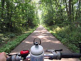
William C. Sterling State Park is a public recreation area located in Frenchtown Charter Township with a small portion lying within the city limits of Monroe, Michigan. It is the only Michigan state park located on Lake Erie. The park encompasses 1,300 acres (530 ha) of mostly man-made lagoons and beachfront near the mouth of Sandy Creek. The main attractions at the park include a 256-site campground, beach area, boat launch, and shore fishing lagoons. There are over seven miles (11 km) of biking and hiking trails within the park.

Dover Township is one of the twelve townships of Fulton County, Ohio, United States. The 2010 census found 1,578 people in the township, and estimated a population of 1,570 for 2014.

A linear park is a park in an urban or suburban setting that is substantially longer than it is wide. Some are rail trails, that are disused railroad beds converted to recreational use, while others use strips of public land next to canals, streams, extended defensive walls, electrical lines, highways and shorelines. They are also often described as greenways. In Australia, a linear park along the coast is known as a foreshoreway.

The Detroit International Riverfront is a tourist attraction and landmark of Detroit, Michigan extending from the Ambassador Bridge in the west to Belle Isle in the east, for a total of 5.5 miles. The International Riverfront encompasses a cruise ship passenger terminal and dock, a marina, a multitude of parks, restaurants, retail shops, skyscrapers, and high rise residential areas along with TCF Center. The Marriott at the Renaissance Center and the Robert's Riverwalk Hotel are also situated along the International Riverfront. Private companies and foundations together with the city, state, and federal government have contributed several hundred million dollars toward the riverfront development. Key public spaces in the International Riverfront, such as the RiverWalk, Dequindre Cut Greenway and Trail, William G. Milliken State Park and Harbor, and a cruise ship passenger terminal and dock at Hart Plaza complement the architecture of the area. The area provides a venue for a variety of annual events and festivals including the Detroit Electronic Music Festival, Detroit Free Press International Marathon, the Detroit International Jazz Festival, Motor City Pride, the North American International Auto Show, River Days and Detroit China Festival. In February 2021, the Detroit International Riverfront was voted best riverwalk in the United States by USA Today readers.

The River Raisin National Battlefield Park preserved the site of the Battle of Frenchtown as the only national battlefield marking a site of the War of 1812. It was established as the 393rd unit of the United States National Park Service under Title VII of the Omnibus Public Land Management Act, which was signed into law on March 30, 2009. The park is located in the city of Monroe in Monroe County, Michigan. It was designated as a Michigan Historic Site on February 18, 1956 and was added to the National Register of Historic Places on December 10, 1982. The house at 1403 East Elm Avenue was added to the National Register listing in 2019. It officially began operation as a national park unit on October 22, 2010.
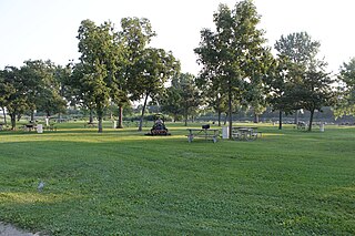
Lake Erie Metropark is a park in the Huron-Clinton system of metro parks. The park is a 1,607-acre (6.50 km2) recreational facility located between the mouth of the Huron River on Lake Erie to the south and the City of Gibraltar to the north, and consists of natural marshes and ponds, hike and bike trails, nature trails, a marina, and a boat launch. The park also has a wave action swimming pool, an 18-hole regulation golf course, and the Marshlands Museum and Nature Center. It has a three-mile (5 km) shoreline along Lake Erie and is a popu bird-watching site. The children's play area, located near the Wave Pool, previously consisted of a child-size city before being reconstructed into a modernized playground.

Detroit is a popular city for cycling. It is flat with an extensive road network with a number of recreational and competitive opportunities and is, according to cycling advocate David Byrne, one of the top eight biking cities in the world. The city has invested in greenways and bike lanes and other bicycle-friendly infrastructure. Bike rental is available from the riverfront and tours of the city's architecture can be booked.

This is a list of trails and greenways in Detroit.
The River Road National Scenic Byway is a National Scenic Byway and National Forest Scenic Byway in the US state of Michigan. This 23+1⁄2-mile-long (37.8 km) byway follows M-65 and River Road; it extends eastward into the Huron National Forest and ends in the historic community of Oscoda near Lake Huron. The road parallels the historic Au Sable River which has historically been a major transportation route for floating Michigan's giant white pine from the forest to the saw mill towns on Lake Huron. Along its course, the roadway offers access to several recreational areas as well as the local scenery. The section of the River Road that follows M-65 was added to the State Trunkline Highway System in the 1930s. The River Road was given National Forest Scenic Byway status in 1988, and National Scenic Byway status in 2005.
The Oconee River Greenway is a trail along the Oconee River in Athens, Georgia. It opened in 2008. It includes fishing areas and boat ramps. A Greenway farmers market is also held. River flow can change rapidly due to operations of a Georgia Power plant upstream of the Greenway.

The Cleveland/Bradley County Greenway is a four-mile (6.4 km)-long public greenway walking path in Cleveland, Tennessee maintained by the local Greenway Advisory Board. The path is the longest path in the Greenway Network, a network of public walking trails located in Bradley County, Tennessee.

The Wabash Cannonball Trail is a rail to trail conversion in northwestern Ohio, U.S. It is 63 miles (101 km) long. The North Fork of the Wabash Cannonball Trail is part of the North Coast Inland Trail, which plans to fully connect Indiana to Pennsylvania, and portions of the trail are included in the North Country National Scenic Trail.