Gauteng is one of the nine provinces of South Africa. The name in Sotho-Tswana languages means 'place of gold'.

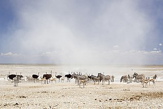
Etosha National Park is a national park in northwestern Namibia and one of the largest national parks in Africa. It was proclaimed a game reserve in March 1907 in Ordinance 88 by the Governor of German South West Africa, Friedrich von Lindequist. It was designated as Wildschutzgebiet in 1958, and was awarded the status of national park in 1967 by an act of parliament of the Republic of South Africa. It spans an area of 22,270 km2 (8,600 sq mi) and was named after the large Etosha pan which is almost entirely within the park. With an area of 4,760 km2 (1,840 sq mi), the Etosha pan covers 23% of the total area of the national park. The area is home to hundreds of species of mammals, birds and reptiles, including several threatened and endangered species such as the black rhinoceros. Sixty-one black rhinoceros were killed during poaching in Namibia during 2022, 46 of which were killed in Etosha.

The Wonderboom Nature Reserve is a 1 km², 200-hectare reserve that incorporates a section of the Magaliesberg range in the northern portion of the Pretoria metropole, South Africa. Its main attractions are the Wonderboom near the reserve entrance in Lavender street and the derelict Fort Wonderboompoort on the crest of the Magaliesberg, that was constructed towards the end of the nineteenth century, during the Second Boer War. The latter is reached by following the steep, paved walkway that leads from the picnic area to the summit. The vicinity of the fort ruins also afford sweeping views of the city, whose council declared the area around the Wonderboom and both banks of the Apies River a reserve on 28 December 1949.

Suikerbosrand Nature Reserve is a protected area in the Suikerbosrand Range, South Africa. It is one of Gauteng’s most frequented ecotourism destinations. Set just a short distance from Johannesburg, an hour's drive from Johannesburg International Airport and near the historical town of Heidelberg, this reserve boasts a representative sample of the fauna and flora of the rocky Highveld grassland biome. With 134 km2 (52 sq mi) of unspoiled natural environment and a mountain range characterised by meandering twists and turns of hiking trails, the reserve offers an unbelievably refreshing break from the bustling city life. Here, the altitude varies between 1,545 and 1,917 m above sea level.

The Highveld is the portion of the South African inland plateau which has an altitude above roughly 1500 m, but below 2100 m, thus excluding the Lesotho mountain regions to the south-east of the Highveld. It is home to some of the country's most important commercial farming areas, as well as its largest concentration of metropolitan centres, especially the Gauteng conurbation, which accommodates one-third of South Africa's population.

The Midewin National Tallgrass Prairie (MNTP) is a tallgrass prairie reserve and similarly preserved as United States National Grassland operated by the United States Forest Service. The first national tallgrass prairie ever designated in the U.S. and the largest conservation site in the Chicago Wilderness region, it is located on the site of the former Joliet Army Ammunition Plant between the towns of Elwood, Manhattan and Wilmington in northeastern Illinois. Since 2015, it has hosted a conservation herd of American bison to study their interaction with prairie restoration and conservation.

Tarangire National Park is a national park in Tanzania's Manyara Region. The name of the park originates from the Tarangire River that crosses the park. The Tarangire River is the primary source of fresh water for wild animals in the Tarangire Ecosystem during the annual dry season. The Tarangire Ecosystem is defined by the long-distance migration of wildebeest and zebras. During the dry season thousands of animals concentrate in Tarangire National Park from the surrounding wet-season dispersal and calving areas.

The Pretoria Forts consists of four forts built by the government of the South African Republic (ZAR) just before the outbreak of the Second Anglo-Boer War around their capital of Pretoria.

The Pretoria National Botanical Garden is one of South Africa's nine National Botanical Gardens. The garden is wedged between Pretoria Road and Cussonia Avenue in Brummeria, in eastern Pretoria, Gauteng, and flanks a central rocky ridge that runs from east to west. The 76 hectares (0.76 km2) garden was established in 1946, and of late hosts the headquarters of the South African National Biodiversity Institute.

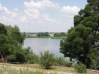
Rietvlei Nature Reserve, located in southern Pretoria, is about 4,000 hectares (40 km2) in size, and includes the entirety of the Rietvlei Dam which impounds the Rietvlei River, in Gauteng, South Africa. The reserve is wedged between the R21 highway on the western side and the R50 (Delmas-Bapsfontein) road on the north-east. The mean elevation above sea level is approximately 1,525 meters, with the highest point at 1,542 m and the lowest at 1,473 m, the dam’s outflow in Sesmylspruit. The reserve covers a surface area of approximately 4,003 ha or 40 km2, of which the dam constitutes some 20ha. A network of roads criss-cross the entire area, which facilitates access to visitors and management.
Mpofu Nature Reserve is a nature reserve in the Amatole district of the Eastern Cape Province, South Africa that is managed by Eastern Cape Parks.

Oviston Nature Reserve is a protected area in the Eastern Cape Province, South Africa. The nature reserve is managed by Eastern Cape Parks. It is located on the southern shores of the Gariep Dam.

Marievale Bird Sanctuary is a protected area in Gauteng, South Africa. It is about 15 km2 in size, and situated on the East Rand on the southern half of the Blesbokspruit wetland, a Ramsar site. The Blesbokspruit is a major perennial river in Gauteng which is flanked by extensive floodplains on either side. Nearby is the Suikerbosrand Nature Reserve.

The Groenkloof Nature Reserve, located adjacent to the Fountains Valley at the southern entrance to Pretoria, was the first game sanctuary in Africa. The reserve of 600 ha is managed by the Department of Nature Conservation. The National Heritage Monument is located within the reserve. It is flanked by Christina de Wit Avenue and Nelson Mandela Drive, that separate it from the Voortrekker Monument and Klapperkop Nature Reserves. In aggregate these reserves conserve some 1,400 ha of bankenveld vegetation which is threatened in Gauteng. The reserve is open to day visitors from 5:30 to 19:00 in summer, and 7:00 to 18:00 in winter.

Western Sydney Regional Park is a large urban park and a nature reserve situated in Western Sydney, Australia within the suburbs of Horsley Park and Abbotsbury. A precinct of Western Sydney Parklands, a park system, and situated within the heart of the Cumberland Plain Woodland, the regional park features several picnic areas, recreational facilities, equestrian trails, and walking paths within the Australian bush.

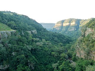
The Krantzkloof Nature Reserve, managed by Ezemvelo KZN Wildlife, conserves 668 ha of the Molweni and Nkutu River gorges that incise the sandstone Kloof plateau in KwaZulu-Natal, South Africa. The reserve conserves coastal scarp forest, sourveld grassland, a cliff face biotope, and aquatic environments along its rivers. Scarp forest is a threatened forest type, protected by South Africa's forests act of 1998, while the grassland is classified as KwaZulu-Natal sandstone sourveld, the most threatened terrestrial habitat in the Durban metropole. The reserve was established in 1950 and was augmented by land donations as late as 1999.

Johannesburg City Hall is an Edwardian building constructed in 1914 by the Hawkey and McKinley construction company. The plan for the building was drawn in 1910 and construction was started in 1913 and finished in 1914. The Gauteng Provincial Legislature currently occupies the building. The City Hall has seen many political events on its steps from protest meetings to a bomb blast in 1988.

Faerie Glen Nature Reserve is a nature reserve at the western limit of the Bronberg in the east of Pretoria, South Africa.

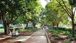
Fairfield Park Precinct, or Fairfield Park, is an urban park situated in the western suburbs of Sydney, New South Wales, Australia. Situated to the south of Fairfield CBD, the park contains an open grassland, bushland, picnic spots, playgrounds, indoor and outdoor sport facilities, and recreational areas within the vicinity of native plants, such as eucalyptus trees.

The Dinokeng Game Reserve is a large wildlife sanctuary in the province of Gauteng, South Africa and can be accessed via the N1 route. It is a 40-minute drive from Pretoria or 75 minutes from the O. R. Tambo Airport and Johannesburg. The reserve is the only wildlife sanctuary in Gauteng that has the Big Five game animals, free walks, and is open for visitors to explore. It covers an area of approximately 21,000 hectares. Its name, Dinokeng, is derived from the language of the Tswana and Bapedi people, and is translated as “a place of rivers”.


