Ukek or Uvek was a city of the Golden Horde, situated on the banks of the Volga River, at the Uvekovka estuary. Ukek marked the half-way distance between Sarai, the capital of the Golden Horde, and Bolghar, the former capital of Volga Bulgaria. Ukek was probably established in the 1240s, and it became an important trade center by the early 14th century.

Daulatpur is an Upazila of Manikganj District in the Division of Dhaka, Bangladesh.

Marunouchi Station is a railway station on the Meitetsu Nagoya Main Line located in Kiyosu, Aichi Prefecture, Japan. It is located 74.3 rail kilometers from the terminus of the Nagoya Main Line at Toyohashi Junction.

Elsham railway station is a former railway station in Elsham, Lincolnshire, England. The station was opened by the Trent, Ancholme and Grimsby Railway on 1 October 1866 and like other T. A. & G. stations had staggered platforms. The station was the most easterly of the T. A. & G. stations the line, situated just a few miles from Wrawby Junction, Barnetby where it joined the M. S. & L. R. towards Grimsby. It was formally closed by British Rail on 3 October 1993.
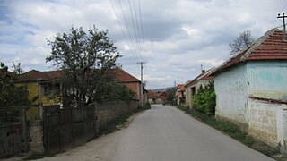
Čifluk Razgojnski is a village in the municipality of Leskovac, Serbia. According to the 2002 census, the village has a population of 335 people.

Draškovac is a village in the municipality of Leskovac, Serbia. According to the 2002 census, the village has a population of 791 people.
Dušanovo is a village in the municipality of Leskovac, Serbia. According to the 2002 census, the village has a population of 236 people.

Grajevce is a village in the municipality of Leskovac, Serbia. According to the 2002 census, the village has a population of 404 people.
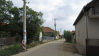
Grdanica is a village in the municipality of Leskovac, Serbia. According to the 2002 census, the village has a population of 605 people.

Milanovo is a village in the municipality of Leskovac, Serbia. According to the 2002 census, the village has a population of 546 people.
Navalin is a village in the municipality of Leskovac, Serbia. According to the 2002 census, the village has a population of 898 people.
Podrimce is a village in the municipality of Leskovac, Serbia. According to the 2002 census, the village has a population of 283 people.
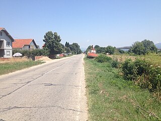
Živkovo is a village in the municipality of Leskovac, Serbia. According to the 2002 census, the village has a population of 669 people.

Zlokućane is a village in the municipality of Leskovac, Serbia. According to the 2002 census, the village has a population of 217 people.
Farmahin Rural District is a rural district (dehestan) in the Central District of Farahan County, Markazi Province, Iran. At the 2006 census, its population was 12,220, in 3,519 families. The rural district has 36 villages.
Talkh Ab Rural District is a rural district (dehestan) in Khenejin District, Farahan County, Markazi Province, Iran. At the 2006 census, its population was 6,956, in 2,075 families. The rural district has 16 villages.
İmamlar is a village in the District of Gerede, Bolu Province, Turkey. As of 2010 it had a population of 86 people.
Sampension is a manager of industry-wide pension schemes for white collar employees in the Danish municipalities (kommuner) and central government.
Jahrom Airport is a village in Jolgah Rural District, in the Central District of Jahrom County, Fars Province, Iran. At the 2006 census, its population was 14, in 4 families.

Sülldorf railway station in Hamburg, Germany, is located on the extended Altona-Blankenese line and is served by the trains of the Hamburg S-Bahn.