
Overberg is a region in South Africa to the east of Cape Town beyond the Hottentots-Holland mountains. It lies along the Western Cape Province's south coast between the Cape Peninsula and the region known as the Garden Route in the east. The boundaries of the Overberg are the Hottentots-Holland mountains in the West; the Riviersonderend Mountains, part of the Cape Fold Belt, in the North; the Atlantic and Indian Oceans in the South and the Breede River in the East.

Overstrand Municipality is a local municipality in the Western Cape province of South Africa. It is located along the Atlantic coast between Cape Town and Cape Agulhas, within the Overberg District Municipality. The principal towns in the municipality are Hermanus, Gansbaai and Kleinmond. As of 2022, it had a population of 132,495.

Swellendam Municipality is a local municipality located within the Overberg District Municipality, in the Western Cape province of South Africa. As of 2022, it had a population of 47,114. Its municipality code is WC034.

Theewaterskloof Municipality is a local municipality located within the Overberg District Municipality, in the Western Cape province of South Africa. As of 2022, the population was 139,563. Its municipality code is WC031. The enormous Theewaterskloof Dam, which provides water for Cape Town and the surrounding areas, is located in the municipality.

The Overberg District Municipality is a district municipality that governs the Overberg region in the Western Cape province of South Africa. It is divided into four local municipalities and includes the major towns of Grabouw, Caledon, Hermanus, Bredasdorp and Swellendam. The municipal area covers 12,241 square kilometres (4,726 sq mi) and had in 2007 an estimated population of 212,787 people in 60,056 households.
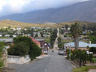
Barrydale is a village on the border of the Overberg and Klein Karoo regions of the Western Cape Province in South Africa. It was named after Joseph Barry, a merchant of the 19th century. It is situated at the northern end of the Tradouws Pass which winds its way through the mountains to Swellendam.

Caledon, originally named Swartberg, is a town in the Overberg region in the Western Cape province of South Africa, located about 100 kilometres (62 mi) east of Cape Town next to mineral-rich hot springs. As of 2011 it had a population of 13,020. It is located in, and the seat of, the Theewaterskloof Local Municipality.
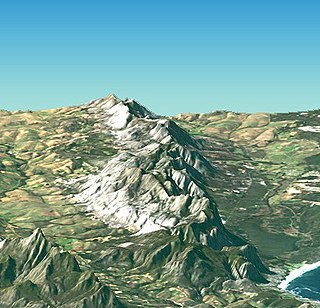
The Kleinrivier Mountains are a mountain range in the Cape Fold Belt of the Western Cape province of South Africa. Kleinrivier means "Small River" in Afrikaans and is named after the Klein River in the area that mouths out near Hermanus where the range begins in the west, then continues eastward to north-east of Stanford and terminates at Akkedisberg Pass. The highest mountain in the range is Maanskynkop (964m) and dominates the entire Walker Bay coastline. The mountains experience a very mild Mediterranean climate, moderated by cool, moist winds blowing off the South Atlantic Ocean. Although no peaks exceed 1000m, the range is still quite imposing, as it rises very steeply from sea level. The Kleinrivier Mountains are classified as Critical Biodiversity Area 1.

Western Cape is a Geographical Unit within the Wine of Origin classification system of South African wine. Corresponding to the province of Western Cape it includes most of the vineyards in South Africa.

Kleinmond is a small coastal town in the Overberg region of the Western Cape province, South Africa. It is situated inside a UNESCO-declared biosphere about 90 km east of Cape Town between Betty's Bay and Hermanus. The town's name, meaning "small mouth" in Afrikaans, refers to its location at the mouth of the Bot River lagoon. Stone axe heads found in the area indicate that people already lived in the vicinity of nearby Hangklip 20,000 years ago. Information about the area has existed in writing since the seventeenth century.
The wine regions of South Africa were defined under the "Wine of Origin" act of 1973. Mirroring the French Appellation d'origine contrôlée (AOC) system, all South African wines listing a "Wine of Origin" must be composed entirely of grapes from its region. The "Wine of Origins" (WO) program mandates how wine regions of South Africa are defined and can appear on wine labels. While some aspects of the WO are taken from the AOC, the WO is primarily concerned with accuracy in labeling. As a result, the WO does not place adjunct regulations on wine regions such as delineating permitted varieties, trellising methods, irrigation techniques, and crop yields.
Bot River is a river in the Western Cape province of South Africa. The Bot River mouth, located at Fisherhaven and Kleinmond, is a Ramsar site. Its tributaries include the Swart River. The river falls within the Drainage system G.

Little Brak River or Klein Brak River is a river in the Western Cape province of South Africa. Its tributaries include the Brandwag River and Moordkuil River. It falls within the Drainage system K.

Rooiels is a settlement in Overberg District Municipality in the Western Cape province of South Africa. It was declared a township in June 1948, and is situated 5 km north of Pringle Bay, on the eastern shore of False Bay. It was named after the farm and river of the same name, which were named after the red alder tree known as rooiels in Afrikaans.
Stanford is a small riverside village in Overberg District Municipality in the Western Cape province of South Africa. Located 16 km east of Hermanus and 22 km north-east of Gansbaai.

Pteronia incana is a species of flowering plant in the family Asteraceae, indigenous to the Karoo regions of South Africa.

Pteronia oppositifolia is a species of flowering plant in the family Asteraceae, indigenous to the western Little Karoo and Overberg regions in the Cape Provinces of South Africa.
Drosanthemum quadratum is a succulent plant in the ice plant family, Aizoaceae, indigenous to the Overberg region of the Western Cape Province, South Africa.
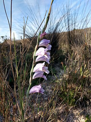
Gladiolus patersoniae is a herbaceous perennial plant belonging to the genus Gladiolus of the family Iridaceae, indigenous to the southern Cape regions of South Africa.
Dianthus bolusii, called the mountain pink or bergangelier, is a species of flowering plant in the family Caryophyllaceae.


