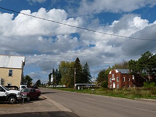
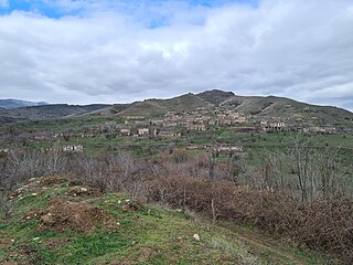
Klenje, Golubac

Last updated
Klenje
Клење
Village
Serbia adm location map.svg
Red pog.svg
Klenje
Coordinates: 44°36′09″N21°31′49″E / 44.60250°N 21.53028°E / 44.60250; 21.53028
CountryFlag of Serbia.svg  Serbia
District Braničevo District
Municipality Golubac
Population (2002)
  Total 493
Time zone CET (UTC+1)
  Summer (DST) CEST (UTC+2)

Klenje is a village in the municipality of Golubac, Serbia. According to the 2002 census, the village has a population of 493 people. [1]

Village Small clustered human settlement smaller than a town

A village is a clustered human settlement or community, larger than a hamlet but smaller than a town, with a population ranging from a few hundred to a few thousand. Though villages are often located in rural areas, the term urban village is also applied to certain urban neighborhoods. Villages are normally permanent, with fixed dwellings; however, transient villages can occur. Further, the dwellings of a village are fairly close to one another, not scattered broadly over the landscape, as a dispersed settlement.

Golubac Village and municipality in Southern and Eastern Serbia, Serbia

Golubac is a village and municipality located in the Braničevo District of the eastern Serbia. It is situated on the right side of the Danube river. It is bordered by Romania to the east, Veliko Gradište to the west and Kučevo to the south. The population of the village is 1,655 and the population of the municipality is 8,161.

Serbia Republic in Southeastern Europe

Serbia, officially the Republic of Serbia, is a country situated at the crossroads of Central and Southeast Europe in the southern Pannonian Plain and the central Balkans. The sovereign state borders Hungary to the north, Romania to the northeast, Bulgaria to the southeast, North Macedonia to the south, Croatia and Bosnia and Herzegovina to the west, and Montenegro to the southwest. The country claims a border with Albania through the disputed territory of Kosovo. Serbia's population is about seven million. Its capital, Belgrade, ranks among the oldest and largest citiеs in southeastern Europe.

Related Research Articles

Kosančić, Vrbas Village in Vojvodina, Serbia

Kosančić is a village in Serbia. It is situated in the Vrbas municipality, South Bačka District, Vojvodina province. The village has a Serb ethnic majority and its population numbering 163 people.

Bheemini Mandal in Telangana, India

Bheemini a Mandal in Mancherial district in the state of Telangana in India.

Jeziora Wielkie Village in Kuyavian-Pomeranian, Poland

Jeziora Wielkie is a village in Mogilno County, Kuyavian-Pomeranian Voivodeship, in north-central Poland. It is the seat of the gmina called Gmina Jeziora Wielkie. It lies approximately 26 kilometres (16 mi) south-east of Mogilno, 61 km (38 mi) south-west of Toruń, and 68 km (42 mi) south of Bydgoszcz.

Ōwada Station (Osaka) railway station in Kadoma, Osaka Prefecture, Japan

Ōwada Station is a train station located in the city of Kadoma, Osaka Prefecture, Japan.

Łączki is a village in the administrative district of Gmina Włocławek, within Włocławek County, Kuyavian-Pomeranian Voivodeship, in north-central Poland.

Korzeszynek is a village in the administrative district of Gmina Lubraniec, within Włocławek County, Kuyavian-Pomeranian Voivodeship, in north-central Poland.

Dəmirçilər, Qubadli Place in Qubadli

Dəmirçilər is a village in the Qubadli Rayon of Azerbaijan. Dəmirçilər is the Azeri village in Qubadli.The origin of this village`s name comes from turkish tribes which subsisted in this region over a period of history.Dəmirçilər is located between two rivers which are called as "Bargushad" and "Aghachay".

Obice Village in Świętokrzyskie, Poland

Obice is a village in the administrative district of Gmina Morawica, within Kielce County, Świętokrzyskie Voivodeship, in south-central Poland. It lies approximately 7 kilometres (4 mi) south of Morawica and 23 km (14 mi) south of the regional capital Kielce.

Kołomań Village in Świętokrzyskie, Poland

Kołomań is a village in the administrative district of Gmina Zagnańsk, within Kielce County, Świętokrzyskie Voivodeship, in south-central Poland. It lies approximately 5 kilometres (3 mi) north-west of Zagnańsk and 14 km (9 mi) north of the regional capital Kielce.

Nowa Zagość Village in Świętokrzyskie, Poland

Nowa Zagość is a village in the administrative district of Gmina Pińczów, within Pińczów County, Świętokrzyskie Voivodeship, in south-central Poland. It lies approximately 14 kilometres (9 mi) south of Pińczów and 52 km (32 mi) south of the regional capital Kielce.

Wola Zagojska Dolna Village in Świętokrzyskie, Poland

Wola Zagojska Dolna is a village in the administrative district of Gmina Pińczów, within Pińczów County, Świętokrzyskie Voivodeship, in south-central Poland. It lies approximately 12 kilometres (7 mi) south-east of Pińczów and 49 km (30 mi) south of the regional capital Kielce.

Zakrzów, Pińczów County Village in Świętokrzyskie, Poland

Zakrzów is a village in the administrative district of Gmina Pińczów, within Pińczów County, Świętokrzyskie Voivodeship, in south-central Poland. It lies approximately 6 kilometres (4 mi) south of Pińczów and 45 km (28 mi) south of the regional capital Kielce.

Holendry Kozienickie Village in Masovian, Poland

Holendry Kozienickie is a village in the administrative district of Gmina Kozienice, within Kozienice County, Masovian Voivodeship, in east-central Poland. It lies approximately 4 kilometres (2 mi) north-east of Kozienice and 80 km (50 mi) south-east of Warsaw.

Gwoździany Village in Silesian, Poland

Gwoździany is a village in the administrative district of Gmina Pawonków, within Lubliniec County, Silesian Voivodeship, in southern Poland. It lies approximately 5 kilometres (3 mi) north-west of Pawonków, 12 km (7 mi) west of Lubliniec, and 63 km (39 mi) north-west of the regional capital Katowice.

Dargoleza Village in Pomeranian, Poland

Dargoleza is a village in the administrative district of Gmina Główczyce, within Słupsk County, Pomeranian Voivodeship, in northern Poland. It lies approximately 9 kilometres (6 mi) east of Główczyce, 35 km (22 mi) north-east of Słupsk, and 78 km (48 mi) west of the regional capital Gdańsk.

Wólka Szczycieńska is a village in the administrative district of Gmina Szczytno, within Szczytno County, Warmian-Masurian Voivodeship, in northern Poland.

Cerik (Brčko) Village in Brčko, Bosnia and Herzegovina

Cerik is a village in the municipality of Brčko, Bosnia and Herzegovina.

Tammiste is a village in Tori Parish, Pärnu County in southwestern Estonia.

Vitovnica Village in Braničevo District, Serbia

Vitovnica is a village situated in Petrovac na Mlavi municipality in Serbia. This village was the birthplace of the important Serbian spiritual writer, Elder Thaddeus who was born in 1914 as Tomislav Štrbulović. The village is also home to the Vitovnica Monastery of the Serbian Orthodox Church. Elder Thaddeus was a hegumen at the Vitovnica Monastery from April 14, 1962 until the end of March in 1972. His gravesite is at the monastery.

Erdemli Yörük Museum Museum in Mersin Province, Turkey

Erdemli Yörük Museum is a museum of ethography in Mersin Province, southern Turkey exhibiting life style of nomadic people in Anatolia.

References

  1. Popis stanovništva, domaćinstava i Stanova 2002. Knjiga 1: Nacionalna ili etnička pripadnost po naseljima. Republika Srbija, Republički zavod za statistiku Beograd 2003. ISBN   86-84433-00-9

Coordinates: 44°36′09″N21°31′49″E / 44.60250°N 21.53028°E / 44.60250; 21.53028

Geographic coordinate system Coordinate system

A geographic coordinate system is a coordinate system that enables every location on Earth to be specified by a set of numbers, letters or symbols. The coordinates are often chosen such that one of the numbers represents a vertical position and two or three of the numbers represent a horizontal position; alternatively, a geographic position may be expressed in a combined three-dimensional Cartesian vector. A common choice of coordinates is latitude, longitude and elevation. To specify a location on a plane requires a map projection.