Related Research Articles
Clendinning Provincial Park is a provincial park in British Columbia, Canada. It surrounds the drainage of Clendinning Creek, which is a tributary of the Elaho River. Its name is shared by the Clendinning Range, of which Mount Clendinning is the highest summit.
Coldwater River Provincial Park is a provincial park in British Columbia, Canada, located at the confluence of the Coldwater River with Cullet Creek, 50 km south of Merritt on BC Highway 5.
Ḵwiḵwa̱sut'inux̱w Ha̱xwa'mis, formerly the Kwicksutaineuk-ah-kwa-mish First Nation is a First Nations band government based on northern Vancouver Island in British Columbia, Canada, in the Queen Charlotte Strait region. It is a member of the Musgamagw Tsawataineuk Tribal Council, along with the ‘Namgis First Nation and the Tsawataineuk First Nation. The Kwikwasut'inuxw and Haxwa'mis are two of the many subgroups of the peoples known as Kwakwaka'wakw, which has two meanings: "smoke of the world" or "beach at the north side of the river."

The Stswecem'c Xgat'tem First Nation, formerly known as Canoe Creek Band/Dog Creek Indian Band, created as a result of merger of the Canoe Creek Band and Dog Creek Band is a First Nations government of the Secwepemc (Shuswap) Nation, located in the Fraser Canyon-Cariboo region of the Central Interior of the Canadian province of British Columbia. It was created when the government of the then-Colony of British Columbia established an Indian reserve system in the 1860s. It is a member government of the Northern Shuswap Tribal Council.
The Ashcroft First Nation is a First Nations government Thompson Canyon area of the Central Interior of the Canadian province of British Columbia. Its Indian Reserves are located near the town of Ashcroft, British Columbia, it is a member of the Nlaka'pamux Nation Tribal Council.
The Lytton First Nation, a First Nations band government, has its headquarters at Lytton in the Fraser Canyon region of the Canadian province of British Columbia. While it is the largest of all Nlaka'pamux bands, unlike all other governments of the Nlaka'pamux (Thompson) people, it is not a member of any of the three Nlaka'pamux tribal councils, which are the Nicola Tribal Association, the Fraser Canyon Indian Administration and the Nlaka'pamux Nation Tribal Council.
The Tlʼesqox First Nation is a Tsilhqotʼin community located west of the Fraser Canyon in the Chilcotin region of the Canadian province of British Columbia. It is a member of the Carrier-Chilcotin Tribal Council, which includes both Tsilhqotʼin and Carrier (Dakelh) communities.

The Seton Lake First Nation, a.k.a. the Seton Lake Indian Band, is a First Nations government located in the Central Interior-Fraser Canyon region of the Canadian province of British Columbia. It is a member of the Lillooet Tribal Council, which is the largest grouping of band governments of the St'at'imc people. Other St'at'imc governments include the smaller In-SHUCK-ch Nation on the lower Lillooet River to the southwest, and the independent N'quatqua First Nation at the farther end of Anderson Lake from Seton Portage, which is the location of three of the band's reserve communities.

The Lil'wat First Nation, a.k.a. the Lil'wat Nation or the Mount Currie Indian Band, is a First Nation band government located in the southern Coast Mountains region of the Interior of the Canadian province of British Columbia. It is a member of the Lillooet Tribal Council, which is the largest grouping of band governments of the St'at'imc or Stl'atl'imx people. Other St'at'imc governments include the smaller In-SHUCK-ch Nation on the lower Lillooet River to the southwest, and the independent N'quatqua First Nation at the near end of Anderson Lake from Mount Currie, which is the main reserve of the Lil'wat First Nation, and also one of the largest Indian reserves by population in Canada.

ALSIB was the Soviet Union portion of the Alaska-Siberian air road receiving Lend-Lease aircraft from the Northwest Staging Route. Aircraft manufactured in the United States were flown over this route for World War II combat service on the Eastern Front.
Klootch Canyon, originally Klootchman Canyon, is a canyon on the Skeena River in northwestern British Columbia, Canada, south of the community of Cedarvale.
The Gates Valley is a valley and group of communities in the Lillooet Country of the Southern Interior of British Columbia, Canada, located between the summit of Pemberton Pass and the head of Anderson Lake at the community of D'Arcy. Though the term strictly refers to the valley of the Gates River, it is usually used more in a sense of the communities located in the valley and is not a term used for the river's drainage basin, which is much larger.
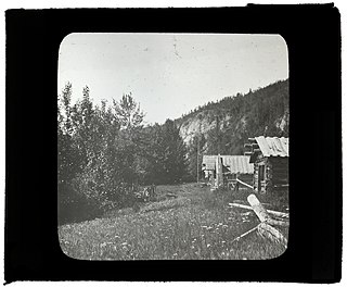
Glenora, also known historically as the Hudson's Bay Company's Fort Glenora and during the Cassiar Gold Rush as Glenora Landing, was an unincorporated settlement in the Stikine Country of northwestern British Columbia, Canada. It was located on the banks of the Stikine River, just southwest and approximately 13 miles downstream from the community of Telegraph Creek. A customs office existed 1901–1903.

Amur Bay, a major bay within Peter the Great Gulf of the Sea of Japan, has an approximate length of 65 kilometres, a width of 10 kilometres to 20 kilometres, and a depth of 20 metres. It is part of a larger bay formed with Ussuri Bay, to which it is connected by the Eastern Bosphorus, and from which it is separated by the Muravyov-Amursky Peninsula and by the Eugénie Archipelago. The Amba River, Razdolnaya River, Narva River, and Barabashevka River all flow into Amur Bay.
The Peak Range is a small subrange of the Swannell Ranges of the Omineca Mountains, located on the northwest side of the junction of Toodoggone River and Finlay River in northern British Columbia, Canada.
Kitsumkalum First Nation is a band government of the Tsimshian people based at Kitsumkalum, British Columbia in the Skeena River valley in the North Coast region near Terrace, British Columbia, Canada. They are a member government of the Tsimshian First Nations treaty council.

Barranca Larga is a village and municipality within the Belén Department of Catamarca Province in northwestern Argentina.
Hill's Bar is a long-abandoned ghost town located in the Fraser Canyon region of British Columbia, Canada. The site of the former boomtown is situated near the right bank of the Fraser River, between Yale and the mouth of Emory Creek. The eponymous bar was the first active placer mining site at the onset of the Fraser Canyon Gold Rush, and was the scene of the Boatmakers of San Francisco claim, which included Ned McGowan of McGowan's War, and involved a dispute with Kowpelst, chief of the Spuzzum people.

Box Canyon is a census-designated place (CDP) in Val Verde County, Texas, United States. The population was 34 at the 2010 census. This CDP was formed prior to the 2010 census from parts of the deleted Box Canyon-Amistad CDP.
Bull Canyon is a canyon at the top of Palm Canyon Wash, which is a tributary to the Whitewater River, in Riverside County, California. Bull Canyon and the creek of Palm Canyon Wash heads at 33°36′47″N116°33′23″W, at an elevation of 6,165 feet in the southern western slope of a ridge in the San Jacinto Mountains. The waters of the creek of Palm Canyon Wash are augmented by Bull Canyon Spring at 33°35′22″N116°33′24″W, at an elevation of 5,331 feet / 1,625 meters. The mouth of Bull Canyon is at an elevation of 4,508 feet / 1,374 meters at the head of Palm Canyon. The mouth of an unnamed creek flows north down from Vandeventer Flat into the head of Palm Canyon at its confluence with Palm Canyon Wash at 33°34′08″N116°31′43″W at an elevation of 4,460 feet.
References
| | This article about a location in the Interior of British Columbia, Canada is a stub. You can help Wikipedia by expanding it. |