The Skatin First Nations, aka the Skatin Nations, are a band government of the In-SHUCK-ch Nation, a small group of the larger St'at'imc people who are also referred to as Lower Stl'atl'imx. The Town of Skatin - the St'at'imcets version of the Chinook Jargon Skookumchuck- is located 4 km south of T'sek Hot Spring- alt. spelling T'sek Hot Spring - commonly & formerly named both St. Agnes' Well & Skookumchuck Hot Springs The community is 28 km south of the outlet of Lillooet Lake on the east side of the Lillooet River. It is approximately 75 km south of the town of Pemberton and the large reserve of the Lil'wat branch of the St'at'imc at Mount Currie. Other bands nearby are Samahquam at Baptiste Smith IR on the west side of the Lillooet River at 30 km. and Xa'xtsa First Nations; the latter is located at Port Douglas, near the mouth of the Lillooet River where it enters the head of Harrison Lake. The N'Quatqua First Nation on Anderson Lake, between Mount Currie and Lillooet, was at one time involved in joint treaty negotiations with the In-SHUCK-ch but its members have voted to withdraw, though a tribal council including the In-SHUCK-ch bands and N'Quatqua remains, the Lower Stl'atl'imx Tribal Council.
The Clendenning Range is a subrange of the Pacific Ranges of the Coast Mountains of British Columbia. About 1500 km2 in area and lies to the northwest of the better-known Tantalus Range near Squamish. Heavily glaciated and very rugged, with severe weather year-round, it is between the valleys of the Elaho River (east) and the Toba River (west).

Boston Bar is an unincorporated town in the Fraser Canyon of the Canadian province of British Columbia.
Bull Canyon Provincial Park is a provincial park in British Columbia, Canada, protecting Bull Canyon on the Chilcotin River, which is 7 km (4 mi) below the confluence of the Chilko River with the Chilcotin. The canyon and park are located just west of the community of Alexis Creek. Bull Canyon is part of a large volcanic plateau called the Chilcotin Group.
Kickininee Provincial Park is a provincial park in British Columbia, Canada, located just south of the town of Summerland in that province's Okanagan region. Originally established in 1970 with approximately 7 acres (28,000 m2) of upland and 113.5 acres (0.459 km2) of foreshore, the park today comprises approximately 48.76 ha.
Sahali is a neighbourhood in South Kamloops, British Columbia, Canada, bordered by the Aberdeen and Downtown districts. It is home to most of Kamloops' major grocery and big box stores. It is also site of one of British Columbia's newest universities: Thompson Rivers University. The neighbourhood is the largest in Kamloops and consists of an Upper and Lower Sahali, with an estimated total population of about 12,000 in 2003.
Stuart River Provincial Park is a provincial park in British Columbia, Canada. It is located in two sections north and northwest of Vanderhoofalong the Stuart River southeast of Stuart Lake and the city of Fort St. James. The upper section is located at 54°13′20″N124°00′00″W and comprises c.7391 ha. while the lower, eastern section is centred at 54°03′00″N123°37′00″W and comprises c.3390 ha. and is within the Greater Prince George area. The upper site, which is located around the confluence of the Stuart and Nechako Rivers, includes the site of Chinlac, a Dakelh village whose inhabitants were massacred and enslaved by the Tsilhqot'in of Anahim Lake c. 1745.
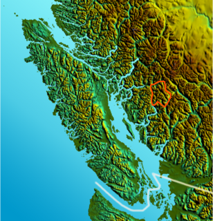
Three Sisters Lake Provincial Park is a provincial park in British Columbia, Canada, located 35 km southeast of Prince George and northeast of the community of Hixon. In addition the three lakes which are the parks namesake the park protects a unique canyon feature on Government Creek.
Todagin South Slope Provincial Park is a provincial park in British Columbia, Canada, located on the west side of Todagin Creek to the east of Kinaskan Lake in the Stikine Country, to the south of the community of Dease Lake. Created in 2001, it contains c. 3557 ha.
Toosey is a Tsilhqot'in First Nations community located west of the Fraser Canyon in the Chilcotin region of the Canadian province of British Columbia. It is a member of the Carrier-Chilcotin Tribal Council, which includes both Tsilhqot'in and Carrier (Dakelh) communities.

Canim Falls is a waterfall on the Canim River between Canim and Mahood Lakes in the Cariboo region of the Central Interior of British Columbia, Canada. It is 25 m (82 ft) high. The waterfall has eroded steadily upstream and created a 4 km (2.5 mi) long canyon cut into a lava plateau associated with the Wells Gray-Clearwater volcanic field. Canim Falls is inside the boundary of Wells Gray Provincial Park.
Klootchman Canyon is a canyon on the Stikine River in northwestern British Columbia, Canada, located south of a bend in the river known as the Devil's Elbow.
The Canim River is a river in the South Cariboo region of the Interior of British Columbia, Canada. It begins at the outlet of Canim Lake and runs approximately 1.8 km to Canim Falls, the river then continues approximately 9 kilometres via a canyon cut into a lava plateau, to Mahood Lake.
The Lord River is a tributary of the Taseko River in the southern Chilcotin District of the Central Interior of British Columbia, Canada, joining that river via the head of Upper Taseko Lake, which is also fed by the upper reaches of the Taseko River proper. The Lord River rises in the area of Lord Pass, which connects to the headwater area of the Bridge River immediately south.
The Tlowitsis Nation, formerly the Tlowitsis Tribe and the Tlowitsis-Mumtagila First Nation, is the Indian Act band government of the Ławit'sis (Tlowitsis) tribe of the Kwakwaka'wakw peoples, located in the Queen Charlotte Strait-Johnstone Strait area in the Discovery Islands between Vancouver Island and the British Columbia mainland in Canada. Ławit'sis territory covers parts of northern Vancouver Island, Johnstone Strait, and adjoining inlets of the mainland. Kalugwis, on Turnour Island, was their principal community in times past, but the band's offices are in the city of Campbell River to the southeast. Hanatsa IR No. 6 on Port Neville is the most populated of the band's Indian reserves.

Nesikep is an unincorporated settlement in British Columbia, Canada, located at the mouth of Nesikep Creek in the Fraser Canyon, to the south of Lillooet and southeast of Texas Creek. It is primarily defined by Nesikep Indian Reserve No. 6 and Nesikep Indian Reserve No. 6A. Nesikep Indian Reserve No. 6 flanks both sides of the Fraser, though the community is only on the right (west) bank.
The Smith River is a river in the Yukon Territory and the province of British Columbia, Canada, arising in the Yukon at 60°09′N126°18′W and crossing the border to enter British Columbia at 60°00′00″N126°23′25″W to its confluence with the Liard River at 59°33′00″N126°29′00″W, between the confluences of the Toad and Coal Rivers. At the confluence is the site of the former Hudson's Bay Company trading post, Fort Halkett, and also Smith River Falls, which are jointly protected by Smith River Falls-Fort Halkett Provincial Park.
Chase River, formerly Chase, named for the Chase River, is a community within the City of Nanaimo, British Columbia, Canada on Vancouver Island. Originally "Chase" as of official adoption of the name in 1924, this was changed to Chase River in 1951. The post office at this location was named Chase River from its establishment in 1910 until it was closed in 1924.


