Cedarvale or Meanskinisht is an unincorporated community in the Skeena region of west central British Columbia. Concentrated on the southeastern shore of the Skeena River, no direct link exists to the portion on the northwestern shore.[1] On BC Highway 16, the locality is by road about 130 kilometres (81mi) northwest of Smithers and 75 kilometres (47mi) northeast of Terrace.
Prior to the arrival of Europeans, the settlement on the northwest shore was called Gitlusec.[2] The later mission settlement was named Meanskinisht (with variations such as Minskinish), which means "under the pitch pines". The subsequent general community was called Cedarvale, which alluded to the cedars growing around the former landing.[3]
Supplied by flumes from the creek, a water-powered sawmill was installed on the northwest shore.[5] Being the only mill in the district, timber was produced both for local demand[6] and for as far away as Hazelton.[7]
During the first few years, the group depended upon canoe transport to obtain supplies from the coast. In 1891, the Hudson's Bay Company (HBC) S.S. Caledonia began a service from the coast to Hazelton.[8] Prior to the arrival of the railway, such steamboats called at the landing,[9] where cordwood was stacked for their boilers.[10][11]
The strict Sabbath observance at the mission meant that even minor activities, which could be considered as work, were not permitted on Sundays. Such strict rules for members prompted outsiders to facetiously call the place "Holy City"[3] or "Little Heaven".[10]
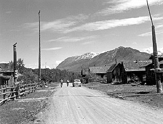
Rev. R. Tomlinson and family, c.1890.
Obligatory were church attendance, school attendance for children, and renouncing First Nations traditions. Work activities included farming, assisting in the general store, handling the government mail contract, and employment in the sawmill. The latter closed in 1913, when the site was expropriated for the railway right-of-way. Tomlinson died that year.[4] He was an Anglican missionary, who emphasized the importance of discipline. An example was placing the jail, which was much used for even non-criminal transgressions, next to the church.[12]
Just beyond the northern boundary of the reserve lies the cemetery and former site of the two mission churches. Erected in 1891, the first was a pioneer-style log structure. In 1907, the replacement was a wooden Gothic-style building with stained glass windows.[4]
In 1906, the schoolhouse burned down. From 1907, Indian Affairs funded the teacher's salary. From 1914, the Missionary Society of the Methodist Church took charge of the mission and the day school. In 1924, the school closed.[13]
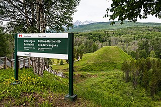
In 2013, the cemetery was designated a national historic site.[4]
East of Cedarvale proper on the east shore, Koonwats 7 is a Gitwangak reserve.[15]
Railway
During the Grand Trunk Pacific Railway (GTP) construction, a camp was established just south of the Meanskinisht sawmill.[16]
In late February 1912, the eastward advance of the GTP rail head from Prince Rupert passed through Cedarvale and reached Mile 143.[17] The next month, the court awarded Rev. R. Tomlinson $4,500 for the GTP right-of-way expropriation of the Meanskinisht mission land on the northwest shore. The amount was close to the original offer, but legal costs consumed the greater part, leaving the owner thousands of dollars worse off.[18]
The standard-design Plan 100‐152 (Bohi's Type E) station building was erected that year, but the station was initially called Hollwood.[19] The HBC intended to operate a steamer from this point upstream during railway construction.[20] By mid-1913, the station had been renamed as Cedarvale.[21]
In 1924, a section foreman died from injuries sustained when his speeder ran into a rockslide about 9 kilometres (6mi) west.[22]
In 1925, another section foreman died when his speeder crashed into an approaching train at Ritchie.[23]
In 1936, a foot caught between two drawbars at Cedarvale was badly crushed.[24]
Around 1956, when CN built repeater stations at Terrace and Smithers to improve CN telegraph services, the Woodcock facility closed.[26]
In 1957, the locomotive and two cars of a westbound passenger train derailed near Woodcock.[27]
The Cedarvale station premises were vacated in the mid-1980s and the salvageable buildings offered for sale in 1987.[28]
During the lengthening of the Cedarvale passing track in 2012, Gitlusec artifacts were discovered.[29] The passing track is 2.1 kilometres (6,855ft).[30]
Since the mission community straddled both sides of the Skeena, the mission canoes provided an informal ferry service from the 1890s.[44]
Although funded for the 1913–14 year[45] and anticipated in 1916,[46] the commencement of the subsidised seasonal ferry seems to have been in 1917.[47]
In 1929–30, a new 4.5-tonne; 4.5-long-ton (5-short-ton)reaction ferry was installed.[48]
In the 1936 flood, the ferry sustained light damage, the ferry house lifted and floated amongst the trees, and the approach bridge across the Skeena River channel washed out.[49]
The new 9.1-tonne; 8.9-long-ton (10-short-ton) reaction ferry constructed for Cedarvale in 1946–47[50] appears to have been installed instead at Kitwanga the next year.[51]
In 1948, the 21-metre (68ft)King truss bridge across the channel on the road to the Cedarvale ferry washed out.[49]
In 1960–61, both cable towers were reconstructed.[52]
Installed in 1963–64 were new landing pontoons and a basket-type aerial passenger ferry using the existing cable during winter.[53]
In 1965–66, separate towers were erected for the aerial basket ferry. A new residence and equipment shed were built.[54]
The ferry remained at two-car capacity[55] until 1973, when a larger four-car ferry was installed.[56]
In 1975, the main cable snapped, which left the loaded ferry stranded 61 metres (200ft) from shore.[57] Apparently, the excessive weight of a dump truck, loader and two cars brought down the two towers, breaking the cable.[10] A helicopter rescued the five people aboard.[58] The ferry stayed out of service the rest of the season.[59]
The aerial ferry remained in use, but it is unclear if the reaction ferry was restored.[60] In 1978, all ferry service was discontinued.[61]
Main road
During 1931–1941, a series of 2-to-6-kilometre (1 to 4mi) stretches were built on the Usk–Cedarvale road.[62]
Completion of the Pacific–Cedarvale section opened the Prince Rupert–Prince George highway in 1944, primarily to military traffic.[63]
In 1958, when a Prince Rupert–Prince George bus service was inaugurated, Cedarvale was a scheduled stop.[64] This stop existed at least until the mid-1960s.[65][66] In later years, Kitwanga has been the nearest stop.
In 1966, the 64-kilometre (40mi) Terrace–Cedarvale section of highway still remained unpaved.[67]
In 1970, Usk–Cedarvale widening and paving were completed.[68]
General community
A.S. Gray was the foreman for wagon road construction. In 1907, he obtained his pre-emption,[69] where he planted fruit trees, harvested wheat, and sold vegetables from his garden to the railway construction camp.[16] Within a few years, he was known as the "potato king".[70]
Opened in 1910, the post office was called Cedarvale, which provided the new name for the locality.[71] Mrs. J.W. Graham was the inaugural postmaster 1910–1918.[72] Her husband operated a significant poultry farm.[73]
In 1918–19, the school opened on the northwest shore,[74] followed by the general store about a year later.[75]
During the early 1920s, a downturn in lumber activity closed the school for three years.[76] In 1926–27, a new school building was erected.[77] At this time, mining, trapping, and logging sustained this poor and scattered community.[78]
During World War II, Japan launched the Fu-Go balloon bombs. One balloon became suspended between three big trees near Cedarvale. The explosives beneath the huge canopy were successfully defused.[79]
On the southeast shore, a small general store, café, and gas bar existed, adjacent to the northern tip of the island.[80]
The one-room school[81] was augmented in 1954–55, when the vacant Skeena Crossing building was moved to Cedarvale.[82]
Cedarvale Elementary appears to have closed in 1975.[83]
The store/post office on the northwest shore closed in the mid-1990s and only a collapsed building remains.[10][84]
West of Cedarvale, Ritchie was named by the GTP in the early 1910s. The specific person honored is subject to speculation. One suggestion was George Hamilton Ritchie, a sternwheeler captain on the Skeena.[85] Another is Joseph Frederick Nelson Ritchie, a government land surveyor.[86] Equally as plausible is John Henderson Ritchie,[87] a GTP construction engineer involved in the project, who died in 1911.[88]
During the 1910s and 1920s, the nearest post office was by rail about 5 kilometres (3mi) south at Lorne Creek.[89]
In the early 1990s, the Skeena Watershed Management Authority established a fish landing site at Ritchie for DFO monitoring.[90]
Woodcock
East of Cedarvale, the former community was an impoverished mountainous farming and mining settlement.[91] Named after William Henry Woodcock, the community now comprises a small scattered population.[92]
In 1920, the Cassiar Farm and Stock Co purchased 142 hectares (350 acres), began land clearing, planted crops, and initiated a dairy farm.[93] In 1923, Robert McKay purchased a two-thirds interest in the venture called the Cassiar Northern Ranch, where 100 dairy cows would supply the Prince Rupert market.[94] Renamed Woodcock Dairies, the bank foreclosed on the farm in 1925 and auctioned off the assets.[95][96]
The school opened in 1923[97][98] and closed in 1945.[99]
↑ "Victoria Daily Times". www.newspapers.com. 5 Jul 1912. p.8. In a short time, the Hudson's Bay Company will operate the steamer "Port Simpson," connecting with the G.T.P. trains, probably at Hollwood.
↑ "Vancouver Daily World". www.newspapers.com. 4 Jun 1913. p.9. Close connection at Prince Rupert with Grand Trunk Pacific trains for Tyee, Terrace, Cedarvale, Hazelton.
↑ "Interior News". www.newspapers.com. 20 Aug 1924. p.1. Mike Scanzusa, section foreman at Ritchie, died in the Hazelton hospital…as a result of injuries received when he ran into a rock slide at the mouth of a tunnel three miles east of Ritchie…
↑ "Interior News". www.newspapers.com. 16 Dec 1925. p.1. Joseph Studal, section foreman at Ritchie met a sudden and horrible death on Saturday. With other members of his crew…he started home on a speeder, but when nearing a bend one of the men observed the smoke of an approaching train…Finding the train right upon them the other members of the crew jumped clear of the track, but the foreman was caught by the engine.
↑ "Interior News". www.newspapers.com. 19 Aug 1936. p.6. …at Cedarvale, Wilfred Abel had a foot badly crushed when caught between two draw bars.
↑ Clapp, Frank A. (1991). Ministry of Transportation and Highways, Lake and River Ferries. Ministry of Transportation and Highways. p.18. ISBN0-7726-1364-8.
↑ "Interior News". www.newspapers.com. 9 Jul 1975. p.1. This main cable of the ferry at Cedarvale…broke…sending the ferry down the Skeena River with passengers and vehicles aboard. The cable eventually caught in a pulley, halting the ferry about 200 feet from shore.
↑ "Interior News". www.newspapers.com. 30 Aug 1978. p.26. The passenger cable ferry service at Cedarvale, B.C., will be discontinued effective 5 p.m. on Friday, September 1, 1978
Highway 16 is a highway in British Columbia, Canada. It is an important section of the Yellowhead Highway, a part of the Trans-Canada Highway that runs across Western Canada. The highway closely follows the path of the northern B.C. alignment of the Canadian National Railway (CN). The number "16" was first given to the highway in 1941, and originally, the route that the highway took was more to the north of today's highway, and it was not as long as it is now. Highway 16 originally ran from New Hazelton east to Aleza Lake. In 1947, Highway 16's western end was moved from New Hazelton to the coastal city of Prince Rupert, and in 1953, the highway was re-aligned to end at Prince George. In 1969, further alignment east into Yellowhead Pass was opened to traffic after being constructed up through 1968 and raised to all-weather standards in 1969. Highway 16's alignment on Haida Gwaii was commissioned in 1983 and is connected to the mainland segment via BC Ferries route #11.
Terrace is a city in the Skeena region of west central British Columbia, Canada. This regional hub lies east of the confluence of the Kitsumkalum River into the Skeena River. On BC Highway 16, junctions branch northward for the Nisga'a Highway to the west and southward for the Stewart–Cassiar Highway to the east. The locality is by road about 204 kilometres (127 mi) southwest of Smithers and 144 kilometres (89 mi) east of Prince Rupert. Transportation links are the Northwest Regional Airport, a passenger train, and bus services.
Hazelton is a village municipality in the Skeena region of west central British Columbia, Canada. The place is on the southeast side of the Skeena River immediately north of the Bulkley River mouth, where the confluence forms a peninsula. On BC Highway 62, the locality is by road about 75 kilometres (47 mi) northwest of Smithers and 144 kilometres (89 mi) northeast of Terrace. Hazelton is the original of the "Three Hazeltons", the other two being New Hazelton to the southeast and South Hazelton to the south.
Usk is an unincorporated community in the Skeena region of west central British Columbia, Canada. The Usk Ferry connects the two parts of the hamlet that straddle the Skeena River. Just off BC Highway 16, the locality is by road about 182 kilometres (113 mi) west of Smithers and 23 kilometres (14 mi) northeast of Terrace.
Seton Lake is a lake in the Squamish-Lillooet region of southwestern British Columbia. On the northeast side is Mission Ridge. On the southwest is the Cayoosh Range. By road, the eastern end is about 7 kilometres (4.3 mi) southwest of Lillooet.
Vanderhoof Airport is about 1.9 nautical miles north of the centre of Vanderhoof, British Columbia, Canada.
Alexandra Bridge Park lies within the lower Fraser Canyon of British Columbia, Canada. This provincial park is adjacent to the historic suspension bridge from 1926, which spans the Fraser River and was built using the eastern abutment of the bridge from 1863. The locality, on BC Highway 1, is by road about 44 kilometres (27 mi) north of Hope and 65 kilometres (40 mi) south of Lytton.
Gitsegukla is an unincorporated community in the Skeena region of west central British Columbia, Canada. The place is on the southeast side of the Skeena River adjacent to the Kitseguecla River mouth. On BC Highway 16, the locality is by road about 94 kilometres (58 mi) northwest of Smithers and 113 kilometres (70 mi) northeast of Terrace.
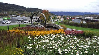
Kitwanga or Gitwangak is in the Skeena region of west central British Columbia. Among the Hazelton and Buckley Mountain Ranges, the place is on the north shore of the Skeena River, east of the Kitwanga River confluence. On BC Highway 37, northeast of the junction with BC Highway 16, the locality is by road about 115 kilometres (71 mi) northwest of Smithers, 99 kilometres (62 mi) northeast of Terrace, and 212 kilometres (132 mi) southeast of Stewart.
Alexandria or Fort Alexandria was a general area encompassing a trading post, ferry site, and steamboat landing in the North Cariboo region of central British Columbia. The present unincorporated community is on the eastern side of the Fraser River. On BC Highway 97, the locality is by road about 74 kilometres (46 mi) northwest of Williams Lake and 45 kilometres (28 mi) south of Quesnel.
Kitselas Canyon is a canyon carved by the Skeena River in the Skeena region of west central British Columbia, Canada. Off BC Highway 16, the landmark is by road about 185 kilometres (115 mi) west of Smithers and 20 kilometres (12 mi) northeast of Terrace.
Kitselas is a railway point on the northwestern shore of the Skeena River in the Skeena region of west central British Columbia, Canada. The former name was Vanarsdol. Across the Skeena to the southwest is the mouth of the Zymoetz River. This river bridge on BC Highway 16 is by road about 10 kilometres (6 mi) northeast of Terrace.
The Usk Ferry operates on the Skeena River at Usk in the Skeena region of west central British Columbia, Canada. The vessel employs reaction ferry propulsion and cable ferry guidance. Off BC Highway 16, the crossing is by road about 182 kilometres (113 mi) west of Smithers and 23 kilometres (14 mi) northeast of Terrace.
Avola is an unincorporated community in the Thompson region of eastern British Columbia. The former ferry site is on the west shore of the North Thompson River immediately north of the mouth of Avola Creek. Off BC Highway 5, the locality is by road about 190 kilometres (118 mi) northeast of the Kamloops and 40 kilometres (25 mi) south of Blue River.
South Hazelton is an unincorporated community in the Skeena region of west central British Columbia, Canada. The place is on the east side of the Skeena River immediately south of the Bulkley River mouth. On BC Highway 16, the locality is by road about 73 kilometres (45 mi) northwest of Smithers and 132 kilometres (82 mi) northeast of Terrace. South Hazelton is one of the "Three Hazeltons", the other two being the original "Old" Hazelton to the north and New Hazelton to the east.
Pacific is a railway point in the Skeena region of west central British Columbia. On the western shore of the Skeena River, no direct link exists to the highway section on the eastern shore near the mouth of Legate Creek. On BC Highway 16, the locality is by road about 164 kilometres (102 mi) west of Smithers and 40 kilometres (25 mi) northeast of Terrace.
Isle Pierre is a railway point in the Nechako Region of central British Columbia. The scattered community straddles the shores of the Nechako River. The west side, off BC Highway 16, is by road about 55 kilometres (34 mi) west of Prince George and 69 kilometres (43 mi) east of Vanderhoof. The east side is by road about 46 kilometres (29 mi) west of Prince George.
Miworth is an unincorporated community on the southeast shore of the Nechako River in the Nechako Region of central British Columbia. The location, via Otway Rd and Miworth Rd, is about 16 kilometres (10 mi) northwest of Prince George.
Chapmans is a locality in the lower Fraser Canyon area of southwestern British Columbia. The place is on the east shore of the Fraser River and north of Alexandra Bridge Park. The locality, on BC Highway 1, is by road about 46 kilometres (29 mi) north of Hope and 64 kilometres (40 mi) south of Lytton.
Anderson Flats Park is in the Skeena region of west central British Columbia, Canada. This provincial park is on the southeast shore at the junction of the Skeena River and Buckley River, between South Hazelton and "Old" Hazelton. Off BC Highway 16, the locality is by road about 73 kilometres (45 mi) northwest of Smithers and 132 kilometres (82 mi) northeast of Terrace.
References
Tomlinson, George; Young, Judith (1991). Challenge the Wilderness: A Family Saga of Robert and Alice Tomlinson, Pioneer Medical Missionaries. Great Northwest Wilderness Books. ISBN0-937708-34-8.
This page is based on this Wikipedia article Text is available under the CC BY-SA 4.0 license; additional terms may apply. Images, videos and audio are available under their respective licenses.