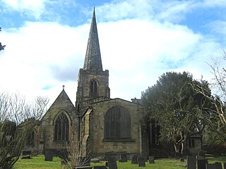
Knifesmithgate is a short street located in Chesterfield, Derbyshire, England. [1] It connects Church Way at the Church of St Mary and All Saints in the east, and Rose Hill in the west. [2] [3]

Knifesmithgate is a short street located in Chesterfield, Derbyshire, England. [1] It connects Church Way at the Church of St Mary and All Saints in the east, and Rose Hill in the west. [2] [3]
Similar to other parts of Derbyshire, the name reflects the history of smithing along the brooks and streams in the area, as well as a local family linked to the trade. [4] Today the street contains mock Tudor buildings, largely dating back to the 1920s. [5]

Chesterfield is a market and industrial town in the county of Derbyshire, England. It is 24 miles (39 km) north of Derby and 11 miles (18 km) south of Sheffield at the confluence of the Rivers Rother and Hipper. In 2011, the built-up-area subdivision had a population of 88,483, making it the second-largest settlement in Derbyshire, after Derby. The wider Borough of Chesterfield had a population of 103,569 in the 2021 Census. In 2021, the town itself had a population of 76,402.

Icknield Street or Ryknild Street is a Roman road in England, with a route roughly south-west to north-east. It runs from the Fosse Way at Bourton on the Water in Gloucestershire to Templeborough in South Yorkshire. It passes through Alcester, Studley, Redditch, Metchley Fort, Birmingham, Sutton Coldfield, Lichfield, Burton upon Trent and Derby.

The A61 is a major trunk road in England connecting Derby and Thirsk in North Yorkshire by way of Alfreton, Clay Cross, Chesterfield, Sheffield, Barnsley, Wakefield, Leeds, Harrogate and Ripon. The road is closely paralleled by the M1 motorway between Derby and Leeds.

North East Derbyshire is a local government district in Derbyshire, England. The council is based in the large village of Wingerworth. The district also includes the towns of Dronfield and Clay Cross as well as numerous villages and surrounding rural areas.

Duffield is a village in the Amber Valley district of Derbyshire, 5 miles (8.0 km) north of Derby. It is centred on the western bank of the River Derwent at the mouth of the River Ecclesbourne. It is within the Derwent Valley Mills World Heritage Area and the southern foothills of the Pennines.

BBC Radio Sheffield is the BBC's local radio station serving South Yorkshire, north Derbyshire and North Nottinghamshire.

Clay Cross is a town and a civil parish in the North East Derbyshire district of Derbyshire, England. It is a former industrial and mining town, about 5 miles (8.0 km) south of Chesterfield. It is directly on the A61. Surrounding settlements include North Wingfield, Tupton, Pilsley and Ashover.

Gleadless Valley ward—which includes the districts of Gleadless Valley, Heeley, Lowfield, and Meersbrook—is one of the 28 electoral wards in City of Sheffield, England. It is located in the southern part of the city and covers an area of 4.5 km2. The population of this ward in 2011 was 21,089 people in 9,516 households. It is one of the five wards that form the Sheffield Heeley parliamentary constituency in the House of Commons. Gleadless Valley actually describes the valley that separates Hemsworth from Herdings, and is a broad area that covers several housing estates: Hemsworth, Herdings and Rollestone. Gleadless Valley is bordered by Gleadless and Norton.

Dore and Totley ward—which includes the districts of Bradway , Dore, Totley, and Whirlow—is one of the 28 electoral wards in City of Sheffield, England. It is currently represented by three Liberal Democrat councillors. It is located in the southwestern part of the city and covers an area of 26.3 km2. The population of this ward in 2001 was 16,404 people in 7,037 households. Dore and Totley ward is one of the five wards that make up the Sheffield Hallam Parliamentary constituency. The population of Dore and Totley is 16,740 (2011) with 7,334 Households.

Graves Park ward—which includes the districts of Norton, Norton Lees, Norton Woodseats, and Woodseats—is one of the 28 electoral wards in City of Sheffield, England. It is located in the southern part of the city and covers an area of 5.8 km2. The population of this ward in 2011 was 16,705 people in 7,464 households. It is one of the five wards that form the Sheffield Heeley parliamentary constituency in the House of Commons. The districts of this ward were in the historic county of Derbyshire, but they have now been absorbed into the metropolitan borough of Sheffield, thus placing them in the ceremonial county of South Yorkshire.

The Diocese of Southwell and Nottingham is a Church of England diocese in the Province of York, headed by the Bishop of Southwell and Nottingham. It covers all the English county of Nottinghamshire and a few parishes in South Yorkshire. It is bordered by the dioceses of Derby, Leicester, Lincoln and Sheffield. The cathedral, Southwell Minster, is in the town of Southwell, 15 miles north of Nottingham.

Chesterfield Road is a shopping street in Sheffield, England. It leads south from the suburb of Meersbrook to Woodseats, before becoming Meadowhead at the Abbey Lane junction, next to the Abbey pub. The road starts at Toll Bar bridge on the Meers Brook, the former boundary between Yorkshire and Derbyshire. There the road changes name from London Road to Chesterfield Road.

Brimington is a large village and civil parish in the Borough of Chesterfield in Derbyshire, England. The population of the parish taken at the 2011 census was 8,788. The town of Staveley is to the east, and Hollingwood is nearby. The parish includes Brimington Common along the Calow Road, and New Brimington, a late 19th-century extension towards the Staveley Iron Works.
Queen's Park is a county cricket ground located in Chesterfield, Derbyshire, England and lies within a park in the centre of the town established for the Golden Jubilee of Queen Victoria in 1887. It has a small pavilion and is surrounded by mature trees.
Whittington railway station is a former railway station on the southern edge of New Whittington, Derbyshire, England.

Chesterfield Museum and Art Gallery is a local museum and art gallery in the town of Chesterfield, Derbyshire, England.

Marsh Lane village is located in the civil parish of Eckington in North-East Derbyshire, England. It is 6 miles north east of Chesterfield. In 2011 the village had a population of 895.

National Cycle Network (NCN) Route 67 is a Sustrans National Route that runs from Long Whatton to Northallerton. The route is 124 miles (200 km) in length and is open but with sections missing.

Low Pavement is a short street located in Chesterfield, Derbyshire, England. It connects West Bars to Vicar Lane. The street is a shopping district.

The Peacock Inn is a grade-II listed building located on Low Pavement in Chesterfield, Derbyshire.