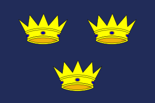
Munster is one of the four provinces of Ireland, located in the south of the island. In early Ireland, the Kingdom of Munster was one of the kingdoms of Gaelic Ireland ruled by a "king of over-kings". Following the Norman invasion of Ireland, the ancient kingdoms were shired into counties for administrative and judicial purposes. In later centuries, local government legislation has seen further sub-division of the historic counties.
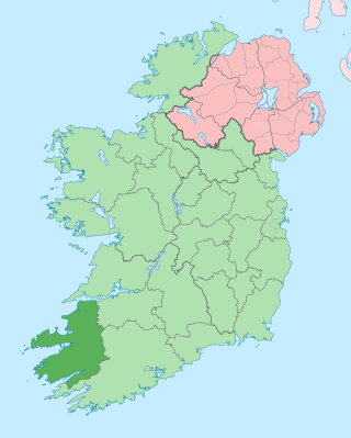
County Kerry is a county on the southwest coast of Ireland, within the province of Munster and the Southern Region. It is bordered by two other counties; Limerick to the east, and Cork to the south and east. It is separated from Clare to the north by the Shannon Estuary. With an area of 4,807 square kilometres (1,856 sq mi) and a population of 156,458 as of 2022, it is the 5th largest of Ireland's 32 counties by land area, and the 15th most populous. The governing local authority is Kerry County Council.

Tralee is the county town of County Kerry in the south-west of Ireland. The town is on the northern side of the neck of the Dingle Peninsula, and is the largest town in County Kerry. The town's population was 26,079 as of the 2022 census, making it the 15th largest urban settlement in Ireland. Tralee is known for the Rose of Tralee International Festival, which has been held annually in August since 1959.
GENUKI is a genealogy web portal, run as a charitable trust. It "provides a virtual reference library of genealogical information of particular relevance to the UK and Ireland". It gives access to a large collection of information, with the emphasis on primary sources, or means to access them, rather than on existing genealogical research.
Daniel Joseph O'Keeffe, known as "Danno", was an Irish Gaelic footballer, regarded by some as the greatest goalkeeper in the history of the sport.

The 2004 United States presidential election in Connecticut took place on November 2, 2004, and was part of the 2004 United States presidential election. Voters chose seven representatives, or electors to the Electoral College, who voted for president and vice president.

The Kerry County Board of the Gaelic Athletic Association (GAA), or Kerry GAA, is one of the 32 county boards of the GAA in Ireland. It is responsible for Gaelic games in County Kerry, and for the Kerry county teams.
Austin Stack Park is a GAA stadium in Tralee, County Kerry, Ireland. It is one of the stadiums used by Kerry GAA's Gaelic football team and the stadium of the hurling team.

Radio Kerry is a full-service, licensed radio station that operates from the franchise area of County Kerry in Southwest Ireland.

2RN is the trading name of RTÉ Transmission Network DAC, a wholly owned subsidiary of Raidió Teilifís Éireann, formerly trading as RTÉNL, which runs Ireland's principal digital terrestrial television and radio broadcast networks. In December 2002 it became an incorporated company and subsidiary of RTÉ; it was previously a division within RTÉ. It operates 12 main TV and radio transmitter sites and many smaller relays and transposers, which carry television and/or radio. It also provides site hosting for mobile telephone operators, the emergency services, wireless broadband and other private mobile communications service providers.
Kerry is a village and geographically large community in Montgomeryshire, Powys, Wales.

Mullaghanish is a 649 m high mountain in the Derrynasaggart range, located just northeast of Ballyvourney in County Cork, Ireland.

The 2008 United States Senate election in Massachusetts took place on November 4, 2008. Incumbent Democratic U.S. Senator John Kerry, who remained in the Senate after losing the presidency to incumbent President George W. Bush in the 2004 presidential election, won re-election to a fifth term in office. Kerry later resigned his seat in 2013 to become Secretary of State under the Obama administration.
Met Éireann is the state meteorological service of Ireland, part of the Department of Housing, Local Government and Heritage.

The Uragh Stone Circle is an axial five-stone circle located near Gleninchaquin Park, County Kerry, Ireland. The Bronze Age site includes a multiple stone circle and some boulder burials.
Channel South was an Irish television channel, operated by City Channel, transmitting 24-hour local programming to Cork, Limerick, and parts of Kerry, Waterford, Clare and Tipperary since November 2008.

Strabane Upper is a barony in County Tyrone, Northern Ireland. It is bordered by six other baronies: Tirkeeran and Keenaght to the north; Loughinsholin and Dungannon Upper to the east; Omagh East to the south; and Strabane Lower to the west.
Knockmoyle Sheskin also known as Knockmoyle/Sheskin or Knockmoyle and Sheskin is an intact Atlantic blanket bog, national nature reserve and Ramsar site of approximately 2,960 acres (12.0 km2) in County Mayo.
