Babino is a village in the administrative district of Gmina Choroszcz, within Białystok County, Podlaskie Voivodeship, in north-eastern Poland. It lies approximately 6 kilometres (4 mi) north-west of Choroszcz and 18 km (11 mi) west of the regional capital Białystok.
Barszczewo is a village in the administrative district of Gmina Choroszcz, within Białystok County, Podlaskie Voivodeship, in north-eastern Poland. It lies approximately 3 kilometres (2 mi) south-east of Choroszcz and 11 km (7 mi) west of the regional capital Białystok.
Dzikie-Kolonia is a village in the administrative district of Gmina Choroszcz, within Białystok County, Podlaskie Voivodeship, in north-eastern Poland. It lies approximately 6 kilometres (4 mi) north of Choroszcz and 14 km (9 mi) north-west of the regional capital Białystok.
Gajowniki is a village in the administrative district of Gmina Choroszcz, within Białystok County, Podlaskie Voivodeship, in north-eastern Poland. It lies approximately 4 kilometres (2 mi) south of Choroszcz and 13 km (8 mi) west of the regional capital Białystok.
Izbiszcze is a village in the administrative district of Gmina Choroszcz, within Białystok County, Podlaskie Voivodeship, in north-eastern Poland. It lies approximately 10 kilometres (6 mi) south-west of Choroszcz and 21 km (13 mi) west of the regional capital Białystok.
Klepacze is a village in the administrative district of Gmina Choroszcz, within Białystok County, Podlaskie Voivodeship, in north-eastern Poland. It lies approximately 7 kilometres (4 mi) south-east of Choroszcz and 7 km (4 mi) west of the regional capital Białystok.
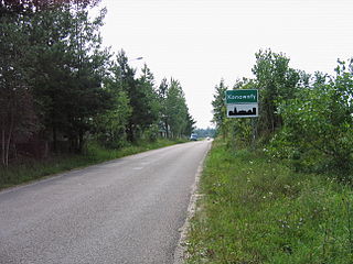
Konowały is a village in the administrative district of Gmina Choroszcz, within Białystok County, Podlaskie Voivodeship, in north-eastern Poland. It lies approximately 6 kilometres (4 mi) west of Choroszcz and 18 km (11 mi) west of the regional capital Białystok.

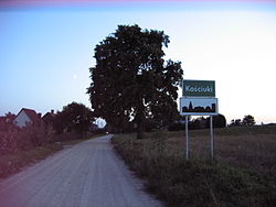
Krupniki is a village in the administrative district of Gmina Choroszcz, within Białystok County, Podlaskie Voivodeship, in north-eastern Poland. It lies approximately 6 kilometres (4 mi) east of Choroszcz and 8 km (5 mi) north-west of the regional capital Białystok.
Kruszewo is a village in the administrative district of Gmina Choroszcz, within Białystok County, Podlaskie Voivodeship, in north-eastern Poland. It lies approximately 11 kilometres (7 mi) west of Choroszcz and 23 km (14 mi) west of the regional capital Białystok.
Oliszki is a village in the administrative district of Gmina Choroszcz, within Białystok County, Podlaskie Voivodeship, in north-eastern Poland. It lies approximately 5 kilometres (3 mi) east of Choroszcz and 9 km (6 mi) west of the regional capital Białystok.
Rogówek is a village in the administrative district of Gmina Choroszcz, within Białystok County, Podlaskie Voivodeship, in north-eastern Poland. It lies approximately 4 kilometres (2 mi) north-west of Choroszcz and 17 km (11 mi) west of the regional capital Białystok.
Rogowo is a village in the administrative district of Gmina Choroszcz, within Białystok County, Podlaskie Voivodeship, in north-eastern Poland. It lies approximately 6 kilometres (4 mi) west of Choroszcz and 19 km (12 mi) west of the regional capital Białystok.
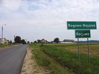
Rogowo-Majątek is a village in the administrative district of Gmina Choroszcz, within Białystok County, Podlaskie Voivodeship, in north-eastern Poland. It lies approximately 5 kilometres (3 mi) west of Choroszcz and 18 km (11 mi) west of the regional capital Białystok.

Ruszczany is a village in the administrative district of Gmina Choroszcz, within Białystok County, Podlaskie Voivodeship, in north-eastern Poland. It lies approximately 3 kilometres (2 mi) north-west of Choroszcz and 14 km (9 mi) west of the regional capital Białystok.
Sienkiewicze is a village in the administrative district of Gmina Choroszcz, within Białystok County, Podlaskie Voivodeship, in north-eastern Poland. It lies approximately 5 kilometres (3 mi) east of Choroszcz and 9 km (6 mi) west of the regional capital Białystok.
Śliwno is a village in the administrative district of Gmina Choroszcz, within Białystok County, Podlaskie Voivodeship, in north-eastern Poland. It lies approximately 11 kilometres (7 mi) south-west of Choroszcz and 23 km (14 mi) west of the regional capital Białystok.
Zaczerlany is a village in the administrative district of Gmina Choroszcz, within Białystok County, Podlaskie Voivodeship, in north-eastern Poland. It lies approximately 4 kilometres (2 mi) south of Choroszcz and 13 km (8 mi) west of the regional capital Białystok.
Złotoria is a village in the administrative district of Gmina Choroszcz, within Białystok County, Podlaskie Voivodeship, in north-eastern Poland. It lies approximately 6 kilometres (4 mi) north-west of Choroszcz and 17 km (11 mi) north-west of the regional capital Białystok.
Wierzbowo is a village in the administrative district of Gmina Śniadowo, within Łomża County, Podlaskie Voivodeship, in north-eastern Poland. It lies approximately 8 kilometres (5 mi) north of Śniadowo, 12 km (7 mi) south-west of Łomża, and 82 km (51 mi) west of the regional capital Białystok.
Sucha Wieś is a village in the administrative district of Gmina Raczki, within Suwałki County, Podlaskie Voivodeship, in north-eastern Poland. It lies approximately 5 kilometres (3 mi) south-east of Raczki, 17 km (11 mi) south-west of Suwałki, and 96 km (60 mi) north of the regional capital Białystok.