Koda River (South Sudan)

Last updated

The Koda River, [1] locally called Khor Koda, [2] is a seasonal tributary of the White Nile in the state of Jubek, South Sudan. [3]

Contents

Course

The river begins approximately at 4°41′13″N31°03′47″E / 4.687°N 31.063°E / 4.687; 31.063 , south of the Miri Hills, approximately 7 km north of the village of Mussikidolk and 60 km west of the state capital Juba. [2] It runs mostly in the northeast direction, being joined by major tributaries from the same general source region at 4°45′19″N31°06′04″E / 4.7554°N 31.1012°E / 4.7554; 31.1012 and 4°51′23″N31°10′37″E / 4.8564°N 31.1769°E / 4.8564; 31.1769 . [2] Near 5°04′48″N31°18′43″E / 5.080°N 31.312°E / 5.080; 31.312 it changes to an eastward general direction. After about 32 km (beeline; near 5°02′49″N31°36′14″E / 5.047°N 31.604°E / 5.047; 31.604 , about 20 km due north of Juba, and 6 km northwest of Luala) it makes a broad curve 6 km south and southeast of Mount Lado, an isolated hill with peak at 1006 m altitude, that dominates the landscape of the area. [4]

From there it flows northeast for about 14 km, almost parallel to the White Nile, until a point 0.5 southwest of the village of Lado Koda ( 5°08′20″N31°42′32″E / 5.139°N 31.709°E / 5.139; 31.709 ). There the course bends sharply to the southwest for another 2.5 km, ending on the White Nile, about 35 km downstream (north) of Juba 5°07′49″N31°43′43″E / 5.1302°N 31.7286°E / 5.1302; 31.7286 . [5] [6] The annual flow has been estimated at about 60 million m3. [7]

For the last 18 km, the river is flanked by a strip of floodplains about 0.5 km wide, [5] with a total area of 3159 ha, including the riverbed. Along that valley, the altitude drops from 470 m (at 5°02′49″N31°36′14″E / 5.047°N 31.604°E / 5.047; 31.604 ) to 435 m. [8]

The river flows near the villages of Wulikare, Logogvi, Ludo Kenyi, Luala, and Lado Koda. Wulikare is located 0.5 km south of the river and 29 km northwest of Juba. [6] [8] [5]

History and demographics

The area near the White Nile is the historic homeland of Bari-speaking people. [9]

The Nyangwara tribe in the Miri Hills, Mongalla province believed that Lotome, the first remembered ancestor of the Gwokorongo chiefs, lived at Dogeleng near the Koda River around 1800. [9]

As of 2018, the South Sudan war was still affecting in the area. [10]

Economics

As of 2012,only about 10% of the area in the flood valley was cultivated, mostly for maize, sorghum, cassava and millet. [8]

As in most of South Sudan, the local population among the poorest in the planet. The area has been of interest to international relief agencies that produced plans for possible irrigation projects [7] [8] or actually created and managed such installations and model farms. [10] For example, the Japan International Cooperation Agency (JICA) offered a study of the construction of three dams—including one on the Koda river, a couple km west of Wulikare—to collect and store water for irrigation in the region of Jalang. [7]

Flora and fauna

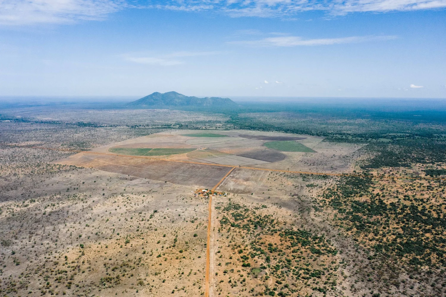
Much of the area has natural vegetation consisting of grasses, bushes, and sparse trees. [7]

See also

Related Research Articles

Sudd Swamp in South Sudan

The Sudd is a vast swamp in South Sudan, formed by the White Nile's Baḥr al-Jabal section. The Arabic word sudd is derived from sadd (سد), meaning "barrier" or "obstruction". The term "the sudd" has come to refer to any large solid floating vegetation island or mat. The area which the swamp covers is one of the world's largest wetlands and the largest freshwater wetland in the Nile basin.

Lado Enclave

The Lado Enclave was an exclave of the Congo Free State and later of Belgian Congo that existed from 1894 until 1910, situated on the west bank of the Upper Nile in what is now South Sudan and northwest Uganda.

Juba Capital of South Sudan

Juba is the capital and largest city of South Sudan. The city is situated on the White Nile and also serves as the capital of Central Equatoria State. It is the newest capital city with a population of 525,953 in 2017. It has an area of 52 km (32 mi), with the metropolitan area covering 336 km (209 mi).

Malakal City in Upper Nile State, South Sudan

Malakal is a city in South Sudan and second largest city after the national capital Juba. And it is the capital of Upper Nile State, South Sudan, near the White Nile River. It also serves as the headquarters of Malakal County.

Railway stations in Sudan Wikipedia list article

Railway stations in Sudan include:

Karima, Sudan town in Northern, Sudan

Karima is a town in Northern State in Sudan some 400 km from Khartoum on a loop of the Nile.

Nile Basin

The Nile Basin is the part of Africa drained by the Nile River and its tributaries.

The Badigeru swamp swamp lies in South Sudan, in the Central Equatoria and Eastern Equatoria states between Terekeka and Lafon.

Mongalla, South Sudan Place in Jubek State, South Sudan

Mongalla or Mangalla is a community in Central Equatoria State in South Sudan, on the east side of the Bahr al Jebel or White Nile river. It lies about 75 km by road northeast of Juba. The towns of Terekeka and Bor lie downstream, north of Mongalla.

Kiro Place in Central Equatoria, South Sudan

Kiro was a colonial post in what is now the Central Equatoria province of South Sudan on the west side of the Bahr al Jebel or White Nile river. It was in part of the Lado enclave.

The Aliab Dinka are a subdivision of the Dinka people of South Sudan. They traditionally lived in an area west of the upper White Nile river. The name is also used to refer to a breed of cattle maintained by the Aliab Dinka people and widespread in the region.

Water supply in South Sudan

Water supply in Southern Sudan is faced with numerous challenges. Although the White Nile runs through the country, water is scarce during the dry season in areas that are not located on the river.

Juba International Airport

Juba Airport is an airport serving Juba, the capital city of South Sudan. The airport is located 5 km (3 mi) northeast of the city's central business district, on the western banks of the White Nile. The city and airport are located in South Sudan's Central Equatoria State.

The Sudans

The Sudans is a region in Africa comprising the countries of South Sudan and the Sudan.

Jubek State

Jubek State was a state in South Sudan that existed between 2 October 2015 and 22 February 2020. It contained the national capital, Juba, which is also the largest city in South Sudan. The state bordered include Yei River State to the southwest, Amadi State to the west, Terekeka State to the north, and Imatong State to the east.

Lado Koda is a small town in Jubek State, South Sudan, about 2 km northwest of the Koda River outlet on the White Nile, 8 km southwest of Mongalla, 14 km north by northeast of Luala, and 36 km from the state capital Juba and 60 km west and 15 km south of the state capital Juba. It is located just north of the Koda River's floodplain, on the new Juba-Terekeka road.

Wulikare is a small settlement in Jubek State, South Sudan, about 0.5 km south of the Koda River, 4 km west of Ludo Kenyi, 14 km from the Jebel Lado mountain, 37 km southwest of Mongalla, and 29 km from the state capital Juba It is located near on the road from Juba to Buko, Tijor, and Rokon.

The Canadian Economic Development Assistance for South Sudan (CEDASS) is a privately funded Canadian registered charity and a registered NGO in South Sudan It was founded in 2005 by British entrepreneur David Tennant and other Canadian philanthropists.

Mount Lado or Jebel Lado is an isolated hillock in Jubek State, South Sudan, about 13 km northwest of the White Nile and 28 km due north of the national capital Juba. The mountain was also called Mount Nyerkenyi.

References

  1. US Army: "Sheet NB36, Series 1301, Edition 2 AMS 3: Mongwalla". Maps for the World site, Map txu-oclc-6654394-nb-36-3rd-ed. Accessed on 2019-03-24.
  2. 1 2 3 Russian Army: "Map E36 X 83-T6" Maps for the world website, Map 500k--b36-3. Accessed on 2019-03-24.
  3. (2016): "South Sudan: Central equatoria - Base Map (as of 15 December 2016)". Médecins Sans Frontières. From the ReliefWeb.int site, accessed on 2019-03-24.
  4. View of the CEDASS farm project with the Koda River, South Sudan and Mount Lado in the background. (Archived) Accessed on 2019-06-04.
  5. 1 2 3 Google Maps: "Koda River". Accessed on 2019-03-23
  6. 1 2 (2013): "Sudan: Central Equatoria State - Detailed Transport Map (as of 17 Jan 2013)". World Food Programme, Logistics Cluster. From the ReliefWeb.int site, accessed on 2019-03-24.
  7. 1 2 3 4 "Irrigation Development Master Plan". Online document, Japan International Cooperation Agency (JICA), with the Water Sector of the Ministry of Electricity, Dams, Irrigation and Water Resources (MEDIWR). Accessed on 2019-03-23. Warning: The authors seem to have obtained all their geographic data from Google Earth and Google Maps, so the names and locations of the towns may be incorrect.
  8. 1 2 3 4 (2012): "Jebel Lado focal area". Assessment of the Irrigation Potential in Burundi, Eastern DRC, Kenya, Rwanda, South Sudan, Tanzania and Uganda - Final Report, Appendix South Sudan, Section 3, pages 98-121. Report 114, FutureWater consultants, Wageningen, Netherlands. Warning: This report incorrectly calls the river "Bahr el-Jebel" ("Mountain River"), which is actually the local name of the White River; and calls its flood valley "Jebel Lado" which is the name of the nearby mountain ("Jebel" or"Jabal" being Arabic for "Mountain"). Also, while the satellite images are useful, the panoramic views may be stock photos.
  9. 1 2 L. F. Nalder (1937): A Tribal Survey of the Mongalla Province, page 193. Oxford University Press.
  10. 1 2 "The Jebel Lado Project" CEDASS website, Accessed on 2019-03-23